Veyrières, Cantal
Veyrières is a commune in the Cantal department in south-central France.
Veyrières | |
|---|---|
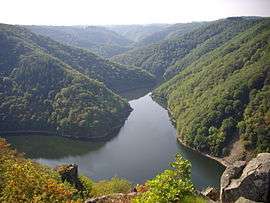 The Sumène valley | |
Location of Veyrières 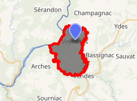
| |
 Veyrières  Veyrières | |
| Coordinates: 45°19′55″N 2°22′30″E | |
| Country | France |
| Region | Auvergne-Rhône-Alpes |
| Department | Cantal |
| Arrondissement | Mauriac |
| Canton | Ydes |
| Intercommunality | Sumène Artense |
| Government | |
| • Mayor (2008–2014) | Catherine Maisonneuve |
| Area 1 | 13.67 km2 (5.28 sq mi) |
| Population (2017-01-01)[1] | 112 |
| • Density | 8.2/km2 (21/sq mi) |
| Time zone | UTC+01:00 (CET) |
| • Summer (DST) | UTC+02:00 (CEST) |
| INSEE/Postal code | 15254 /15350 |
| Elevation | 321–675 m (1,053–2,215 ft) (avg. 617 m or 2,024 ft) |
| 1 French Land Register data, which excludes lakes, ponds, glaciers > 1 km2 (0.386 sq mi or 247 acres) and river estuaries. | |
Population
| Year | Pop. | ±% |
|---|---|---|
| 1962 | 225 | — |
| 1968 | 228 | +1.3% |
| 1975 | 200 | −12.3% |
| 1982 | 147 | −26.5% |
| 1990 | 136 | −7.5% |
| 1999 | 116 | −14.7% |
| 2008 | 123 | +6.0% |
gollark: According to GTech™ Badology, 92% of the bad is actually caused by apioforms being insufficiently bewared.
gollark: Well, people use "neoliberal" to complain about 27% of bad things.
gollark: In Australia.
gollark: Wasn't there that APIOFORMIC antiencryption law recently?
gollark: Crimes are detected by the omnipresent monitoring drones, and neutralized via orbital bombardment.
See also
References
- "Populations légales 2017". INSEE. Retrieved 6 January 2020.
| Wikimedia Commons has media related to Veyrières (Cantal). |
| Authority control |
|
|---|
This article is issued from Wikipedia. The text is licensed under Creative Commons - Attribution - Sharealike. Additional terms may apply for the media files.