U.S. Route 71 in Arkansas
U.S. Highway 71 (US 71) is a U.S. highway that runs from Krotz Springs, LA to the Fort Frances–International Falls International Bridge at the Canadian border. In Arkansas, the highway runs from the Louisiana state line near Doddridge to the Missouri state line near Bella Vista. In Texarkana, the highway runs along State Line Avenue with US 59 and partially runs in Texas (northbound traffic is in Arkansas and southbound in Texas). Other areas served by the highway include Fort Smith and Northwest Arkansas.
| |||||||||
|---|---|---|---|---|---|---|---|---|---|
_map.svg.png) Route of US 71 in Arkansas in red | |||||||||
| Route information | |||||||||
| Maintained by ArDOT, TxDOT | |||||||||
| Length | 310.0 mi (498.9 km) About 4 miles of highway is located in Texas near Texarkana | ||||||||
| Major junctions | |||||||||
| South end | |||||||||
| |||||||||
| North end | |||||||||
| Location | |||||||||
| Counties | Miller, Bowie (TX), Little River, Sevier, Polk, Scott, Logan, Sebastian, Crawford, Washington, Benton | ||||||||
| Highway system | |||||||||
| |||||||||
.svg.png)
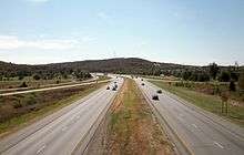
Route description
_map.svg.png)

The route enters Arkansas near the Red River, and runs north through the communities of Doddridge and Fouke.[1] Most motorists can now bypass US 71 from the Louisiana border to Texarkana via Interstate 49. After approximately 30 miles (48 km) of paralleling I-49, the route turns west, passes the historic Averitt House and enters Texarkana. Highway 71 has a brief concurrency with Highway 237 before crossing over The Loop Interstate 49 (former Interstate 130)[2] in the southeast part of town.
Inside the loop, Highway 71 becomes East Street, passing the Texarkana Country Club and Hobo Jungle Park before becoming Hickory Street in downtown Texarkana. The street is four-lane undivided, passing the Bottoms House and J.K. Wadley House before meeting US 67/US 82. US 71 forms a short, two-block concurrency with US 67/US 82 before turning north along Hazel Street. This street runs northwest to intersect State Line Avenue. On State Line Avenue, the northbound lanes are in Arkansas, while the southbound lanes are in Texas.[1] While on State Line Avenue, US 71 intersects Loop 14 (Texas Boulevard), in Texas, and Arkansas Boulevard, in Arkansas. Before US 59 joins US 71 at Interstate 30, nearly a mile north.
From Arkansas Highway 296 north of Texarkana to the Red River, US 71 runs concurrent with US 59 as a divided highway. Except for the northbound lanes (which return to the Arkansas side just before the Red River), this section of 3.39 miles (5.46 km) is entirely in Texas.[lower-alpha 1]
The highways re-enter Arkansas (specifically Little River County) completely at the Red River. Less than a mile north of the River, all commercial truck traffic is required to pull into an Arkansas Highway Police weigh station. US 59/US 71 serve as an eastern terminus for Highway 380 upon entering Ogden. Although US 59/US 71 bypass the community as a four-lane highway, the route formerly served Ogden as Grand Street, which as of 2016, retains original 1926 US 71 paving for some of its length.[3] Following the Kansas City Southern Railroad tracks, US 59/US 71 enters Ashdown, where it becomes Constitution Avenue. As it heads north, the routes goes under Highway 32, entering the southern part of Ashdown, serving as Little River's county seat. The highway is named Constitution Avenue, and passes within two blocks of the Little River County Courthouse. The routes intersect with Highway 32B, Rankin Street, and Highway 108, before exiting town due north to Wilton.[4] Entering Wilton, it passes the S.S.P. Mills and Son Building, Highway 234, and the Texarkana and Fort Smith Railway Depot.[5] Just north of town a former alignment comes into view briefly before the Mills Cemetery and the Sevier County line.

Once across the Little River, US 59/US 71 passes another former alignment, crosses through Pond Creek National Wildlife Refuge, and runs east of Ben Lomond before entering Lockesburg.[6] A junction in Lockesburg joins US 59/US 71 with US 371, with Highway 24 running west from the junction. Five miles (8.0 km) north of Lockesburg US 70 joins US 59/US 71/US 371, and the concurrent routes turn west to De Queen. Upon entering De Queen, US 59/US 71 turns north, US 70 continues west, US 70 Business/Highway 41 (US 70B/AR 41) runs south, and US 371 terminates at the junction.[7] US 59/US 71 continue through Gillham and Grannis to serve as the western terminus of US 278 in Wickes. Junctions with Highway 246 and Highway 4 precede the route entering Mena, the county seat of Polk County.[8]
In Mena, US 59/US 71 has a brief overlap with Highway 8, during which the routes pass two NRHP listings, the Mena Kansas City-Southern Depot and the Mena Commercial Historic District.[9] US 59/US 71/AR 8 also has an overlap with Highway 88, although the western end of the overlap serves as the eastern terminus of the Talimena Scenic Drive National Scenic Byway designation. After Highway 8 and Highway 88 have left the route US 59/US 71 run north to a junction with US 270 in Acorn. At a fork in the road, US 59 splits onto US 270 west, and US 270 east begins a concurrency with US 71 northbound into Ouachita National Forest.[8] US 71/US 270 continue into Scott County to Y City, where the concurrency ends and US 270 turns east. US 71 runs north through the forest to Waldron, a town the mainline route bypasses to the west while US 71B runs through downtown Waldron. While skirting Waldron, US 71 has a junction with Highway 272 near Waldron Municipal Airport as well as junctions with Highway 248, Highway 80, and Highway 28.[10] This section of US 71 from north of Mena through Fayetteville (following the original sections bypassing the new Interstate 540 has been designated a scenic byway and the Boston Mountains Scenic Loop.

North of Waldron, US 71 passes through Mansfield and Greenwood before intersecting with Interstate 540 on the south end of Fort Smith. US 71 overlaps I-540 for approximately 12 miles (19 km) until it reaches Iinterstate 40, then US-71 follows I-40 six miles (9.7 km) to Alma.
US 71 passes through Mountainburg, Winslow, West Fork and Greenland on its way to Fayetteville. At Fayetteville, US 71 overlaps I-49 to Bentonville, as well as U.S. Route 62.
North of Bentonville US 71 continues another 12 miles (19 km) passing through Bella Vista to the Missouri state line.
History
US 71 between Bentonville and the Arkansas–Missouri state line north of Bella Vista was once known as Highway 100. Running approximately 11 miles (18 km), its southern terminus was in Bentonville at the intersection of Central Ave and SW A Street. Its northern terminus was at the Arkansas–Missouri state line where it continued as Route 88. By the mid-1960s, Highway 100 had been replaced by a new alignment of US 71.
Future
Most of US 71 will be bypassed by the northern extension of Interstate 49. Most of the Missouri route has been completed, but stops near Pineville. The Bella Vista Bypass is under construction and will run from Bentonville to Pineville and will also bypass the town of Jane, Missouri.[11] Also part of the I-49 extension, I-540 north of Alma has been replaced and resigned as Interstate 49.[12]
Major intersections
| State | County | Location | mi | km | Exit | Destinations | Notes | |
|---|---|---|---|---|---|---|---|---|
| Arkansas | Miller | | 0.00 | 0.00 | Louisiana state line | |||
| | 4.2 | 6.8 | I-49 exit 4 | |||||
| Doddridge | 5.3 | 8.5 | ||||||
| | 7.2 | 11.6 | ||||||
| | 14.8 | 23.8 | ||||||
| | 16.4 | 26.4 | I-49 exit 16 | |||||
| Texarkana | 26.6 | 42.8 | Southern end of AR 237 overlap | |||||
| 27.9 | 44.9 | Northern end of AR 237 overlap | ||||||
| 29.2 | 47.0 | I-49 exit 29A | ||||||
| 31.3 | 50.4 | |||||||
| 32.3 | 52.0 | Southern end of US 67/US 82 overlap | ||||||
| 32.8 | 52.8 | Northern end of US 67/US 82 overlap | ||||||
| Arkansas–Texas state line | Miller–Bowie county line | Texarkana | 35.0 | 56.3 | ||||
| 35.6 | 57.3 | Southern end of US 59 overlap; I-30 exit 223 | ||||||
| 37.0 | 59.5 | |||||||
| 37.3 0.00 | 60.0 0.00 | Arkansas–Texas state line | ||||||
| Texas | Bowie | | 1.4 | 2.3 | I-49 exit 42; temporary overlap with I-49 | |||
| | 3.2 | 5.1 | ||||||
| Red River | 4.0 41.3 | 6.4 66.5 | Bridge | |||||
| Arkansas | Little River | Ogden | 44.1 | 71.0 | ||||
| Ashdown | 51.0 | 82.1 | Interchange | |||||
| 52.3 | 84.2 | Southern end of AR 32B overlap | ||||||
| 52.5 | 84.5 | Northern end of AR 32B overlap | ||||||
| 54.3 | 87.4 | |||||||
| Wilton | 57.3 | 92.2 | ||||||
| Sevier | | 62.6 | 100.7 | |||||
| | 64.4 | 103.6 | ||||||
| Bellville | 71.6 | 115.2 | ||||||
| Lockesburg | 73.7 | 118.6 | Southern end of US 371 overlap | |||||
| | 79.2 | 127.5 | Southern end of US 70 overlap | |||||
| De Queen | 87.1 | 140.2 | Northern end of US 70/US 371 overlap | |||||
| Polk | Wickes | 106.6 | 171.6 | |||||
| | 109.3 | 175.9 | ||||||
| | 113.1 | 182.0 | ||||||
| Cove | 117.2 | 188.6 | ||||||
| Hatfield | 121.7 | 195.9 | ||||||
| Old Potter | 127.8 | 205.7 | ||||||
| Mena | 131.3 | 211.3 | Southern end of AR 8 overlap | |||||
| 132.6 | 213.4 | Southern end of AR 88 overlap | ||||||
| 133.4 | 214.7 | Northern end of AR 8 overlap | ||||||
| 134.3 | 216.1 | Northern end of AR 88 overlap | ||||||
| Acorn | 138.3 | 222.6 | Northern end of US 59 overlap; southern end of US 270 overlap | |||||
| Scott | Y City | 153.7 | 247.4 | Northern end of US 270 overlap | ||||
| Needmore | 159.9 | 257.3 | ||||||
| | 163.8 | 263.6 | ||||||
| | 166.7 | 268.3 | Southern end of AR 272 overlap | |||||
| | 166.8 | 268.4 | Northern end of AR 272 overlap | |||||
| Waldron | 167.2 | 269.1 | ||||||
| 167.8 | 270.0 | |||||||
| 170.1 | 273.7 | |||||||
| | 170.9 | 275.0 | ||||||
| Elm Park | 177.6 | 285.8 | ||||||
| | 178.3 | 286.9 | ||||||
| Logan |
No major junctions | |||||||
| Scott | Mansfield | 187.9 | 302.4 | |||||
| Sebastian | Huntington | 189.4 | 304.8 | Southern end of AR 252 overlap | ||||
| | 191.4 | 308.0 | Northern end of AR 252 overlap | |||||
| | 198.3 | 319.1 | ||||||
| | 199.9 | 321.7 | ||||||
| | 203.4 | 327.3 | Northbound segment complete and opened between Greenwood and Barling; southbound segment into Greenwood unbuilt; AR 549/I-49 future exit 187 | |||||
| Fort Smith | 205.5 | 330.7 | Southern end of AR 45 overlap | |||||
| 206.1 | 331.7 | Northern end of AR 45 overlap | ||||||
| 208.2 | 335.1 | Southern end of I-540 overlap; US 71 south follows exit 12; temporary overlap with I-49 | ||||||
| See I-540 | ||||||||
| Crawford | Van Buren | 220.2 | 354.4 | Northern end of I-540 overlap; southern end of I-40 overlap; US 71 north follows exit 1B; US 71 south follows exit 7; temporary overlap with I-49 | ||||
| | 224.8 | 361.8 | 12 | |||||
| Alma | 225.9 | 363.6 | Northern end of I-40 overlap; US 71 north follows exit 13 | |||||
| Deans Market | 229.7 | 369.7 | Southern end of AR 282 overlap | |||||
| | 230.4 | 370.8 | Northern end of AR 282 overlap | |||||
| Cain | 234.8 | 377.9 | ||||||
| Mountainburg | 236.7 | 380.9 | ||||||
| | 240.0 | 386.2 | ||||||
| | 244.2 | 393.0 | ||||||
| Washington | Winslow | 252.5 | 406.4 | |||||
| Brentwood | 255.9 | 411.8 | ||||||
| West Fork | 264.2 | 425.2 | ||||||
| Fayetteville | 270.8 | 435.8 | ||||||
| 271.3 | 436.6 | At-grade intersection; Southern end of freeway | ||||||
| 272.0 | 437.7 | 60 | No direct southbound exit (accessed via I-49 south) | |||||
| 272.6 | 438.7 | Southern end of I-49 overlap; no direct northbound exit (signed at exit 60); US 71 south follows exit 61 | ||||||
| See I-49 | ||||||||
| Benton | Bentonville | 303.2 | 488.0 | 93 | Northern end of I-49 overlap | |||
| Bella Vista | 307.6 | 495.0 | 98 | Interchange | ||||
| 310.0 | 498.9 | Missouri state line | ||||||
1.000 mi = 1.609 km; 1.000 km = 0.621 mi
| ||||||||
See also


Notes
- Map note: 3.39 mi. exception to Texas portion of US 71[1]
References
- "Miller County" (Map). Route and Section Map (PDF). Arkansas State Highway and Transportation Department. Retrieved June 14, 2011.
- "Interstate 130 route to be designated in Arkansas" (Press release). Arkansas State Highway and Transportation Department. January 2001. Archived from the original on December 13, 2013.
- "Little River County" (Map). Map Adopted by Arkansas State Legislature as State Highway System. Arkansas State Highway and Transportation Department. 1929. Retrieved July 1, 2011.
- "Little River County" (Map). Route and Section Map (PDF). Arkansas State Highway and Transportation Department. Retrieved July 1, 2011.
- "Little River County" (Map). General Highway Map (PDF). Arkansas State Highway and Transportation Department. Retrieved July 1, 2011.
- "Sevier County" (Map). Route and Section Map (PDF). Arkansas State Highway and Transportation Department. Retrieved March 18, 2012.
- General Highway Map, Sevier County, Arkansas (PDF) (Map). 1:62500. Cartography by Planning and Research Division. Arkansas State Highway and Transportation Department. April 11, 2000. Retrieved March 18, 2012.
- General Highway Map, Polk County, Arkansas (PDF) (Map). 1:62500. Cartography by Planning and Research Division. Arkansas State Highway and Transportation Department. December 22, 2000. Retrieved March 18, 2012.
- "National Register Information System". National Register of Historic Places. National Park Service. July 9, 2010.
- General Highway Map, Scott County, Arkansas (PDF) (Map). 1:62500. Cartography by Planning and Research Division. Arkansas State Highway and Transportation Department. November 1999. Retrieved July 22, 2012.
- "Bella Vista Bypass". Bella Vista, AR. Retrieved December 22, 2013.
- "Interstate 540 Arkansas". Interstate Guide. Self-published. Retrieved December 22, 2013.
| Previous state: Louisiana |
Arkansas | Next state: Texas |
| Previous state: Texas |
Arkansas | Next state: Missouri |