Huntington, Arkansas
Huntington is a city in Sebastian County, Arkansas, United States. It is part of the Fort Smith, Arkansas-Oklahoma Metropolitan Statistical Area. As of the 2010 Census the population was 635.[3]
Huntington, Arkansas | |
|---|---|
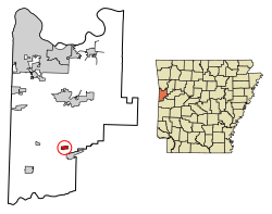 Location of Huntington in Sebastian County, Arkansas. | |
| Coordinates: 35°4′51″N 94°15′52″W | |
| Country | United States |
| State | Arkansas |
| County | Sebastian |
| Area | |
| • Total | 0.67 sq mi (1.74 km2) |
| • Land | 0.67 sq mi (1.73 km2) |
| • Water | 0.00 sq mi (0.00 km2) |
| Elevation | 636 ft (194 m) |
| Population (2010) | |
| • Total | 635 |
| • Estimate (2019)[2] | 621 |
| • Density | 929.64/sq mi (358.79/km2) |
| Time zone | UTC-6 (Central (CST)) |
| • Summer (DST) | UTC-5 (CDT) |
| ZIP code | 72940 |
| Area code(s) | 479 |
| FIPS code | 05-33940 |
| GNIS feature ID | 0050422 |
History
Huntington began as a coal mining town. In 1887, The Missouri, Kansas, & Texas Coal Company surveyed the site and selected it as a townsite because coal was around the site, but not directly beneath it. The town was incorporated on February 4, 1888. The town was named after J. B. Huntington, a well-liked mine superintendent, who died after his horse jumped from a bridge over Cherokee Creek.[4]
Geography
Huntington is located at 35°4′51″N 94°15′52″W (35.080833, -94.264462).[5]
According to the United States Census Bureau, the city has a total area of 0.7 square miles (1.8 km2), all land.
Demographics
| Historical population | |||
|---|---|---|---|
| Census | Pop. | %± | |
| 1890 | 913 | — | |
| 1900 | 1,298 | 42.2% | |
| 1910 | 1,700 | 31.0% | |
| 1920 | 1,453 | −14.5% | |
| 1930 | 813 | −44.0% | |
| 1940 | 863 | 6.2% | |
| 1950 | 744 | −13.8% | |
| 1960 | 560 | −24.7% | |
| 1970 | 627 | 12.0% | |
| 1980 | 662 | 5.6% | |
| 1990 | 715 | 8.0% | |
| 2000 | 688 | −3.8% | |
| 2010 | 635 | −7.7% | |
| Est. 2019 | 621 | [2] | −2.2% |
| U.S. Decennial Census[6] | |||
As of the census[7] of 2000, there were 688 people, 262 households, and 184 families residing in the city. The population density was 1,012.2 people per square mile (390.6/km2). There were 298 housing units at an average density of 438.4/sq mi (169.2/km2). The racial makeup of the city was 93.60% White, 0.15% Black or African American, 0.44% Native American, 1.89% from other races, and 3.92% from two or more races. 4.36% of the population were Hispanic or Latino of any race.
There were 262 households, out of which 37.4% had children under the age of 18 living with them, 58.8% were married couples living together, 8.0% had a female householder with no husband present, and 29.4% were non-families. 26.3% of all households were made up of individuals, and 13.0% had someone living alone who was 65 years of age or older. The average household size was 2.63 and the average family size was 3.19.
In the city, the population was spread out, with 28.3% under the age of 18, 7.7% from 18 to 24, 28.9% from 25 to 44, 22.7% from 45 to 64, and 12.4% who were 65 years of age or older. The median age was 35 years. For every 100 females, there were 96.6 males. For every 100 females age 18 and over, there were 94.9 males.
The median income for a household in the city was $30,703, and the median income for a family was $36,250. Males had a median income of $27,277 versus $15,781 for females. The per capita income for the city was $12,614. About 13.5% of families and 15.1% of the population were below the poverty line, including 12.1% of those under age 18 and 20.7% of those age 65 or over.
Notable people
- Jake Freeze, Chicago White Sox pitcher
- Britney Haynes, Big Brother 12 (U.S.) houseguest
References
- "2019 U.S. Gazetteer Files". United States Census Bureau. Retrieved June 30, 2020.
- "Population and Housing Unit Estimates". United States Census Bureau. May 24, 2020. Retrieved May 27, 2020.
- "U.S. Census website". Retrieved 29 April 2014.
- "A Brief History of Huntington, Arkansas". Archived from the original on 2 October 2010. Retrieved 11 April 2011.
- "US Gazetteer files: 2010, 2000, and 1990". United States Census Bureau. 2011-02-12. Retrieved 2011-04-23.
- "Census of Population and Housing". Census.gov. Retrieved June 4, 2015.
- "U.S. Census website". United States Census Bureau. Retrieved 2008-01-31.
Municipalities and communities of Sebastian County, Arkansas, United States | ||
|---|---|---|
| Cities | 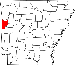 Map of Arkansas highlighting Sebastian County | |
| Towns | ||
| Unincorporated communities | ||
| Footnotes | ‡This populated place also has portions in an adjacent county or counties | |
| Authority control |
|---|