U.S. Route 70 in Texas
U.S. Route 70 (US 70) is the portion of a west–east US Highway in Texas that begins at the New Mexico state line in Farwell and ends at the Oklahoma state line northeast of Oklaunion.
| ||||
|---|---|---|---|---|
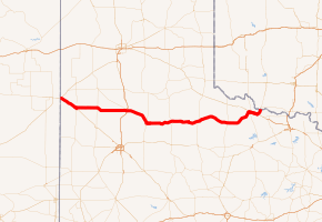
US 70 highlighted in red | ||||
| Route information | ||||
| Maintained by TxDOT | ||||
| Length | 253.9 mi (408.6 km) | |||
| Major junctions | ||||
| West end | ||||
| East end | ||||
| Location | ||||
| Counties | Parmer, Bailey, Lamb, Hale, Floyd, Motley, Cottle, Foard, Wilbarger | |||
| Highway system | ||||
| ||||

Route description
US 70 enters Texas with US 84 just after with US 60 splits off to the northeast in Texico, New Mexico, at the state line. US 70/US 84 then angles southeast to Muleshoe, where the two routes split.[1] US 70 heads due east, meeting US 385 at Springlake and has an interchange with Interstate 27/US 87 (I-27/US 87) in Plainview.[1] US 70 then arcs toward the south and runs concurrently with US 62 in Floydada. The two routes head east to Paducah, where US 62 splits off to the north to join with US 83.[1] US 70 then proceeds to Vernon, where it overlaps US 287 and US 183 (and has a junction with US 283). Near Oklaunion, US 70/US 183 splits off to the north to cross the Red River into Oklahoma.
History
The route through Texas was cosigned with State Highway 28 (SH 28) before 1939. SH 28' was designated in 1919 as a route from Muleshoe to Olney with a spur, SH 28A, from SH 28 at Crowell east to the Oklahoma border. In 1922, the route split in Benjamin, going south to Sagerton and east to Olney. In 1926, The portion from Crowell to Sagerton became SH 51, while the portion from Benjamin to Olney became SH 24. SH 28 was instead rerouted over SH 28A to end at the Oklahoma border. By 1939, the route was decommissioned in favor of US 70.[2]
Junction list
| County | Location | mi | km | Destinations | Notes | ||
|---|---|---|---|---|---|---|---|
| Parmer | Farwell | 0.0 | 0.0 | Continuation into New Mexico | |||
| See US 84 | |||||||
| Bailey | Muleshoe | 21.8 | 35.1 | Eastern end of US 84 concurrency; western end of SH 214 concurrency | |||
| 22.1 | 35.6 | Eastern end of SH 214 concurrency | |||||
| | 25.1 | 40.4 | |||||
| Lamb | | 31.3 | 50.4 | ||||
| | 33.7 | 54.2 | |||||
| Earth | 40.0 | 64.4 | |||||
| | 43.0 | 69.2 | |||||
| Springlake | 45.9 | 73.9 | |||||
| 46.1 | 74.2 | ||||||
| Circle | 51.0 | 82.1 | |||||
| 52.2 | 84.0 | ||||||
| Olton | 56.7 | 91.2 | Western end of FM 168 concurrency | ||||
| 56.8 | 91.4 | Eastern end of FM 168 concurrency | |||||
| Hale | | 63.2 | 101.7 | ||||
| | 65.2 | 104.9 | Western end of FM 179 concurrency | ||||
| Halfway | 67.2 | 108.1 | Eastern end of FM 179 concurrency | ||||
| | 71.2 | 114.6 | Western end of FM 1424 concurrency | ||||
| | 72.3 | 116.4 | Eastern end of FM 1424 concurrency | ||||
| Plainview | 78.9 | 127.0 | I-27 exit 49 | ||||
| 80.4 | 129.4 | ||||||
| 81.4 | 131.0 | Access to Hale County Airport | |||||
| 81.9 | 131.8 | ||||||
| | 86.1 | 138.6 | |||||
| Floyd | Aiken | 92.7 | 149.2 | ||||
| | 93.7 | 150.8 | |||||
| Lockney | 96.1 | 154.7 | |||||
| 97.2 | 156.4 | Western end of FM 378 concurrency | |||||
| 97.7 | 157.2 | Eastern end of FM 378 concurrency | |||||
| | 102.0 | 164.2 | |||||
| Floydada | 108.5 | 174.6 | |||||
| 108.9 | 175.3 | Western end of US 62 / SH 207 concurrency | |||||
| 109.8 | 176.7 | Eastern end of SH 207 concurrency; access to Floydada Municipal Airport | |||||
| | 113.8 | 183.1 | |||||
| | 115.8 | 186.4 | Western end of FM 602 concurrency | ||||
| | 116.8 | 188.0 | Eastern end of FM 602 concurrency | ||||
| | 122.8 | 197.6 | Western end of FM 28 concurrency | ||||
| | 123.3 | 198.4 | Eastern end of FM 28 concurrency | ||||
| Motley | Matador | 139.5 | 224.5 | ||||
| 139.9 | 225.1 | ||||||
| | 142.7 | 229.7 | |||||
| Cottle | | 168.6 | 271.3 | ||||
| Paducah | 171.0 | 275.2 | Eastern end of US 62 concurrency | ||||
| | 174.8 | 281.3 | |||||
| | 182.5 | 293.7 | |||||
| Foard | | 197.1 | 317.2 | ||||
| | 197.9 | 318.5 | |||||
| | 204.8 | 329.6 | |||||
| Crowell | 207.3 | 333.6 | |||||
| 207.7 | 334.3 | ||||||
| | 209.7 | 337.5 | |||||
| | 213.8 | 344.1 | |||||
| Thalia | 218.0 | 350.8 | |||||
| Wilbarger | | 225.0 | 362.1 | ||||
| | 226.8 | 365.0 | |||||
| Lockett | 228.8 | 368.2 | |||||
| 230.4 | 370.8 | ||||||
| | 234.1 | 376.7 | |||||
| Vernon | 235.5 | 379.0 | |||||
| 236.6 | 380.8 | Western end of US 287 Bus. concurrency | |||||
| 236.7 | 380.9 | Interchange; eastern end of US 287 Bus. concurrency; western end of US 287 concurrency | |||||
| See US 287 | |||||||
| Oklaunion | 247.2 | 397.8 | Interchange; eastern end of US 287 concurrency | ||||
| See US 183 | |||||||
| Red River | 253.9 | 408.6 | Continuation into Oklahoma | ||||
1.000 mi = 1.609 km; 1.000 km = 0.621 mi
| |||||||
References
- Rand McNally (2014). "Texas" (Map). The Road Atlas. Chicago: Rand McNally. pp. 98–99.
- U.S. Highway Ends by Dale Sanderson (Mapguy), Last Retrieved July 22, 2017
| Previous state: New Mexico |
Texas | Next state: Oklahoma |