Menomonee Falls, Wisconsin
Menomonee Falls is a village in Waukesha County, Wisconsin, United States, and is part of the Greater Milwaukee area. The population was 35,626 at the 2010 census, making it the most populous village in Wisconsin.[7] It is the fourth largest community in Waukesha County.
Menomonee Falls, Wisconsin | |
|---|---|
| Coordinates: 43°10′44″N 88°7′2″W | |
| Country | |
| State | |
| County | Waukesha |
| Area | |
| • Total | 33.30 sq mi (86.25 km2) |
| • Land | 32.91 sq mi (85.23 km2) |
| • Water | 0.39 sq mi (1.02 km2) |
| Elevation | 856 ft (261 m) |
| Population | |
| • Total | 35,626 |
| • Estimate (2019)[4] | 38,014 |
| • Density | 1,155.12/sq mi (446.00/km2) |
| Time zone | UTC−6 (Central (CST)) |
| • Summer (DST) | UTC−5 (CDT) |
| Area code(s) | 262 |
| FIPS code | 55-51000[5] |
| GNIS feature ID | 1569346[6] |
| Website | www |
History
Early 1800s
The area that became Menomonee Falls was first inhabited by Native Americans, including the people of the Menomonee and Chippewa tribes.
Late 1800s
Menomonee Falls continued to grow throughout the 1870s. By 1890, the population was 2,480.[8] In 1892, a section of Menomonee Falls was incorporated as a village. In 1894 the first village board was elected and the first village fire department formed. After becoming a village, many important buildings were built, including the village hall/fire station, Menomonee Falls High School, and the Wisconsin Sugar Factory.[8] The Wisconsin Sugar Factory employed as many as 500 laborers and produced up to 15 million pounds of sugar annually.[9]
Early 1900s
The first public telephone service was offered in 1902; a local electricity plant offered a substitute for kerosene lamps by 1907; water mains were installed in the 1910s; and the first sewer lines were laid in 1924. New neighborhoods were developed and the Menomonee Falls Public Library was built.[8] The village's second bank, the Farmers and Merchants Bank, was established in 1908 by attorney Samuel A. Connell.[10] By 1910, automobiles started being sold in the village, which led to an increase in paved roads. By 1919, Highway 15 connected Menomonee Falls to Milwaukee and Illinois and, by 1922, to Green Bay.[8]
In the early 20th century, a new municipal building was built to house village offices, the fire department, the police department, and a new Menomonee Falls Public Library. A subdivision named Hiawatha Heights added 58 single-family homes with 95% of the home buyers relocating from Milwaukee.[9] By 1940, the population had come to 3,674.[8] Along with all of this, the building of shopping areas had begun, including the Hiawatha Shopping Center, which today can be seen along Appleton Avenue, with Krueger's Entertainment and Pop's Custard as the main attractions.[8]
Mid-1900s
In the 1950s more subdivisions were built, and US 41 was completed. This increased the attractiveness of Menomonee Falls as there was now an easy commute to Milwaukee jobs.[8] In 1958, the village of Menomonee Falls annexed the Town of Menomonee Falls, which increased the total area from 2 square miles to 32 square miles and the population from 4,500 to 12,000.[8]
In the 1960s the school district built six new schools because of population growth in the baby boom era. In 1965, a can manufacturing plant with a capacity of 150 million cans per year was established in the village, owned by Containers, Inc., a joint venture of the Miller Brewing Company and Carnation Company.[11] "By the end of the 1960s, 48 percent of the population in the Village was 19 years old or under."[8] Both a better park system and better public services were developed. Several full-time police officers were hired, along with full-time firefighters. Shopping centers were developed and major employers established in the village, including Harley-Davidson and Wacker Neuson. Old structures were razed to make way for several new streets.[8]
Late 1900s
Near the end of the 20thcentury, Menomonee Falls continued to grow in population. Between 1990 and 2010, the population had grown by almost 9,000.[8] New subdivisions and apartments were built in the community. Reports in 2016 state, "As of 2016, the Village had an estimated 36,907 residents and had become an important economic hub of Greater Milwaukee area."[8] Major business developments include Kohl's Corporate campus and the Westbrook Corporate Center. A new village hall/municipal center was built and a new Library.[9]
Geography

According to the United States Census Bureau, the village has a total area of 33.31 square miles (86.27 km2), of which, 32.92 square miles (85.26 km2) of it is land and 0.39 square miles (1.01 km2) is water.[12]
Neighborhoods
Fussville is a neighborhood of Menomonee Falls located at 43°09′06″N 88°04′40″W.[13] Fussville was once a separate unincorporated community; it was annexed by Menomonee Falls sometime between 1950 and 1960.[14][15]

Demographics
| Historical population | |||
|---|---|---|---|
| Census | Pop. | %± | |
| 1880 | 366 | — | |
| 1890 | 422 | 15.3% | |
| 1900 | 687 | 62.8% | |
| 1910 | 919 | 33.8% | |
| 1920 | 1,019 | 10.9% | |
| 1930 | 1,291 | 26.7% | |
| 1940 | 1,469 | 13.8% | |
| 1950 | 2,469 | 68.1% | |
| 1960 | 18,276 | 640.2% | |
| 1970 | 31,697 | 73.4% | |
| 1980 | 27,845 | −12.2% | |
| 1990 | 26,840 | −3.6% | |
| 2000 | 32,647 | 21.6% | |
| 2010 | 35,626 | 9.1% | |
| Est. 2019 | 38,014 | [4] | 6.7% |
| U.S. Decennial Census[16] | |||
2010 census
As of the census[3] of 2010, there were 35,626 people, 14,567 households, and 10,028 families residing in the village. The population density was 1,082.2 inhabitants per square mile (417.8/km2). There were 15,142 housing units at an average density of 460.0 per square mile (177.6/km2). The racial makeup of the village was 91.6% White, 3.0% African American, 0.2% Native American, 3.5% Asian, 0.4% from other races, and 1.3% from two or more races. Hispanic or Latino of any race were 2.0% of the population.
There were 14,567 households of which 30.5% had children under the age of 18 living with them, 59.1% were married couples living together, 6.9% had a female householder with no husband present, 2.9% had a male householder with no wife present, and 31.2% were non-families. 26.8% of all households were made up of individuals and 14% had someone living alone who was 65 years of age or older. The average household size was 2.43 and the average family size was 2.97.
The median age in the village was 43.3 years. 23% of residents were under the age of 18; 6% were between the ages of 18 and 24; 23.5% were from 25 to 44; 29.6% were from 45 to 64; and 17.8% were 65 years of age or older. The gender makeup of the village was 48.2% male and 51.8% female.
Economy
The overall economy of Menomonee Falls employs 18,839 people and “is specialized in Management of Companies and Enterprises; Manufacturing; and Wholesale trade”.[17] The largest industries in the Village are manufacturing, healthcare/social assistance, and retail trade which employ 3,917, 2,704 and 2,465 people respectively. Income per capita with adults and children included is $36,386 with the median household income in Menomonee Falls being $73,350.[18] The average male salary is $93,192 and average female salary is $61,294.[17] The unemployment rate is 4.00% with a job growth of 0.73%. Sales tax is 5.1% and income tax is at 6.27%.[18] With an overall poverty rate of only 3.72%, Menomonee Falls has a very healthy economy.[17]
Companies based in Menomonee Falls include Kohl's and Enerpac Tool Group.
Top employers
According to Menomonee Falls's 2017 Comprehensive Annual Financial Report,[19] the top employers in the village are:
| # | Employer | # of Employees |
|---|---|---|
| 1 | Kohl's | 4,937 |
| 2 | Froedtert Health | 1,323 |
| 3 | Harley-Davidson[20] | 917 |
| 4 | FIS Management Services LLC | 655 |
| 5 | Arandell Schmidt | 625 |
| 6 | Menomonee Falls School District | 559 |
| 7 | Wacker Neuson | 550 |
| 8 | Wells Fargo | 531 |
| 9 | Bradley Corporation | 370 |
| 10 | Village of Menomonee Falls | 232 |
Parks and recreation
A 150-acre, 18 hole golf course, partially completed in the mid-1960s, sits at the south east corner of the village.[21]
In the mid-1950s, the village held an Annual Field Day, an annual all-village family fair, part of the village's recreation program.[22]
Government
Menomonee Falls has a governing body consisting of a Board President and a six-member Board of Trustees. The current Village Board President is Dave Glasgow.[23] The Trustees are: Katie Kress, Randy Van Alstyne, Tim Newman, Paul Tadda, Jeremy Walz, and Steve Taggart
Education
Menomonee Falls School District operates Menomonee Falls High School, North Middle School, Benjamin Franklin Elementary School, Riverside Elementary School, Valley View Elementary School, and Shady Lane Elementary School. Saint Mary's Catholic School, Calvary Baptist School, Grace Lutheran School, Bethlehem Lutheran School, Zion Lutheran School, and Aquinas Academy are private schools in Menomonee Falls.
 Menomonee Falls, Wisconsin, as seen on January 22, 2014.
Media
- The Menomonee Falls Express News[24]
- The Menomonee Falls Gazette (1971–1978) — comic strip publication
- The Menomonee Falls Guardian (1973–1976) — comic strip publication
- Menomonee Falls Now[25]
Infrastructure
As of 1967, the water supply for the village was provided by a set of four wells, providing a daily water capacity of five million gallons.[26]
Transportation
Milwaukee County Transit System bus routes 61 & 79 serve Menomonee Falls
Notable people
- Josh Bilicki, NASCAR driver
- Mark Borchardt, independent filmmaker
- Janel Brandtjen, Businesswoman and Wisconsin State Representative
- Mel Eslyn, film producer
- Brett Hartmann, National Football League punter[27]
- George E. Hoyt, Wisconsin State Representative and Senator
- Andy Hurley, drummer of Fall Out Boy
- Elmer Klumpp, Major League Baseball player
- Victor Nehs, Wisconsin State Representative[28]
- Justus Henry Nelson, Methodist missionary in the Amazon
- John H. Niebler, Wisconsin State Representative
- Vic Perrin, actor
- Richard Riehle, actor
- Lolita Schneiders, Wisconsin State Representative[29]
- Barry Schultz, professional disc golfer
- James Sensenbrenner, U.S. congressman
- Mike Solwold, NFL player
- Peter J. Somers, U.S. congressman
- Jessica Szohr, actress
- Bob Uecker, baseball radio broadcaster
- Joel Whitburn, music historian
- Mark Wilson, five-time winner on the PGA Tour
- Mark Phillipi, strongman
References
- "2019 U.S. Gazetteer Files". United States Census Bureau. Retrieved August 7, 2020.
- "US Board on Geographic Names". United States Geological Survey. 2007-10-25. Retrieved 2008-01-31.
- "U.S. Census website". United States Census Bureau. Retrieved 2012-11-18.
- "Population and Housing Unit Estimates". United States Census Bureau. May 24, 2020. Retrieved May 27, 2020.
- "U.S. Census website". United States Census Bureau. Retrieved 2008-01-31.
- U.S. Geological Survey Geographic Names Information System: Menomonee Falls, Wisconsin
- Wisconsin Blue Book 2017-2018 (PDF). Madison: Wisconsin Legislative Reference Bureau. 2017. p. 617.
- "Village History". Village of Menomonee Falls. Retrieved April 25, 2018.
- "Village of Menomonee Falls". Encyclopedia of Milwaukee. Retrieved April 25, 2018.
- "Bank Sets Open House". Waukesha Freeman Saturday Review. Waukesha, Wisconsin. June 12, 1965. p. 8, Col. 1. Retrieved June 9, 2018 – via Newspapers.com.
- "Start Work On Can Firm This Month". Waukesha Freeman. Waukesha, Wisconsin. June 3, 1965. p. 14, Col. 6. Retrieved June 9, 2018 – via Newspapers.com.
- "US Gazetteer files 2010". United States Census Bureau. Archived from the original on 2012-07-14. Retrieved 2012-11-18.
- "Fussville". Geographic Names Information System. United States Geological Survey.
- "Sussex-Lisbon Historic Society, Land Divisions Within Waukesha County". Archived from the original on 2011-07-17. Retrieved 2011-05-25.
- "Fussville" (PDF). Archived from the original (PDF) on 2016-03-04. Retrieved 2012-01-05.
- "Census of Population and Housing". Census.gov. Retrieved June 4, 2015.
- "Menomonee Falls, WI". Data USA. Retrieved 2018-04-18.
- "Menomonee Falls, Wisconsin Economy". www.bestplaces.net. Retrieved 2018-04-18.
- Village of Menomonee Falls CAFR
- Shafer, Dan (18 July 2017). "Harley-Davidson to cut 180 jobs, affecting Milwaukee-area, KC plants". Milwaukee Business Journal. Retrieved 19 July 2017.
She did not provide further details on how many will be affected at Milwaukee-based Harley-Davidson’s (NYSE: HOG) 912,000-square-foot plant in Menomonee Falls.
- "Golf Course Is Offered To County". Waukesha Freeman. Waukesha, Wisconsin. June 16, 1966. p. 2, Col. 4. Retrieved June 9, 2018 – via Newspapers.com.
- "Field Day Ends Rec Playground Season At Falls". Waukesha Daily Freeman. Waukesha, Wisconsin. July 30, 1954. p. 9, Col. 5. Retrieved June 9, 2018 – via Newspapers.com.
- "Village of Menomonee Falls Board".
- Express News official website
- Menomonee Falls Now official website
- "Will Enlarge Water Capacity". Waukesha Freeman. Waukesha, Wisconsin. May 10, 1967. p. 16. Retrieved June 9, 2018 – via Newspapers.com.
- Bret Hartmann
- 'Wisconsin Blue Book 1937,' Biographical sketch of Victor Nehs, pg. 206
- 'Wisconsin Blue Book 1995-1996,' Biographical Sketch of Lolita Schneiders, pg. 37
External links
- Menomonee Falls village website
- Menomonee Falls Public Library
- Sanborn fire insurance map: 1910
Municipalities and communities of Waukesha County, Wisconsin, United States | ||
|---|---|---|
| Cities | 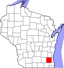 | |
| Villages | ||
| Towns | ||
| CDP | ||
| Unincorporated communities | ||
| Ghost towns/ neighborhoods | ||
| Footnotes | ‡This populated place also has portions in an adjacent county or counties | |
| Central city | 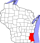 | |
|---|---|---|
| Largest municipalities (over 25,000 in 2010) | ||
| Municipalities (over 10,000 in 2010) | ||
| Smaller municipalities (under 10,000 in 2010) |
| |
| Counties | ||
| Other topics | ||
Notes: Vvillage Ttown Ccity | ||
| Authority control |
|
|---|