Wales, Wisconsin
Wales is a village in Waukesha County, Wisconsin, United States, first settled by Welsh immigrants.[6] The population was 2,549 at the 2010 census.
Wales, Wisconsin | |
|---|---|
 Location of Wales in Waukesha County, Wisconsin. | |
| Coordinates: 43°0′14″N 88°22′39″W | |
| Country | |
| State | |
| County | Waukesha |
| Area | |
| • Total | 3.23 sq mi (8.37 km2) |
| • Land | 3.23 sq mi (8.36 km2) |
| • Water | 0.01 sq mi (0.01 km2) |
| Elevation | 1,001 ft (305 m) |
| Population | |
| • Total | 2,549 |
| • Estimate (2019)[4] | 2,585 |
| • Density | 801.30/sq mi (309.39/km2) |
| Time zone | UTC-6 (Central (CST)) |
| • Summer (DST) | UTC-5 (CDT) |
| ZIP Code | 53183 |
| Area code(s) | 262 |
| FIPS code | 55-83175[5] |
| GNIS feature ID | 1576156[2] |
| Website | www |
Geography
Wales is located at 43°0′14″N 88°22′39″W (43.003882, -88.377558).[7]
According to the United States Census Bureau, the village has a total area of 3.29 square miles (8.52 km2), of which, 3.28 square miles (8.50 km2) of it is land and 0.01 square miles (0.03 km2) is water.[8]
Demographics
| Historical population | |||
|---|---|---|---|
| Census | Pop. | %± | |
| 1930 | 132 | — | |
| 1940 | 170 | 28.8% | |
| 1950 | 237 | 39.4% | |
| 1960 | 356 | 50.2% | |
| 1970 | 691 | 94.1% | |
| 1980 | 1,992 | 188.3% | |
| 1990 | 2,471 | 24.0% | |
| 2000 | 2,523 | 2.1% | |
| 2010 | 2,549 | 1.0% | |
| Est. 2019 | 2,585 | [4] | 1.4% |
| U.S. Decennial Census[9] | |||
2010 census
As of the census[3] of 2010, there were 2,549 people, 949 households, and 792 families living in the village. The population density was 777.1 inhabitants per square mile (300.0/km2). There were 987 housing units at an average density of 300.9 per square mile (116.2/km2). The racial makeup of the village was 97.9% White, 0.4% African American, 0.2% Native American, 0.5% Asian, 0.1% Pacific Islander, 0.2% from other races, and 0.7% from two or more races. Hispanic or Latino of any race were 1.8% of the population.
There were 949 households of which 37.7% had children under the age of 18 living with them, 68.5% were married couples living together, 10.3% had a female householder with no husband present, 4.6% had a male householder with no wife present, and 16.5% were non-families. 12.5% of all households were made up of individuals and 3.5% had someone living alone who was 65 years of age or older. The average household size was 2.69 and the average family size was 2.93.
The median age in the village was 43.1 years. 25.8% of residents were under the age of 18; 6.1% were between the ages of 18 and 24; 21.7% were from 25 to 44; 36.7% were from 45 to 64; and 9.8% were 65 years of age or older. The gender makeup of the village was 50.3% male and 49.7% female.
2000 census
As of the census[5] of 2000, there were 2,523 people, 846 households, and 731 families living in the village. The population density was 1,033.4 people per square mile (399.2/km²). There were 863 housing units at an average density of 353.5 per square mile (136.6/km²). The racial makeup of the village was 98.61% White, 0.16% African American, 0.24% Native American, 0.24% Asian, 0.20% from other races, and 0.55% from two or more races. Hispanic or Latino of any race were 1.03% of the population.
There were 846 households out of which 46.2% had children under the age of 18 living with them, 76.7% were married couples living together, 7.0% had a female householder with no husband present, and 13.5% were non-families. 10.2% of all households were made up of individuals and 2.7% had someone living alone who was 65 years of age or older. The average household size was 2.98 and the average family size was 3.20.
In the village, the population was spread out with 30.3% under the age of 18, 7.3% from 18 to 24, 29.0% from 25 to 44, 29.2% from 45 to 64, and 4.2% who were 65 years of age or older. The median age was 37 years. For every 100 females, there were 103.5 males. For every 100 females age 18 and over, there were 101.4 males.
The median income for a household in the village was $75,000, and the median income for a family was $77,468. Males had a median income of $50,609 versus $35,268 for females. The per capita income for the village was $26,712. None of the families and 0.2% of the population were living below the poverty line, including no under eighteens and none of those over 64.
Education
- School District of Kettle Moraine
- Kettle Moraine High School, a recognized Blue Ribbon School
- Wales Elementary School
Places of worship
- Jerusalem Presbyterian Church
- All Saints Lutheran Church, ELCA
- Bethlehem Lutheran Church, Missouri Synod
Public safety
All fire rescue and EMS services are provided by the Wales/Genesee Fire Department. Law enforcement in Wales is provided by the Waukesha County Sheriff.
History
Welsh immigrants settled the village of Wales in 1840. The remains of Welsh history can be seen in the village's flag that replicates the Welsh national flag.[10]
References
- "2019 U.S. Gazetteer Files". United States Census Bureau. Retrieved August 7, 2020.
- "US Board on Geographic Names". United States Geological Survey. 2007-10-25. Retrieved 2008-01-31.
- "U.S. Census website". United States Census Bureau. Retrieved 2012-11-18.
- "Population and Housing Unit Estimates". United States Census Bureau. May 24, 2020. Retrieved May 27, 2020.
- "U.S. Census website". United States Census Bureau. Retrieved 2008-01-31.
- Chicago and North Western Railway Company (1908). A History of the Origin of the Place Names Connected with the Chicago & North Western and Chicago, St. Paul, Minneapolis & Omaha Railways. p. 135.
- "US Gazetteer files: 2010, 2000, and 1990". United States Census Bureau. 2011-02-12. Retrieved 2011-04-23.
- "US Gazetteer files 2010". United States Census Bureau. Retrieved 2012-11-18.
- "Census of Population and Housing". Census.gov. Retrieved June 4, 2015.
- Village of Wales, Wisconsin
External links
Municipalities and communities of Waukesha County, Wisconsin, United States | ||
|---|---|---|
| Cities | 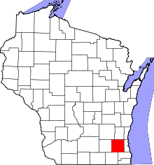 | |
| Villages | ||
| Towns | ||
| CDP | ||
| Unincorporated communities | ||
| Ghost towns/ neighborhoods | ||
| Footnotes | ‡This populated place also has portions in an adjacent county or counties | |
| Central city | 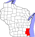 | |
|---|---|---|
| Largest municipalities (over 25,000 in 2010) | ||
| Municipalities (over 10,000 in 2010) | ||
| Smaller municipalities (under 10,000 in 2010) |
| |
| Counties | ||
| Other topics | ||
Notes: Vvillage Ttown Ccity | ||
| Authority control |
|
|---|