Kewaskum, Wisconsin
Kewaskum is a village in Washington and Fond du Lac counties in the U.S. state of Wisconsin. The population was 4,004 at the 2010 census. All of this population resided in the Washington County portion of the village. The village is located mostly within the Town of Kewaskum.

Kewaskum, Wisconsin | |
|---|---|
 Intersection of US 45 and WIS 28 in downtown Kewaskum | |
 Location of Kewaskum in Fond du Lac County (top) and Washington County (bottom), Wisconsin. | |
| Coordinates: 43°30′51″N 88°13′24″W | |
| Country | |
| State | |
| Counties | Washington & Fond du Lac |
| Area | |
| • Total | 2.35 sq mi (6.10 km2) |
| • Land | 2.35 sq mi (6.10 km2) |
| • Water | 0.00 sq mi (0.00 km2) |
| Elevation | 935 ft (285 m) |
| Population | |
| • Total | 4,004 |
| • Estimate (2019)[4] | 4,264 |
| • Density | 1,811.38/sq mi (699.38/km2) |
| Time zone | UTC-6 (Central (CST)) |
| • Summer (DST) | UTC-5 (CDT) |
| Area code(s) | 262 |
| FIPS code | 55-39325[5] |
| GNIS feature ID | 1583474[2] |
| Website | village |
Toponymy
Kewaskum was the leader of a group of Potawatomi Native Americans who lived in Washington County in the 1840s.[6] He was friendly with the early settlers, including future Wisconsin state senator Densmore Maxon.[7] He died sometime between 1847 and 1850. In 1849, the early settlers named the Town of Kewaskum (and later the village) in his honor. In the Potawatomi language, Kewaskum means "turning back on his tracks" or "retracing his steps."[8]
History
In the early 19th century, the Kewaskum area was home to Potawatomi Native Americans, who surrendered the land the United States Federal Government in 1833 through the Treaty of Chicago, which required them to leave Wisconsin by 1838.[9] While many Potawatomis moved west of the Mississippi River to Kansas, some chose to remain, and were known as "strolling Potawatomi" because they were itinerant squatters.[10] One band of strolling Potawatomi travelled through Dodge, Jefferson, and Washington counties, and was led by Chief Kewaskum, who had a camp on Pike Lake. The chief was friendly with the white settlers who began arriving in the 1840s.[7] He died sometime between 1847 and 1850,[8] but itinerant Potawatomis lived in Washington County into the late 19th century, when many of them gathered in northern Wisconsin to form the Forest County Potawatomi Community.[11]
A post office called Kewaskum has been in operation since 1849.[12] Kewaskum was incorporated as a village in 1895.[13] It was further expanded by annexations in the Town of Kewaskum; first in 1959, and then in twenty of the next forty-six years.[14] In 1963, Kewaskum annexed a noncontiguous parcel of land in the Town of Auburn in Fond du Lac County.[15]
Geography
The primary north-south highway serving Kewaskum is U.S. Route 45, and the primary east-west highway is Wisconsin Highway 28. Kewaskum is located in the 262 Area Code of south-eastern Wisconsin, with Prefix 626.
According to the United States Census Bureau, the village has a total area of 2.45 square miles (6.35 km2), all of it land.[16]
Demographics
| Historical population | |||
|---|---|---|---|
| Census | Pop. | %± | |
| 1880 | 471 | — | |
| 1890 | 557 | 18.3% | |
| 1900 | 679 | 21.9% | |
| 1910 | 625 | −8.0% | |
| 1920 | 707 | 13.1% | |
| 1930 | 799 | 13.0% | |
| 1940 | 880 | 10.1% | |
| 1950 | 1,183 | 34.4% | |
| 1960 | 1,572 | 32.9% | |
| 1970 | 1,926 | 22.5% | |
| 1980 | 2,394 | 24.3% | |
| 1990 | 2,515 | 5.1% | |
| 2000 | 3,274 | 30.2% | |
| 2010 | 4,004 | 22.3% | |
| Est. 2019 | 4,264 | [4] | 6.5% |
| U.S. Decennial Census[17] | |||
2010 census
As of the census[3] of 2010, there were 4,004 people, 1,581 households, and 1,148 families living in the village. The population density was 1,634.3 inhabitants per square mile (631.0/km2). There were 1,698 housing units at an average density of 693.1 per square mile (267.6/km2). The racial makeup of the village was 96.0% White, 0.5% African American, 0.3% Native American, 0.5% Asian, 1.2% from other races, and 1.3% from two or more races. Hispanic or Latino of any race were 2.9% of the population.
There were 1,581 households, of which 35.3% had children under the age of 18 living with them, 57.9% were married couples living together, 10.0% had a female householder with no husband present, 4.7% had a male householder with no wife present, and 27.4% were non-families. 21.6% of all households were made up of individuals, and 8.3% had someone living alone who was 65 years of age or older. The average household size was 2.52 and the average family size was 2.92.
The median age in the village was 36.8 years. 25.4% of residents were under the age of 18; 7.1% were between the ages of 18 and 24; 29.7% were from 25 to 44; 24.9% were from 45 to 64; and 12.7% were 65 years of age or older. The gender makeup of the village was 49.0% male and 51.0% female.
2000 census
As of the census[5] of 2000, there were 3,274 people, 1,212 households, and 895 families living in the village. The population density was 2,217.3 people per square mile (854.1/km2). There were 1,264 housing units at an average density of 856.0 per square mile (329.8/km2). The racial makeup of the village was 97.95% White, 0.27% Black or African American, 0.18% Native American, 0.37% Asian, 0.37% from other races, and 0.86% from two or more races. 0.92% of the population were Hispanic or Latino of any race.
There were 1,212 households, out of which 37.8% had children under the age of 18 living with them, 59.8% were married couples living together, 10.0% had a female householder with no husband present, and 26.1% were non-families. 21.1% of all households were made up of individuals, and 7.1% had someone living alone who was 65 years of age or older. The average household size was 2.64 and the average family size was 3.09.
In the village, the population was spread out, with 27.4% under the age of 18, 9.3% from 18 to 24, 31.7% from 25 to 44, 19.5% from 45 to 64, and 12.0% who were 65 years of age or older. The median age was 33 years. For every 100 females, there were 97.3 males. For every 100 females age 18 and over, there were 94.8 males.
The median income for a household in the village was $49,861, and the median income for a family was $55,144. Males had a median income of $37,639 versus $25,806 for females. The per capita income for the village was $20,509. About 4.0% of families and 5.0% of the population were below the poverty line, including 4.0% of those under age 18 and 8.7% of those age 65 or over.
Notable people
- Louis D. Guth, Wisconsin State Representative and businessman, lived in Kewaskum.[18]
- Kenneth William Haebig, Wisconsin State Representative and lawyer, lived in Kewaskum.[19]
- Einar H. Ingman Jr., Medal of Honor recipient, lived in Kewaskum.
- Glenway Wescott, noted American author, was born in Kewaskum in 1901. He lived abroad, wrote poetry, novels, and criticism, returned to the United States, and died in 1987.
References
- "2019 U.S. Gazetteer Files". United States Census Bureau. Retrieved August 7, 2020.
- "US Board on Geographic Names". United States Geological Survey. 2007-10-25. Retrieved 2008-01-31.
- "U.S. Census website". United States Census Bureau. Retrieved 2012-11-18.
- "Population and Housing Unit Estimates". United States Census Bureau. May 24, 2020. Retrieved May 27, 2020.
- "U.S. Census website". United States Census Bureau. Retrieved 2008-01-31.
- Chicago and North Western Railway Company (1908). A History of the Origin of the Place Names Connected with the Chicago & North Western and Chicago, St. Paul, Minneapolis & Omaha Railways. p. 90.
- Quickert, Carl (1912). Washington County, Wisconsin: Past and Present. Chicago, IL: S. J. Clarke Publishing Company. p. 33.
- "About Kewaskum". Kewaskum Public Library. Retrieved March 17, 2020.
- "Early history of Ozaukee County, Wisconsin". University of Wisconsin-Madison Libraries. Retrieved 2020-01-01.
- "Potawatomi History". Milwaukee Public Museum. Retrieved February 20, 2020.
- "Potawatomi History". Milwaukee Public Museum. Retrieved February 20, 2020.
- "Washington County". Jim Forte Postal History. Retrieved 21 March 2015.
- "About This Collection". Kewaskum Public Library. Retrieved December 28, 2019.
- Annexations of the Town of Kewaskum occurred in 1959, 1960, 1962, 1965, 1966, 1973, 1976, 1978, 1982, 1984, 1986, 1987, 1989, 1991, 1993, 1996, 1998, 2002, 2003, 2004, 2005. http://sos.nmtvault.com/SearchResults.aspx?City=V212%5B%5D
- http://sos.nmtvault.com/pdf/THEOSOS_006/images/00003677.pdf The Wisconsin Department of Transportation did not become aware of this until 2003. http://www.doa.state.wi.us/docview.asp?docid=2270
- "US Gazetteer files 2010". United States Census Bureau. Archived from the original on 2012-07-02. Retrieved 2012-11-18.
- "Census of Population and Housing". Census.gov. Retrieved June 4, 2015.
- 'L. D. Guth-obituary,' Wisconsin State Journal, March 16, 1939, part 2, pg. 1
- 'Wisconsin Blue Book 1953,' Biographical Sketch of William Haebig, pg. 60
External links
- Village of Kewaskum
- Sanborn fire insurance maps: 1894 1900 1910
Municipalities and communities of Fond du Lac County, Wisconsin, United States | ||
|---|---|---|
| Cities | 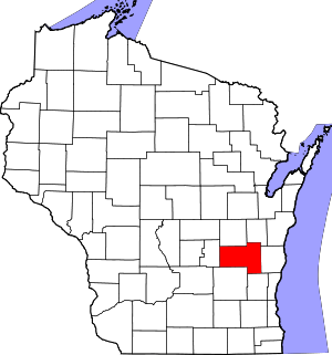 | |
| Villages | ||
| Towns | ||
| CDPs | ||
| Unincorporated communities |
| |
| Ghost towns/neighborhoods | ||
| Footnotes | ‡This populated place also has portions in an adjacent county or counties | |
Municipalities and communities of Washington County, Wisconsin, United States | ||
|---|---|---|
| Cities | 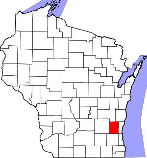 | |
| Villages | ||
| Towns | ||
| CDP | ||
| Unincorporated communities |
| |
| Footnotes | ‡This populated place also has portions in an adjacent county or counties | |