River Hills, Wisconsin
River Hills is a village in Milwaukee County, Wisconsin, United States. The population was 1,597 at the 2010 census.
River Hills, Wisconsin | |
|---|---|
 Location of River Hills in Milwaukee County, Wisconsin. | |
| Coordinates: 43°9′55″N 87°55′57″W | |
| Country | |
| State | |
| County | Milwaukee |
| Area | |
| • Total | 5.33 sq mi (13.81 km2) |
| • Land | 5.16 sq mi (13.35 km2) |
| • Water | 0.17 sq mi (0.45 km2) |
| Elevation | 709 ft (216 m) |
| Population | |
| • Total | 1,597 |
| • Estimate (2019)[4] | 1,575 |
| • Density | 305.47/sq mi (117.95/km2) |
| Time zone | UTC-6 (Central (CST)) |
| • Summer (DST) | UTC-5 (CDT) |
| Area code(s) | 414 |
| FIPS code | 55-68325[5] |
| GNIS feature ID | 1572350[2] |
| Website | www |
Geography
River Hills is located at 43°9′55″N 87°55′57″W (43.165142, -87.932566).[6]
According to the United States Census Bureau, the village has a total area of 5.31 square miles (13.75 km2), of which, 5.13 square miles (13.29 km2) of it is land and 0.18 square miles (0.47 km2) is water.[7]
Demographics
| Historical population | |||
|---|---|---|---|
| Census | Pop. | %± | |
| 1940 | 541 | — | |
| 1950 | 567 | 4.8% | |
| 1960 | 1,257 | 121.7% | |
| 1970 | 1,561 | 24.2% | |
| 1980 | 1,642 | 5.2% | |
| 1990 | 1,612 | −1.8% | |
| 2000 | 1,631 | 1.2% | |
| 2010 | 1,597 | −2.1% | |
| Est. 2019 | 1,575 | [4] | −1.4% |
| U.S. Decennial Census[8] | |||
2010 census
As of the census[3] of 2010, there were 1,597 people, 595 households, and 492 families living in the village. The population density was 311.3 inhabitants per square mile (120.2/km2). There were 647 housing units at an average density of 126.1 per square mile (48.7/km2). The racial makeup of the village was 82.3% White, 6.3% African American, 0.3% Native American, 7.5% Asian, 1.0% from other races, and 2.7% from two or more races. Hispanic or Latino of any race were 4.1% of the population.
There were 595 households, of which 32.6% had children under the age of 18 living with them, 74.6% were married couples living together, 5.4% had a female householder with no husband present, 2.7% had a male householder with no wife present, and 17.3% were non-families. 15.3% of all households were made up of individuals, and 6.7% had someone living alone who was 65 years of age or older. The average household size was 2.68 and the average family size was 2.97.
The median age in the village was 49.5 years. 24% of residents were under the age of 18; 4.5% were between the ages of 18 and 24; 14% were from 25 to 44; 38.5% were from 45 to 64; and 19.1% were 65 years of age or older. The gender makeup of the village was 48.7% male and 51.3% female.
2000 census
As of the census[5] of 2000, there were 1,631 people, 590 households, and 493 families living in the village. The population density was 320.3 people per square mile (123.7/km2). There were 617 housing units at an average density of 121.2 per square mile (46.8/km2). The racial makeup of the village was 85.71% White, 4.90% African American, 0.12% Native American, 7.54% Asian, 0.06% from other races, and 1.66% from two or more races. Hispanic or Latino of any race were 2.08% of the population.
There were 590 households, out of which 33.4% had children under the age of 18 living with them, 77.8% were married couples living together, 3.7% had a female householder with no husband present, and 16.3% were non-families. 12.7% of all households were made up of individuals, and 4.7% had someone living alone who was 65 years of age or older. The average household size was 2.76 and the average family size was 3.02.
In the village, the population was spread out, with 24.5% under the age of 18, 4.8% from 18 to 24, 18.8% from 25 to 44, 37.0% from 45 to 64, and 14.8% who were 65 years of age or older. The median age was 46 years. For every 100 females, there were 100.9 males. For every 100 females age 18 and over, there were 99.2 males.
The median income for a household in the village was $161,292, and the median income for a family was $181,443, but the central regions of River Hills tend to be much wealthier than the outlying regions. Males had a median income of $100,000 versus $54,167 for females. The per capita income for the village was $94,479. About 0.4% of families and 1.7% of the population were below the poverty line, including 1.3% of those under age 18 and 1.3% of those age 65 or over.
References
- "2019 U.S. Gazetteer Files". United States Census Bureau. Retrieved August 7, 2020.
- "US Board on Geographic Names". United States Geological Survey. 2007-10-25. Retrieved 2008-01-31.
- "U.S. Census website". United States Census Bureau. Retrieved 2012-11-18.
- "Population and Housing Unit Estimates". United States Census Bureau. May 24, 2020. Retrieved May 27, 2020.
- "U.S. Census website". United States Census Bureau. Retrieved 2008-01-31.
- "US Gazetteer files: 2010, 2000, and 1990". United States Census Bureau. 2011-02-12. Retrieved 2011-04-23.
- "US Gazetteer files 2010". United States Census Bureau. Archived from the original on 2012-01-25. Retrieved 2012-11-18.
- "Census of Population and Housing". Census.gov. Retrieved June 4, 2015.
External links
Municipalities and communities of Milwaukee County, Wisconsin, United States | ||
|---|---|---|
| Cities | 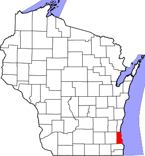 | |
| Villages | ||
| Ghost towns/ neighborhoods | ||
| Indian reservation | ||
| Footnotes | ‡This populated place also has portions in another county or counties | |
| Central city | 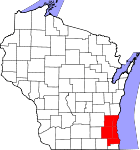 | |
|---|---|---|
| Largest municipalities (over 25,000 in 2010) | ||
| Municipalities (over 10,000 in 2010) | ||
| Smaller municipalities (under 10,000 in 2010) |
| |
| Counties | ||
| Other topics | ||
Notes: Vvillage Ttown Ccity | ||
| Authority control |
|
|---|