Franklin, Milwaukee County, Wisconsin
Franklin is a city in Milwaukee County, Wisconsin, United States. It is a suburb of Milwaukee with a population of 35,451 as of the 2010 census.
Franklin, Wisconsin | |
|---|---|
 Location of Franklin in Milwaukee County, Wisconsin. | |
| Coordinates: 42°53′57″N 88°0′8″W | |
| County | Milwaukee |
| Founded | 1841 |
| Incorporated | 1956 |
| Government | |
| • Mayor | Steve Olson |
| Area | |
| • Total | 34.68 sq mi (89.82 km2) |
| • Land | 34.58 sq mi (89.55 km2) |
| • Water | 0.10 sq mi (0.27 km2) |
| Elevation | 790 ft (241 m) |
| Population | |
| • Total | 35,451 |
| • Estimate (2019)[3] | 35,811 |
| • Density | 1,035.75/sq mi (399.91/km2) |
| Time zone | UTC−6 (Central) |
| • Summer (DST) | UTC−5 (Central) |
| Area code(s) | 414 |
| FIPS code | 55-27300 |
| GNIS feature ID | 1583234 |
| Website | www |
History
On December 20, 1839, the south portion of the Town of Kinnikinick was split off to form the town of Franklin. The town consisted of a 36-square-mile area that was originally covered with heavy timber, which was mostly hardwoods such as hickory, walnut, and butternut. Most of the town's drainage was delivered by the Root River and there was an abundance of wildlife including bears, deer, and wolves.[4] As of the 1840 census, the population of the Town of Franklin was 248.[5] The name "Franklin" was given in homage to Benjamin Franklin.
By the 1950s, Franklin was known as a "City of Homes" for its growing residential areas, which served as a suburb of the city of Milwaukee. In 1956, town officials were concerned by the possibility that the city of Milwaukee might attempt to annex portions of Franklin. In response, the town was incorporated as a fourth-class city on August 15, 1956.
Geography
Franklin is located at 42°53′57″N 88°00′08″W (42.899166, −88.002204).[6] It is bounded by the city of Oak Creek to the east, the villages of Greendale and Hales Corners to the north, the county of Racine to the south, and the county of Waukesha to the west.[7]
According to the United States Census Bureau, the city has a total area of 34.69 square miles (89.85 km2), of which, 34.58 square miles (89.56 km2) is land and 0.11 square miles (0.28 km2) is water.[8]
The Root River runs south through Franklin, cutting the city in half.

Climate
| ||||||||||||||||||||||||||||||||||||||||||||||||||||||||||||||||||||||||||||||||||||||||||||||||||||||||||||||||||||||||||||
Demographics
| Historical population | |||
|---|---|---|---|
| Census | Pop. | %± | |
| 1960 | 10,006 | — | |
| 1970 | 12,247 | 22.4% | |
| 1980 | 16,871 | 37.8% | |
| 1990 | 21,855 | 29.5% | |
| 2000 | 29,494 | 35.0% | |
| 2010 | 35,451 | 20.2% | |
| Est. 2019 | 35,811 | [3] | 1.0% |
| U.S. Decennial Census[10] | |||
2010 census
As of the census[2] of 2010, there were 35,451 people, 13,642 households, and 9,351 families living in the city. The population density was 1,025.2 inhabitants per square mile (395.8/km2). There were 14,356 housing units at an average density of 415.2 per square mile (160.3/km2). The racial makeup of the city was 87.1% White, 4.9% African American, 0.4% Native American, 5.4% Asian, 0.8% from other races, and 1.5% from two or more races. Hispanic or Latino of any race were 4.5% of the population. Please note that the House of Correction members are counted in this demographic.
There were 13,642 households, of which 30.5% had children under the age of 18 living with them, 58.3% were married couples living together, 6.8% had a female householder with no husband present, 3.5% had a male householder with no wife present, and 31.5% were non-families. 26.4% of all households were made up of individuals, and 10.7% had someone living alone who was 65 years of age or older. The average household size was 2.45 and the average family size was 2.99.
The median age in the city was 41.5 years. 21.6% of residents were under the age of 18; 7.7% were between the ages of 18 and 24; 25.9% were from 25 to 44; 31.4% were from 45 to 64; and 13.4% were 65 years of age or older. The gender makeup of the city was 51.1% male and 48.9% female.
2000 census
As of the census[11] of 2000, there were 29,494 people, 10,602 households, and 7,697 families living in the city. The population density was 851.8 people per square mile (328.8/km2). There were 10,936 housing units at an average density of 315.8 per square mile (121.9/km2). The racial makeup of the city was 98.78% White, 0.15% African American, 0.036% Native American, 2.10% Asian, 0.03% Pacific Islander, 0.67% from other races, and 0.91% from two or more races. Hispanic or Latino of any race were 2.64% of the population.
There were 10,602 households, out of which 33.8% had children under the age of 18 living with them, 63.2% were married couples living together, 6.6% had a female householder with no husband present, and 27.4% were non-families. 22.5% of all households were made up of individuals, and 6.9% had someone living alone who was 65 years of age or older. The average household size was 2.58, and the average family size was 3.06.
In the city, the population was spread out, with 23.4% under the age of 18, 8.4% from 18 to 24, 32.7% from 25 to 44, 25.6% from 45 to 64, and 9.9% who were 65 years of age or older. The median age was 38 years. For every 100 females, there were 109.2 males. For every 100 females age 18 and over, there were 110.0 males.
The median income for a household in the city was US$75,315, and the median income for a family was $95,532. Males had a median income of $61,827 versus $54,737 for females. The per capita income for the city was $33,474. About 0.4% of families and 0.7% of the population were below the poverty line, including 2.7% of those under age 18 and 3.9% of those age 65 or over.
Government

Franklin government consists of a mayor (executive branch), a common council (legislative branch), and a municipal judge (judicial branch). The Common Council's primary purpose is the passage of laws, ordinances and policies, establishment of pay ranges for city employees and management of the city's financial affairs; its budget, its revenues, and the raising of funds for the operation of the city. The Common Council is composed of the mayor and six members representing the six aldermanic districts, serving three-year overlapping terms. One alderman is elected and serves as common council president.[12]

The mayor of the city, elected for a three-year term of office, is the chief executive officer of the city. The mayor is responsible for ensuring that city ordinances and state laws are observed and enforced, and that city officers, boards and commissions properly discharge their duties. The mayor oversees the police and fire departments; nominates the appointment of certain city employees, board and commission members to the council; and is chairman of the Plan Commission and the Community Development Authority. The mayor presides at meetings of the Common Council, voting only in cases if tie votes. City ordinances designate eight cabinet officers, as well as other unclassified positions within city government, that are appointed by the mayor subject to the confirmation by a majority of all members of the common council.[13] Mayor Steve Olson was re-elected in April, 2020.[14]
County
Franklin is in Milwaukee County. It shares parts of the 9th, 11th and 17th Milwaukee County Supervisor districts, which are the only three districts that fall within the city.[15]
State
All of Franklin lies in the 28th State Senate District and the 82nd State Assembly District.
Federal
Franklin is represented in the United States Senate by Senators Ron Johnson (R) and Tammy Baldwin (D). The city falls within Wisconsin's 1st congressional district, which is represented by Bryan Steil (R).
Transportation
Franklin is four miles (6 km) from Milwaukee Mitchell International Airport and close to Interstate 94. Running through the city are U.S. Highway 45, and WIS 36, WIS 100, and WIS 241.
Education
Public
The majority of Franklin primary and secondary students attend schools in the Franklin Public School District, which was formed in 1962 as a K-12 common school district. Franklin has five elementary schools, one middle school and one high school. The Franklin Recreation Department is also operated by the school district. The district is governed by an annual meeting of electors and a seven-member school board elected every three years with overlapping terms and election held every year in April. City government exercises no fiscal control over the school district.
The Oak Creek-Franklin School District serves residents of the far eastern side of Franklin, along 27th street. The district also serves all of the city of Oak Creek.
The Whitnall School District, which serves primarily the neighboring village of Hales Corners and parts of the city of Greenfield, serves Franklin residents residing on the city's far northwest side.
Private
Franklin's private schools include:
- St. Martin of Tours Parish School K4-8, the only Catholic school in Franklin
- St. Pauls Lutheran K4-8, founded in 1865 by a group of German Lutherans
- Indian Community School of Milwaukee K4-8, serving Indian children and youth.
Economy
Top employers
According to Franklin's 2012 Comprehensive Annual Financial Report,[16] the top employers in the city were:
| # | Employer | # of Employees |
|---|---|---|
| 1 | Northwestern Mutual | 2,550 |
| 2 | Wheaton Franciscan Healthcare | 712 |
| 3 | Franklin Public School District | 543 |
| 4 | Krones | 450 |
| 5 | GA Precision | 364 |
| 6 | Milwaukee County Corrections South | 360 |
| 7 | Walmart | 357 |
| 8 | Carlisle Interconnect Technologies | 270 |
| 9 | Central Aquatics | 261 |
| 10 | Strauss Brands | 250 |
Environmental concerns

Franklin is home to one of the Environmental Protection Agency's Superfund sites. Referred to as the "Fadrowski Drum Disposal Site",[17] or FDDS, the 40-acre (160,000 m2) site located at 42°55′14″N 87°57′10″W 6865 South 27th Street was found to be contaminated with high amounts of lead and chromium. Trace amounts of arsenic and DDT were also found.[18] The site also contains levels of mercury above Wisconsin enforcement standards.[19] The site once included a man-made pond with elevated cyanide levels. The site was placed on the National Priorities List in 1986, with remedial action (RA) completed in 1994. The site was deleted from the National Priorities List in 2003.[20] The site remedies included restricting access to the site, restricting use of land at the site, limited excavation of the waste (some drums), removal of hazardous soil, monitoring ground water, monitoring surface water, and installing a landfill cap.[21] The site has been largely remediated via landfill and limited excavation, however waste material above health-based levels was left on site.[22]
The site is currently under a monitoring status, with the U.S. Environmental Protection Agency reviewing the site every five years.[23] The site is now encircled by development. It is bordered on the north by a Hobby Lobby, a tributary that flows into the Root River, and South 27th Street. The southern boundary of the site is lined with a Goodwill Industries retail store. Residential properties are just 1,000 feet (300 m) west of the site and 600 feet (180 m) to the south. A Walmart is just 600 feet (180 m) north of the site. The site itself is prohibited from ever being used for potable water, residential development, or any development that would disturb the landfill cap.
Rankings
In July 2007, CNN/Money and Money magazine ranked Franklin the 90th best place to live in the United States.[24]
Franklin ranked 94th in the 2011 Money Magazine rankings.
Notable people
- Peter Doyle, Wisconsin Secretary of State
- Michael Egan, state senator and representative
- Sam Mayer, racing driver
- Scott Mayer, racing driver
- Ted Musgrave, NASCAR driver
- Bill Prietzel, racing driver nicknamed the "Franklin Flyer"
- Alisa Rodriguez, musician
- Jessie Rodriguez, advocate and politician
- Ken Skowronski, Wisconsin State Representative
References
- "2019 U.S. Gazetteer Files". United States Census Bureau. Retrieved August 7, 2020.
- "U.S. Census website". United States Census Bureau. Retrieved 2012-11-18.
- "Population and Housing Unit Estimates". United States Census Bureau. May 24, 2020. Retrieved May 27, 2020.
- http://www.franklinhistory.net/Franklin Historical Society
- Watrous, Jerome Anthony. Memoirs of Milwaukee County: From the Earliest Historical Times Down to the Present. Chicago: Western Historical Association, 1909; Volume 1, pp. 68-69.
- "US Gazetteer files: 2010, 2000, and 1990". United States Census Bureau. 2011-02-12. Retrieved 2011-04-23.
- http://www.franklinwi.gov/display/router.aspx?DocID=73City of Franklin
- "US Gazetteer files 2010". United States Census Bureau. Archived from the original on 2012-07-14. Retrieved 2012-11-18.
- "NASA Earth Observations Data Set Index". NASA. Retrieved 30 January 2016.
- "Census of Population and Housing". Census.gov. Retrieved June 4, 2015.
- "U.S. Census website". United States Census Bureau. Retrieved 2008-01-31.
- Common Council
- Mayor
- "Franklin mayor and alderman win re-election, note Ballpark Commons in goals for next term". My South Now. Retrieved June 6, 2017.
- Milwaukee County Board
- City of Franklin CAFR
- http://www.epa.gov/superfund/sites/npl/nar729.htm
- http://www.epa.gov/R5Super/npl/wisconsin/WID980901227.htm
- http://www.epa.gov/superfund/sites/rods/fulltext/r0591164.pdf#SSC
- http://www.epa.gov/superfund/sites/npl/d050906.htm
- http://www.epa.gov/region5/sites/fadrowski/
- http://www.epa.gov/superfund/sites/rods/fulltext/r0591164.pdf#SRRA
- http://www.epa.gov/superfund/sites/fiveyear/f2008050002658.pdf
- Ashford, Kate; Bartz, Andrea; Cox, Jeff; Fitch, Asa; Gandel, Stephen; Hyatt, Josh; Kelley, Rob; Knight, Kathleen; et al. "Best Places to Live: Top 100". CNN Money.com. Retrieved 2010-04-24.
External links
Municipalities and communities of Milwaukee County, Wisconsin, United States | ||
|---|---|---|
| Cities | 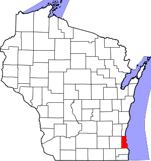 | |
| Villages | ||
| Ghost towns/ neighborhoods | ||
| Indian reservation | ||
| Footnotes | ‡This populated place also has portions in another county or counties | |
| Central city | 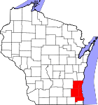 | |
|---|---|---|
| Largest municipalities (over 25,000 in 2010) | ||
| Municipalities (over 10,000 in 2010) | ||
| Smaller municipalities (under 10,000 in 2010) |
| |
| Counties | ||
| Other topics | ||
Notes: Vvillage Ttown Ccity | ||
| Authority control |
|
|---|