Marengo County, Alabama
Marengo County is a county located in the west central portion of the U.S. state of Alabama. As of the 2010 census, the population was 21,027.[2] The largest city is Demopolis and the county seat is Linden.[1] It is named in honor of Battle of Marengo near Turin, Italy, where French leader Napoleon Bonaparte defeated the Austrians on June 14, 1800.
Marengo County | |
|---|---|
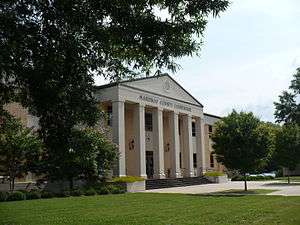 Marengo County Courthouse in Linden | |
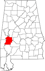 Location within the U.S. state of Alabama | |
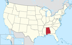 Alabama's location within the U.S. | |
| Coordinates: 32°14′31″N 87°47′22″W | |
| Country | |
| State | |
| Founded | February 6, 1818 |
| Named for | Battle of Marengo[1] |
| Seat | Linden |
| Largest city | Demopolis |
| Area | |
| • Total | 983 sq mi (2,550 km2) |
| • Land | 977 sq mi (2,530 km2) |
| • Water | 5.8 sq mi (15 km2) 0.6%% |
| Population (2010) | |
| • Total | 21,027 |
| • Estimate (2019) | 18,863 |
| • Density | 21/sq mi (8.3/km2) |
| Time zone | UTC−6 (Central) |
| • Summer (DST) | UTC−5 (CDT) |
| Congressional district | 7th |
| Website | marengocountyal |
| |
History
Marengo County was created by the Alabama Territorial legislature on February 6, 1818, from land acquired from the Choctaw Indians by the Treaty of Fort St. Stephens on October 24, 1816.[3] The name of the county commemorates Napoleon's victory at the Battle of Marengo over the Austrian armies on June 14, 1800.[1] This name was chosen in honor of the first European-American settlers, Bonapartists exiled from France after Napoleon's downfall, who in 1817 settled the area around Demopolis. They were trying to develop a Vine and Olive Colony.[3][4]
The county seat was originally known as the Town of Marengo, but in 1823 the name was changed to Linden.[1] Linden is a shortened version of Hohenlinden, scene of the Battle of Hohenlinden, a French victory in Bavaria on December 3, 1800 during Napoleon's campaign.[1] County courthouse fires occurred in 1848 and 1965, but most of the courthouse records were in a vault and largely saved in both instances.[1]
Situated in Alabama's Black Belt and having a naturally rich soil, the county was developed by planters for numerous cotton plantations, dependent on the labor of gangs of enslaved African Americans.[3] The enslaved black population comprised the majority of the county decades before the American Civil War. In 1860 the population consisted of 24,409 slaves, 6761 free whites (including 944 slave owners), and one "free person of color," for a total combined population of 31,171.[5] At this time there were 778 plantations and farms in the county.[5]
Demopolis was home to the fourth-oldest Jewish congregation in Alabama, B'nai Jeshurun. It was established in 1858.[6] After the American Civil War, the economy continued to be based on agriculture. In the transition to free labor, many freedmen turned to sharecropping or tenant farming as a way to establish some independence. They did not want to work in owner-controlled field gangs.[3]
The county population began to diminish rapidly after World War II. People left the farms for manufacturing jobs elsewhere, particularly with the wartime buildup of the defense industry on the West Coast.[3] The movement of blacks out of Mississippi and other parts of the Deep South was considered part of their Great Migration, by which 5 million African Americans left the South from 1940 to 1970.
The former cotton fields were gradually converted to other uses. Some were used for pastures for cattle and horses, others for woodlands for timber, and others developed as commercial catfish ponds for farming grain-fed catfish.[3] Beginning in the 1960s, industry began to move into the area; and the work force was employed in paper mills, lumber mills, and chemical plants.[3]
Geography
Marengo County is situated in the west-central area of the state.[1] According to the U.S. Census Bureau, the county has a total area of 983 square miles (2,550 km2), of which 977 square miles (2,530 km2) is land and 5.8 square miles (15 km2) (0.6%) is water.[7] The entire western county border is formed by the Tombigbee River and a small northwestern portion is formed by the Black Warrior River.
Major highways


Adjacent counties
- Hale County (north)
- Perry County (northeast)
- Dallas County (east)
- Wilcox County (southeast)
- Clarke County (south)
- Choctaw County (southwest)
- Sumter County (northwest)
- Greene County (north-northwest)
Demographics
| Historical population | |||
|---|---|---|---|
| Census | Pop. | %± | |
| 1820 | 2,933 | — | |
| 1830 | 7,700 | 162.5% | |
| 1840 | 17,264 | 124.2% | |
| 1850 | 27,831 | 61.2% | |
| 1860 | 31,171 | 12.0% | |
| 1870 | 26,151 | −16.1% | |
| 1880 | 30,890 | 18.1% | |
| 1890 | 33,095 | 7.1% | |
| 1900 | 38,315 | 15.8% | |
| 1910 | 39,923 | 4.2% | |
| 1920 | 36,065 | −9.7% | |
| 1930 | 36,426 | 1.0% | |
| 1940 | 35,736 | −1.9% | |
| 1950 | 29,494 | −17.5% | |
| 1960 | 27,098 | −8.1% | |
| 1970 | 23,819 | −12.1% | |
| 1980 | 25,047 | 5.2% | |
| 1990 | 23,084 | −7.8% | |
| 2000 | 22,539 | −2.4% | |
| 2010 | 21,027 | −6.7% | |
| Est. 2019 | 18,863 | [8] | −10.3% |
| U.S. Decennial Census[9] 1790–1960[10] 1900–1990[11] 1990–2000[12] 2010–2018[2] | |||
As of the 2010 census, there were 21,027 people living in the county. 51.7% were Black or African American, 46.4% White, 0.3% Asian, 0.2% Native American, 0.1% Pacific Islander, 0.7% of some other race and 0.8% of two or more races. 1.7% were Hispanic or Latino (of any race).
In 2000 there were 22,539 people, 8,767 households, and 6,277 families living in the county. The population density was 23 people per square mile (9/km2). There were 10,127 housing units at an average density of 10 per square mile (4/km2). The racial makeup of the county was 51.71% Black or African American, 47.28% White, 0.08% Native American, 0.18% Asian, 0.01% Pacific Islander, 0.25% from other races, and 0.47% from two or more races. 0.97% of the population were Hispanic or Latino of any race.
There were 8,767 households out of which 34.70% had children under the age of 18 living with them, 48.40% were married couples living together, 19.40% had a female householder with no husband present, and 28.40% were non-families. 26.50% of all households were made up of individuals and 12.10% had someone living alone who was 65 years of age or older. The average household size was 2.55 and the average family size was 3.08.
In the county, the population was spread out with 28.50% under the age of 18, 8.00% from 18 to 24, 26.00% from 25 to 44, 22.90% from 45 to 64, and 14.60% who were 65 years of age or older. The median age was 36 years. For every 100 females there were 88.30 males. For every 100 females age 18 and over, there were 82.20 males.
The median income for a household in the county was $27,025, and the median income for a family was $35,475. Males had a median income of $36,053 versus $19,571 for females. The per capita income for the county was $15,308. About 22.20% of families and 25.90% of the population were below the poverty line, including 33.70% of those under age 18 and 25.30% of those age 65 or over.
According to the New York Times, by 2017, the rural Black Belt (called that for its soil) that stretches across the middle of the state is home to largely poor counties that are predominantly African-American. These counties include Dallas, Lowndes, Marengo and Perry."[13]
Education
For the 2014-15 school year, the Marengo County School District is operating three K–12 schools, one each in Dixons Mills, Sweet Water. and Thomaston.[14] One former county school in the Demopolis area was closed by the school board following the 2013-14 school year. Demopolis and Linden have city-run school systems, the Demopolis City School District and Linden City Schools.[15] Private school education offerings include West Alabama Christian School in Demopolis and Marengo Academy est. 1969 in Linden.
Culture
Events
- Candlelight Evening at Gaineswood, part of Christmas in the Canebrake, in Demopolis[16]
- Christmas on the River in Demopolis[16]
- Faunsdale Biker Rally in Faunsdale[17]
- Alabama Crawfish Festival in Faunsdale[18]
- Harvest Festival in Demopolis[16]
- Historic Demopolis Spring Pilgrimage in Demopolis[16]
- Pepper Jelly Festival in Thomaston[19]
- Southern Literary Trail in Demopolis[16]
Places of interest
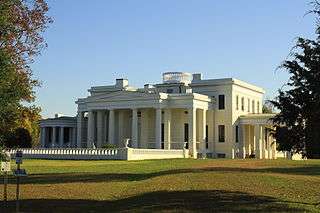
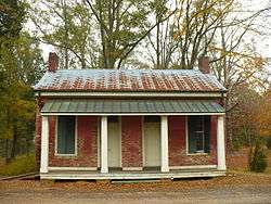
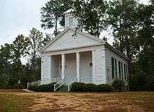
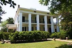
Marengo County is home to the Alabama Rural Heritage Center and Chickasaw State Park. The Tombigbee River and Black Warrior River form portions of the western and northern county borders and provide recreational opportunities. Marengo County has 28 sites listed on the National Register of Historic Places, one of which is also a National Historic Landmark.[20] Additionally, 19 sites are listed on the Alabama Register of Landmarks and Heritage.[21]
Government
Like the rest of the Black Belt, Marengo County leans Democratic. However, it often produces narrow margins for winning candidates; no presidential candidate has won more than 54% of the vote in Marengo since Richard Nixon in 1972.
| Year | GOP | Dem | Others |
|---|---|---|---|
| 2016 | 47.6% 5,233 | 51.1% 5,615 | 1.3% 146 |
| 2012 | 46.2% 5,336 | 53.4% 6,167 | 0.4% 40 |
| 2008 | 48.1% 5,516 | 51.7% 5,926 | 0.3% 29 |
| 2004 | 50.9% 5,255 | 48.8% 5,037 | 0.3% 30 |
| 2000 | 48.8% 4,690 | 50.4% 4,841 | 0.8% 77 |
| 1996 | 43.2% 4,013 | 52.7% 4,899 | 4.1% 382 |
| 1992 | 39.8% 4,470 | 50.1% 5,632 | 10.2% 1,142 |
| 1988 | 48.6% 4,241 | 50.5% 4,402 | 0.9% 82 |
| 1984 | 51.5% 5,261 | 47.1% 4,811 | 1.4% 141 |
| 1980 | 41.9% 4,048 | 53.6% 5,178 | 4.5% 434 |
| 1976 | 43.9% 3,841 | 54.0% 4,731 | 2.1% 183 |
| 1972 | 65.1% 5,156 | 33.4% 2,645 | 1.6% 125 |
| 1968 | 5.0% 457 | 38.0% 3,479 | 57.0% 5,218 |
| 1964 | 82.3% 3,677 | 17.7% 789 | |
| 1960 | 44.3% 1,235 | 51.5% 1,436 | 4.3% 120 |
| 1956 | 33.1% 1,009 | 60.9% 1,858 | 6.1% 185 |
| 1952 | 43.2% 1,362 | 56.8% 1,790 | 0.0% 0 |
| 1948 | 3.5% 67 | 96.6% 1,876 | |
| 1944 | 4.8% 89 | 94.7% 1,746 | 0.5% 9 |
| 1940 | 3.0% 70 | 96.9% 2,284 | 0.1% 2 |
| 1936 | 1.4% 33 | 98.5% 2,287 | 0.0% 1 |
| 1932 | 2.3% 50 | 95.5% 2,097 | 2.3% 50 |
| 1928 | 28.4% 752 | 71.6% 1,898 | 0.0% 0 |
| 1924 | 1.4% 17 | 98.4% 1,243 | 0.2% 3 |
| 1920 | 3.0% 42 | 97.0% 1,370 | 0.0% 0 |
| 1916 | 1.3% 19 | 98.6% 1,491 | 0.1% 2 |
| 1912 | 0.6% 9 | 97.9% 1,386 | 1.5% 21 |
| 1908 | 5.5% 78 | 93.2% 1,333 | 1.4% 20 |
| 1904 | 4.6% 56 | 94.7% 1,149 | 0.7% 9 |
Communities
Unincorporated communities
- Aimwell
- Alfalfa
- Beaver Creek
- Clayhill
- Consul
- Coxheath
- Dixons Mills
- Exmoor
- Half Acre
- Half Chance
- Hampden
- Hoboken
- Hugo
- Jefferson
- Lasca
- McKinley
- Magnolia
- Marengo
- Moores Valley
- Moscow
- Nicholsville
- Octagon
- Old Spring Hill
- Pin Hook
- Pope
- Rembert
- Salt Well
- Shiloh
- Siddonsville
- Surginer
- Vangale
- Vineland
- Wayne
Ghost town
- Aigleville
See also
References
- "Alabama Counties: Marengo County". "Alabama Department of Archives and History". Retrieved November 30, 2007.
- "State & County QuickFacts". United States Census Bureau. Archived from the original on June 6, 2011. Retrieved May 16, 2014.
- Marengo County Heritage Book Committee. The Heritage of Marengo County, Alabama, pages 1-4. Clanton, Alabama: Heritage Publishing Consultants, 2000. ISBN 1-891647-58-X
- Smith, Winston. Days of Exile: The Story of the Vine and Olive Colony in Alabama, page 9. Tuscaloosa, Alabama: W. B. Drake and Son, 1967.
- "Census Data for the Year 1860". "Inter-University Consortium for Political and Social Research". Archived from the original on May 6, 2007. Retrieved 2007-11-30.
- "Alabama". Encyclopedia of Southern Jewish Communities. Goldring / Woldenberg Institute of Southern Jewish Life. Retrieved 5 October 2010.
- "2010 Census Gazetteer Files". United States Census Bureau. August 22, 2012. Retrieved August 22, 2015.
- "Population and Housing Unit Estimates". Retrieved May 17, 2019.
- "U.S. Decennial Census". United States Census Bureau. Retrieved August 22, 2015.
- "Historical Census Browser". University of Virginia Library. Retrieved August 22, 2015.
- Forstall, Richard L., ed. (March 24, 1995). "Population of Counties by Decennial Census: 1900 to 1990". United States Census Bureau. Retrieved August 22, 2015.
- "Census 2000 PHC-T-4. Ranking Tables for Counties: 1990 and 2000" (PDF). United States Census Bureau. April 2, 2001. Retrieved August 22, 2015.
- Martin, Jonathan; Blinder, Alan (December 12, 2017). "Alabama Senate Race Between Roy Moore and Doug Jones Ends With More Controversy".
- "Schools". Marengo County Schools. School In Sites. Retrieved 2 October 2010.
- "Marengo County". Encyclopedia of Alabama. Auburn University. Retrieved 2 October 2010.
- "Demopolis". Alabama Tourism Department - Official Web Site. Archived from the original on 24 November 2008. Retrieved 6 December 2008.
- "Faunsdale Biker Rally - Alabama's wildest biker event". "Bama Rides". 2008-04-26. Archived from the original on August 19, 2008. Retrieved 2008-10-07.
- "Annual Faunsdale Crawfish Festival". Alabama Tourism Department - Official Web Site. Archived from the original on 25 November 2008. Retrieved 6 December 2008.
- "Rural Heritage Day & Pepper Jelly Festival, 2nd". Alabama Tourism Department - Official Web Site. Archived from the original on 24 November 2008. Retrieved 6 December 2008.
- "National Register Information System". National Register of Historic Places. National Park Service. April 15, 2008.
- "The Alabama Register of Landmarks & Heritage". preserveala.org. Alabama Historical Commission. May 31, 2011. Archived from the original (PDF) on June 6, 2011. Retrieved 6 June 2011.
- "Dave Leip's Atlas of U.S. Presidential Elections". Retrieved November 21, 2016.
Places adjacent to Marengo County, Alabama | ||||||||||
|---|---|---|---|---|---|---|---|---|---|---|
| ||||||||||
Municipalities and communities of Marengo County, Alabama, United States | ||
|---|---|---|
| Cities | Map of Alabama highlighting Marengo County | |
| Towns | ||
| CDPs | ||
| Unincorporated communities |
| |
| Ghost town |
| |
Montgomery (capital) | ||
| Topics | ||
| Society |
| |
| Regions | ||
| Flora and fauna | ||
| Largest cities | ||
| Metros |
| |
| Counties |
| |
| Authority control |
|
|---|