Thomaston, Alabama
Thomaston is a town in Marengo County, Alabama, United States. At the 2010 census the population was 417, up from 383 in 2000. Thomaston is home to the Pepper Jelly Festival which takes place the last Saturday of April and celebrates Thomaston's famous Mama Nem's pepper jelly, as well as, folk artists and other vendors.
Thomaston, Alabama | |
|---|---|
 Location of Thomaston in Marengo County, Alabama. | |
| Coordinates: 32°16′10″N 87°37′30″W | |
| Country | United States |
| State | Alabama |
| County | Marengo |
| Area | |
| • Total | 2.01 sq mi (5.21 km2) |
| • Land | 2.01 sq mi (5.21 km2) |
| • Water | 0.00 sq mi (0.00 km2) |
| Elevation | 187 ft (57 m) |
| Population (2010) | |
| • Total | 417 |
| • Estimate (2019)[2] | 381 |
| • Density | 189.27/sq mi (73.07/km2) |
| Time zone | UTC-6 (Central (CST)) |
| • Summer (DST) | UTC-5 (CDT) |
| ZIP code | 36783 |
| Area code(s) | 334 |
| FIPS code | 01-75936 |
| GNIS feature ID | 0127881 |
| Website | townofthomaston |

History
Thomaston was platted in 1901 when the railroad was extended to that point.[3] Thomaston was named for C. B. Thomas, a town promoter.[3] A post office called Thomaston has been in operation since 1892.[4] It was incorporated on November 15, 1901.[5]
Historic sites
Thomaston has one historic district, the Thomaston Central Historic District, which encompasses the core of the town. Additionally, there are three individually listed properties on the National Register of Historic Places: the Thomaston Colored Institute, C. S. Golden House, and Patrick Farrish House.[6] The town is home to the Alabama Rural Heritage Center, and the Thomaston Community Market, (now defunct), both community projects of Auburn University's Rural Studio and funded by a State Grant of around $500,000. The Center was supposed to be a cannery; however, it never materialized and the Rural Heritage Center became a remote gift shop that does hardly any business.ref name="Rural">"Alabama Rural Heritage Foundation". "Alabama Technology Network-Auburn University". Retrieved 2008-02-25.</ref> Thomaston is also home to the Alabama Whitetail Records Museum.
Geography
Thomaston is located at 32°16′10″N 87°37′30″W.[7] According to the U.S. Census Bureau, the town has a total area of 2.0 square miles (5.2 km2), all land.
Demographics
| Historical population | |||
|---|---|---|---|
| Census | Pop. | %± | |
| 1910 | 309 | — | |
| 1920 | 372 | 20.4% | |
| 1930 | 377 | 1.3% | |
| 1940 | 345 | −8.5% | |
| 1950 | 1,027 | 197.7% | |
| 1960 | 857 | −16.6% | |
| 1970 | 824 | −3.9% | |
| 1980 | 679 | −17.6% | |
| 1990 | 497 | −26.8% | |
| 2000 | 383 | −22.9% | |
| 2010 | 417 | 8.9% | |
| Est. 2019 | 381 | [2] | −8.6% |
| U.S. Decennial Census[8] 2013 Estimate[9] | |||
As of the census of 2000, there were 383 people, 163 households, and 105 families residing in the town. The population density was 190.3 people per square mile (73.6/km2). There were 212 housing units at an average density of 105.3 per square mile (40.7/km2). The racial makeup of the town was 50.13% Black or African American, 48.56% White, and 1.31% from two or more races. 2.35% of the population were Hispanic or Latino of any race.
There were 163 households out of which 27.0% had children under the age of 18 living with them, 39.9% were married couples living together, 23.3% had a female householder with no husband present, and 35.0% were non-families. 33.7% of all households were made up of individuals and 25.2% had someone living alone who was 65 years of age or older. The average household size was 2.35 and the average family size was 3.01.
In the town, the population was spread out with 24.0% under the age of 18, 9.4% from 18 to 24, 24.0% from 25 to 44, 20.6% from 45 to 64, and 21.9% who were 65 years of age or older. The median age was 40 years. For every 100 females, there were 79.0 males. For every 100 females age 18 and over, there were 69.2 males.
The median income for a household in the town was $25,972, and the median income for a family was $31,250. Males had a median income of $32,404 versus $21,750 for females. The per capita income for the town was $13,390. About 22.1% of families and 29.2% of the population were below the poverty line, including 43.2% of those under age 18 and 33.8% of those age 65 or over.
Government
Thomaston is governed by an elected Mayor and elected Council of five. Police protection is provided by the Thomaston Police Department. Thomaston has a small volunteer fire department. A rural health clinic is located in Thomaston and can handle small emergencies. It is open week days to offer medical care..
References
- "2019 U.S. Gazetteer Files". United States Census Bureau. Retrieved June 29, 2020.
- "Population and Housing Unit Estimates". United States Census Bureau. May 24, 2020. Retrieved May 27, 2020.
- Jones, Joel D. (21 September 2006). "French colonists settled Linden when it became county seat". Sep 21, 2006. The Democrat-Reporter. p. 2. Retrieved 28 October 2015.
- "Marengo County". Jim Forte Postal History. Retrieved 28 October 2015.
- http://www.ruralswalabama.org/attraction/old-ln-depot-thomaston-al/
- "Alabama: Marengo County". "Nationalhistoricalregister.com". Retrieved 2008-03-05.
- "US Gazetteer files: 2010, 2000, and 1990". United States Census Bureau. 2011-02-12. Retrieved 2011-04-23.
- "U.S. Decennial Census". Census.gov. Retrieved June 6, 2013.
- "Annual Estimates of the Resident Population: April 1, 2010 to July 1, 2013". Retrieved June 3, 2014.
External links
- Town of Thomaston Website
- Thomaston Volunteer Fire & Rescue Department
- Alabama Rural Heritage Foundation
Municipalities and communities of Marengo County, Alabama, United States | ||
|---|---|---|
| Cities | 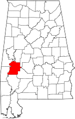 Map of Alabama highlighting Marengo County | |
| Towns | ||
| CDPs | ||
| Unincorporated communities |
| |
| Ghost town |
| |