Bullock County, Alabama
Bullock County is a county of the U.S. state of Alabama. As of the 2010 census the population was 10,914.[1] Union Springs was chosen as the county seat in 1867.[2] The county was named in honor of Colonel Edward C. Bullock who was a state senator and outspoken secessionist who died serving in the Confederate Army during the American Civil War.[3]
Bullock County | |
|---|---|
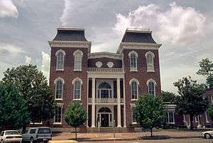 Bullock County courthouse in Union Springs | |
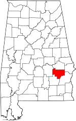 Location within the U.S. state of Alabama | |
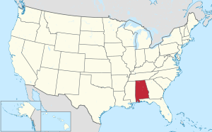 Alabama's location within the U.S. | |
| Coordinates: 32°05′52″N 85°43′02″W | |
| Country | |
| State | |
| Founded | December 5, 1866 |
| Named for | Edward Bullock |
| Seat | Union Springs |
| Largest city | Union Springs |
| Area | |
| • Total | 625 sq mi (1,620 km2) |
| • Land | 623 sq mi (1,610 km2) |
| • Water | 2.3 sq mi (6 km2) 0.4%% |
| Population (2010) | |
| • Total | 10,914 |
| • Estimate (2019) | 10,101 |
| • Density | 17/sq mi (6.7/km2) |
| Time zone | UTC−6 (Central) |
| • Summer (DST) | UTC−5 (CDT) |
| Congressional district | 2nd |
| Website | bullockcountyalrev |
| |
A National Center for Education Statistics report released in January 2009 showed that Bullock County had the highest illiteracy rate in Alabama at 34 percent.[4]
History
Bullock County was established on December 5, 1866. The boundaries were changed in February 1867.
Geography
According to the U.S. Census Bureau, the county has a total area of 625 square miles (1,620 km2), of which 623 square miles (1,610 km2) is land and 2.3 square miles (6.0 km2) (0.4%) is water.[5] The county is in the southeastern section of the state, in the prairie region. The Chunnennuggee Ridge runs through the center of the county.
Adjacent counties
- Macon County (north)
- Russell County (northeast)
- Barbour County (southeast)
- Pike County (southwest)
- Montgomery County (west)
Demographics
| Historical population | |||
|---|---|---|---|
| Census | Pop. | %± | |
| 1870 | 24,474 | — | |
| 1880 | 29,066 | 18.8% | |
| 1890 | 27,063 | −6.9% | |
| 1900 | 31,944 | 18.0% | |
| 1910 | 30,196 | −5.5% | |
| 1920 | 25,333 | −16.1% | |
| 1930 | 20,016 | −21.0% | |
| 1940 | 19,810 | −1.0% | |
| 1950 | 16,054 | −19.0% | |
| 1960 | 13,462 | −16.1% | |
| 1970 | 11,824 | −12.2% | |
| 1980 | 10,596 | −10.4% | |
| 1990 | 11,042 | 4.2% | |
| 2000 | 11,714 | 6.1% | |
| 2010 | 10,914 | −6.8% | |
| Est. 2019 | 10,101 | [6] | −7.4% |
| U.S. Decennial Census[7] 1790–1960[8] 1900–1990[9] 1990–2000[10] 2010–2018[1] | |||
As of the 2010 United States Census, there were 10,914 people living in the county. 70.2% were Black or African American, 23.0% White, 0.4% Pacific Islander, 0.2% Native American, 0.2% Asian, 5.2% of some other race and 0.8% of two or more races. 7.1% were Hispanic or Latino (of any race).[11]
As of the census[12] of 2000, there were 11,714 people, 3,986 households, and 2,730 families living in the county. The population density was 19 people per square mile (7/km2). There were 4,727 housing units at an average density of 8 per square mile (3/km2). The racial makeup of the county was 73.11% Black or African American, 25.25% White, 0.38% Native American, 0.18% Asian, 0.02% Pacific Islander, 0.37% from other races, and 0.70% from two or more races. 2.75% of the population were Hispanic or Latino of any race.
There were 3,986 households out of which 33.50% had children under the age of 18 living with them, 35.50% were married couples living together, 28.20% had a female householder with no husband present, and 31.50% were non-families. 28.90% of all households were made up of individuals and 12.30% had someone living alone who was 65 years of age or older. The average household size was 2.56 and the average family size was 3.13.
In the county, the population was spread out with 26.10% under the age of 18, 10.30% from 18 to 24, 29.30% from 25 to 44, 21.20% from 45 to 64, and 13.20% who were 65 years of age or older. The median age was 35 years. For every 100 females there were 110.20 males. For every 100 females age 18 and over, there were 113.40 males.
The median income for a household in the county was $20,605, and the median income for a family was $23,990. Males had a median income of $22,560 versus $19,069 for females. The per capita income for the county was $10,163. About 29.80% of families and 33.50% of the population were below the poverty line, including 44.70% of those under age 18 and 29.10% of those age 65 or over.
Government and infrastructure
Bullock County is powerfully Democratic. The only Republican to carry the county since 1900 has been Barry Goldwater in 1964 – when essentially none of the county's black majority had voted for over seven decades and opposition by the voting white minority to Civil Rights meant that national Democrat Lyndon Johnson was not allowed on the ballot. Even after the Voting Rights Act of 1965, black registration was so slow that segregationist Governor George Wallace carried the county by five percentage points in 1968, but since then the Democratic presidential candidate has carried Bullock in every election. It was one of only six Wallace counties[lower-alpha 1] to vote for George McGovern against Richard Nixon’s 3,000-plus-county landslide of 1972.
| Year | GOP | DEM | Others |
|---|---|---|---|
| 2016 | 24.2% 1,140 | 75.0% 3,530 | 0.9% 40 |
| 2012 | 23.5% 1,251 | 76.3% 4,061 | 0.2% 10 |
| 2008 | 25.7% 1,391 | 74.1% 4,011 | 0.2% 13 |
| 2004 | 31.7% 1,494 | 68.1% 3,210 | 0.3% 13 |
| 2000 | 29.2% 1,433 | 69.2% 3,395 | 1.6% 76 |
| 1996 | 26.3% 1,154 | 70.2% 3,078 | 3.5% 152 |
| 1992 | 26.0% 1,253 | 67.7% 3,259 | 6.3% 304 |
| 1988 | 31.0% 1,421 | 68.1% 3,122 | 0.9% 41 |
| 1984 | 32.0% 1,697 | 66.8% 3,537 | 1.2% 65 |
| 1980 | 25.7% 1,446 | 70.3% 3,960 | 4.1% 231 |
| 1976 | 29.1% 1,482 | 69.4% 3,536 | 1.5% 74 |
| 1972 | 47.4% 2,178 | 50.6% 2,321 | 2.0% 92 |
| 1968 | 4.4% 190 | 45.2% 1,964 | 50.5% 2,193 |
| 1964 | 57.6% 1,516 | 42.4% 1,114 | |
| 1960 | 35.1% 412 | 64.5% 757 | 0.4% 5 |
| 1956 | 24.3% 304 | 64.9% 812 | 10.9% 136 |
| 1952 | 32.5% 442 | 67.5% 918 | 0.0% 0 |
| 1948 | 1.2% 10 | 98.8% 799 | |
| 1944 | 2.2% 24 | 97.8% 1,056 | 0.0% 0 |
| 1940 | 1.4% 18 | 98.6% 1,301 | 0.0% 0 |
| 1936 | 0.4% 5 | 99.5% 1,188 | 0.1% 1 |
| 1932 | 1.2% 12 | 98.7% 1,004 | 0.1% 1 |
| 1928 | 26.3% 249 | 73.7% 699 | 0.0% 0 |
| 1924 | 1.0% 8 | 98.8% 763 | 0.1% 1 |
| 1920 | 0.2% 2 | 99.7% 877 | 0.1% 1 |
| 1916 | 0.5% 4 | 99.2% 743 | 0.3% 2 |
| 1912 | 0.5% 4 | 99.2% 736 | 0.3% 2 |
| 1908 | 1.3% 10 | 98.7% 782 | 0.0% 0 |
| 1904 | 0.0% 0 | 99.7% 726 | 0.3% 2 |
Alabama Department of Corrections operates the Bullock Correctional Facility in an unincorporated area in the county.[14][15]
Transportation
Major highways


Airport
Franklin Field is a county-owned public-use airport located five nautical miles (9 km) west of the central business district of Union Springs, Alabama.[16]
Communities
City
- Union Springs (county seat)
Town
Census-designated place
Unincorporated communities
Ghost town
Places of interest
Bullock County is home to several historic homes including the McCaslan-Garner House and Bonus-Foster-Chapman House.
Climate
| ||||||||||||||||||||||||||||||||||||||||||||||||||||||||||||||||||||||||||||||||||||||||||||||||||||||||||||||||||||||||||||
See also
References
- "State & County QuickFacts". United States Census Bureau. Archived from the original on May 17, 2014. Retrieved May 15, 2014.
- "Find a County". National Association of Counties. Archived from the original on May 31, 2011. Retrieved June 7, 2011.
- "Bullock County, Alabama History, ADAH". Alabama Department of Archives and History. Retrieved June 12, 2019.
- The Associated Press (January 8, 2009). "Study finds Alabama literacy rate improved, Shelby County has state's lowest illiteracy". AL.com.
- "2010 Census Gazetteer Files". United States Census Bureau. August 22, 2012. Retrieved August 22, 2015.
- "Population and Housing Unit Estimates". Retrieved May 17, 2019.
- "U.S. Decennial Census". United States Census Bureau. Retrieved August 22, 2015.
- "Historical Census Browser". University of Virginia Library. Retrieved August 22, 2015.
- Forstall, Richard L., ed. (March 24, 1995). "Population of Counties by Decennial Census: 1900 to 1990". United States Census Bureau. Retrieved August 22, 2015.
- "Census 2000 PHC-T-4. Ranking Tables for Counties: 1990 and 2000" (PDF). United States Census Bureau. April 2, 2001. Retrieved August 22, 2015.
- 2010 census report for Bullock County, Alabama
- "U.S. Census website". United States Census Bureau. Retrieved 2011-05-14.
- "Dave Leip's Atlas of U.S. Presidential Elections". Retrieved November 15, 2016.
- "Bullock Correctional Facility Archived 2011-10-08 at the Wayback Machine." Alabama Department of Corrections. Retrieved on July 1, 2011.
- "Union Springs city, Alabama." U.S. Census Bureau. Retrieved on July 4, 2011.
- FAA Airport Master Record for 07A (Form 5010 PDF). Federal Aviation Administration. Effective 3 June 2010.
- "NASA Earth Observations Data Set Index". NASA. Retrieved 30 January 2016.
Notes
- The others were the fellow Alabama counties of Lowndes and Wilcox with similarly delayed black registration after 1965, and the white majority, historically secessionist Middle Tennessee trio of Houston County, Perry County and Stewart County.
External links
- Barbour / Bullock County Drug Task Force Webpage
- Alabama State Archives
- Markers from Alabama State Archives
- Owen, Thomas McAdory. History of Alabama and Dictionary of Alabama Biography. Chicago: S.J. Clarke Publishing Co., 1921.
Places adjacent to Bullock County, Alabama | ||||||||||
|---|---|---|---|---|---|---|---|---|---|---|
| ||||||||||
Municipalities and communities of Bullock County, Alabama, United States | ||
|---|---|---|
| Cities | Map of Alabama highlighting Bullock County | |
| Towns | ||
| CDP | ||
| Unincorporated communities | ||
| Ghost towns | ||
Montgomery (capital) | ||
| Topics | ||
| Society |
| |
| Regions | ||
| Flora and fauna | ||
| Largest cities | ||
| Metros |
| |
| Counties |
| |
| Authority control |
|
|---|