Linden, Alabama
Linden is a city in and the county seat of Marengo County, Alabama, United States.[4] The population was 2,123 at the 2010 census.
Linden | |
|---|---|
| Linden, Alabama | |
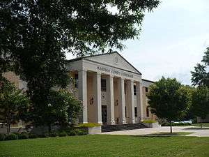 Marengo County Courthouse in Linden | |
 Seal | |
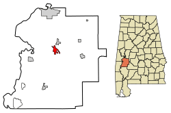 Location of Linden in Marengo County, Alabama. | |
| Coordinates: 32°18′4″N 87°47′34″W | |
| Country | United States |
| State | Alabama |
| County | Marengo |
| Area | |
| • Total | 3.61 sq mi (9.36 km2) |
| • Land | 3.58 sq mi (9.27 km2) |
| • Water | 0.03 sq mi (0.09 km2) |
| Elevation | 161 ft (49 m) |
| Population | |
| • Total | 2,123 |
| • Estimate (2019)[3] | 1,880 |
| • Density | 525.29/sq mi (202.84/km2) |
| Time zone | UTC-6 (Central (CST)) |
| • Summer (DST) | UTC-5 (CDT) |
| ZIP code | 36748 |
| Area code(s) | 334 |
| FIPS code | 01-43240 |
| GNIS feature ID | 0152070 |
| Website | City of Linden |
History
Settled prior to 1818, the community was first known as Screamersville, since the cry of wild animals could still be heard during the night. It became the county seat in 1819 and was then known as the Town of Marengo. This was changed to Hohenlinden in 1823, to honor the county's earliest European settlers, French Bonapartist refugees to the Vine and Olive Colony.[5] The name commemorated the battle in 1800 at Hohenlinden, Bavaria, where the French defeated the armies of both Austria and Bavaria. The spelling was later shorten to just to Linden.[6]
Geography
Linden is located at 32°18′4″N 87°47′34″W (32.301154, −87.792650).[7] According to the U.S. Census Bureau, the city has a total area of 3.6 square miles (9.3 km2), of which 3.6 square miles (9.3 km2) is land and 0.04 square miles (0.10 km2) (0.83%) is water.
Demographics
| Historical population | |||
|---|---|---|---|
| Census | Pop. | %± | |
| 1860 | 171 | — | |
| 1870 | 300 | 75.4% | |
| 1910 | 600 | — | |
| 1920 | 700 | 16.7% | |
| 1930 | 982 | 40.3% | |
| 1940 | 1,203 | 22.5% | |
| 1950 | 1,363 | 13.3% | |
| 1960 | 2,516 | 84.6% | |
| 1970 | 2,697 | 7.2% | |
| 1980 | 2,773 | 2.8% | |
| 1990 | 2,548 | −8.1% | |
| 2000 | 2,424 | −4.9% | |
| 2010 | 2,123 | −12.4% | |
| Est. 2019 | 1,880 | [3] | −11.4% |
| U.S. Decennial Census[8] 2013 Estimate[9] | |||
At the 2000 census, there were 2,424 people, 938 households, and 662 families living in the city. The population density was 675.6 people per square mile (260.7/km2). There were 1,084 housing units at an average density of 302.1 per square mile (116.6/km2). The racial makeup of the city was 52.43% White, 46.20% Black or African American, 0.17% Native American, 0.33% Asian, and 0.87% from two or more races. 1.07% of the population were Hispanic or Latino of any race.[10]
Of the 938 households 33.0% had children under the age of 18 living with them, 45.1% were married couples living together, 22.1% had a female householder with no husband present, and 29.4% were non-families. 27.8% of households were one person and 14.4% were one person aged 65 or older. The average household size was 2.48 and the average family size was 2.98.[10]
The age distribution was 27.7% under the age of 18, 8.0% from 18 to 24, 23.8% from 25 to 44, 20.9% from 45 to 64, and 19.5% 65 or older. The median age was 38 years. For every 100 females, there were 81.4 males. For every 100 females age 18 and over, there were 74.3 males.[10]
The median household income was $22,303 and the median family income was $30,733. Males had a median income of $38,964 versus $17,857 for females. The per capita income for the city was $16,536. About 23.8% of families and 29.6% of the population were below the poverty line, including 46.8% of those under age 18 and 19.0% of those age 65 or over.[10]
2010 census
At the 2010 census, there were 2,123 people, 877 households, and 555 families living in the city. The population density was 589.7 people per square mile (228.3/km2). There were 1,013 housing units at an average density of 281.4 per square mile (108.9/km2). The racial makeup of the city was 51.1% White, 46.7% Black or African American, 0.1% Native American, 0.2% Asian, and 0.9% from two or more races. 2.0% of the population were Hispanic or Latino of any race.[11]
Of the 877 households 23.4% had children under the age of 18 living with them, 37.7% were married couples living together, 21.1% had a female householder with no husband present, and 36.7% were non-families. 34.3% of households were one person and 14.7% were one person aged 65 or older. The average household size was 2.25 and the average family size was 2.88.
The age distribution was 20.8% under the age of 18, 10.1% from 18 to 24, 21.2% from 25 to 44, 25.1% from 45 to 64, and 22.8% 65 or older. The median age was 42.6 years. For every 100 females, there were 85.1 males. For every 100 females age 18 and over, there were 92.0 males.
The median household income was $20,145 and the median family income was $35,714. Males had a median income of $30,833 versus $25,000 for females. The per capita income for the city was $14,701. About 31.1% of families and 31.8% of the population were below the poverty line, including 41.1% of those under age 18 and 8.7% of those age 65 or over.
Media
The Democrat-Reporter, a weekly newspaper, is based in Linden.[12]
Education
The city runs its own citywide school system, Linden City Schools. It also has one private school, Marengo Academy, founded in 1969; one of many segregation academies as they are known, which cropped up in the South after segregation was made illegal.[13][14][15][16]
Notable people
- Ralph Abernathy, civil rights leader
- William J. Alston, United States Representative to the Thirty-first Congress
- Frank Evans, professional baseball player in the Negro Leagues
- Lucy Hannah, oldest African-American person ever, the second-oldest person ever from the United States and the world's third oldest person ever
- Sean Richardson, safety for the Green Bay Packers
- Roy Rogers, professional basketball player and coach
References
- "2019 U.S. Gazetteer Files". United States Census Bureau. Retrieved June 29, 2020.
- "U.S. Census website". United States Census Bureau. Retrieved 2014-09-08.
- "Population and Housing Unit Estimates". United States Census Bureau. May 24, 2020. Retrieved May 27, 2020.
- "Find a County". National Association of Counties. Retrieved 2011-06-07.
- "Alabama Counties: Marengo County". "Alabama Department of Archives and History". Retrieved 2007-11-30.
- Marengo County Heritage Book Committee. The Heritage of Marengo County, Alabama, pages 1-4. Clanton, Alabama: Heritage Publishing Consultants, 2000. ISBN 1-891647-58-X
- "US Gazetteer files: 2010, 2000, and 1990". United States Census Bureau. 2011-02-12. Retrieved 2011-04-23.
- United States Census Bureau. "Census of Population and Housing". Retrieved September 8, 2014.
- "Population Estimates". United States Census Bureau. Archived from the original on 2014-05-22. Retrieved 2014-09-08.
- "U.S. Census website". United States Census Bureau. Retrieved 2008-01-31.
- "U.S. Census website". United States Census Bureau. Retrieved 2015-08-02.
- "About The Democrat-reporter. (Linden, Ala.)". Library of Congress. Retrieved 2 March 2019.
- https://www.cbcfinc.org/thevillage/2014/05/15/brown-60-years-later-segregation-academies-in-the-deep-south/
- Marengo County Heritage Book Committee. The Heritage of Marengo County, Alabama, page 29. Clanton, Alabama: Heritage Publishing Consultants, 2000. ISBN 1-891647-58-X
- Scarborough, Alex (September 25, 2011). "Linden school transfer policy ensures segregation". The Tuscaloosa News. Retrieved March 3, 2013.
- Scarborough, Alex (September 25, 2011). "Linden, a town divided by race". The Tuscaloosa News. Retrieved March 3, 2013.
External links
Municipalities and communities of Marengo County, Alabama, United States | ||
|---|---|---|
| Cities | 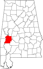 Map of Alabama highlighting Marengo County | |
| Towns | ||
| CDPs | ||
| Unincorporated communities |
| |
| Ghost town |
| |
| Authority control |
|
|---|