Shelby County, Alabama
Shelby County is located in the central portion of the U.S. state of Alabama. As of the 2010 census the population was 195,085.[1] The county seat is Columbiana.[2] The county is named in honor of Isaac Shelby, Governor of Kentucky from 1792 to 1796 and again from 1812 to 1816.
Shelby County | |
|---|---|
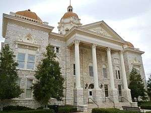 Shelby County Courthouse in Columbiana | |
 Seal | |
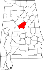 Location within the U.S. state of Alabama | |
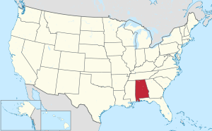 Alabama's location within the U.S. | |
| Coordinates: 33°15′55″N 86°40′04″W | |
| Country | |
| State | |
| Founded | February 7, 1818 |
| Named for | Isaac Shelby |
| Seat | Columbiana |
| Largest city | Alabaster |
| Area | |
| • Total | 810 sq mi (2,100 km2) |
| • Land | 785 sq mi (2,030 km2) |
| • Water | 25 sq mi (60 km2) 3.0%% |
| Population (2010) | |
| • Total | 195,085 |
| • Estimate (2019) | 217,702 |
| • Density | 240/sq mi (93/km2) |
| Time zone | UTC−6 (Central) |
| • Summer (DST) | UTC−5 (CDT) |
| Congressional district | 6th |
| Website | www |
| |
Shelby County is included in the Birmingham–Hoover, AL Metropolitan Statistical Area.
History
Shelby County was established on February 7, 1818, and it was named for the Revolutionary War hero and the first Governor of Kentucky, Isaac Shelby. Beginning in 1820, the first county seat was located at Shelbyville. This settlement, long defunct, was located within the modern city limits of Pelham. The first courthouse was built of logs. The seat was moved to Columbia, now Columbiana, in 1826. Initially housed in an old school building, a new brick courthouse building was completed in 1854. It is now known as the Old Shelby County Courthouse and houses the Shelby County Museum and Archives. The current limestone courthouse was built from 1905–06, at a cost of $300,000.[3]
Shelby County has a long history in agriculture, and since about 1990, it has become an important location for growing soybeans, which has exceeded cotton as the most important crop grown there.
Shelby County was the home of an early inland waterway, the Coosa River, and it was also the location of a very early east-west railroad in Alabama that connected Atlanta, Georgia, with locations to its west. Shelby County was also crossed by an early north-south railroad, the Louisville and Nashville Railroad, that connected Louisville, Nashville, Decatur, Birmingham, and Montgomery.
With the advent of the automobile and the truck, Shelby County was soon crossed from north to south by U.S. Highway 31, the major one that followed the same route as the Louisville and Nashville Railroad did. (All odd-numbered U.S. Highways are north-south routes: e.g. U.S. 1, 11, 21, 31, 41, 51, 61, and 71, 101, going from East to West) The eastern part of Shelby County was later crossed by U.S. Highway 231 and U.S. 280.
Decades later, Shelby County was crossed by Interstate Highway 65. Hence, an important ingredient in the eventual growth of Shelby County has been its ready access to modern systems of transportation. Interstate 65 and U.S. Highway 31 have long provided strong connections between Shelby county and the more populous Jefferson County directly to its north, leading to suburban development in towns such as Pelham, Helena, Alabaster, and Chelsea.
Geography
According to the U.S. Census Bureau, the county has a total area of 810 square miles (2,100 km2), of which 785 square miles (2,030 km2) is land and 25 square miles (65 km2) (3.0%) is water.[4]
Parts of Shelby County are crossed by the southernmost extensions of the Appalachian Mountains, such as Oak Mountain and Double Oak Mountain. However, large parts of Shelby County are much flatter, giving good land for farms and pastures. Shelby County also has lowlands along two rivers, and one large man-made reservoir, Lay Lake, which also borders Coosa, Talladega and Chilton counties.
Most of Shelby County is drained either by the Cahaba River, which flows along the northern edge of the county, and then to the southwest, or by the Coosa River, whose valley includes the eastern end of the county. These are both important rivers in Alabama. Much farther south, both the Cahaba River and the Coosa River flow into the Alabama River, and thence to the Gulf of Mexico. To be more precise, the Coosa River and the Tallapoosa River flow together at Wetumpka, Alabama, to form the Alabama River, and then the Cahaba River is a tributary to that one farther to the west. Waxahatchee Creek, a major tributary of the Coosa River, forms the southeastern portion of the border between Shelby County and Chilton County.
Adjacent counties
- St. Clair County (northeast)
- Talladega County (east)
- Coosa County (southeast)
- Chilton County (south)
- Bibb County (southwest)
- Jefferson County (northwest)
Demographics
| Historical population | |||
|---|---|---|---|
| Census | Pop. | %± | |
| 1820 | 2,416 | — | |
| 1830 | 5,704 | 136.1% | |
| 1840 | 6,112 | 7.2% | |
| 1850 | 9,536 | 56.0% | |
| 1860 | 12,618 | 32.3% | |
| 1870 | 12,218 | −3.2% | |
| 1880 | 17,236 | 41.1% | |
| 1890 | 20,886 | 21.2% | |
| 1900 | 23,684 | 13.4% | |
| 1910 | 26,949 | 13.8% | |
| 1920 | 27,097 | 0.5% | |
| 1930 | 27,576 | 1.8% | |
| 1940 | 28,962 | 5.0% | |
| 1950 | 30,362 | 4.8% | |
| 1960 | 32,132 | 5.8% | |
| 1970 | 38,037 | 18.4% | |
| 1980 | 66,298 | 74.3% | |
| 1990 | 99,358 | 49.9% | |
| 2000 | 143,293 | 44.2% | |
| 2010 | 195,085 | 36.1% | |
| Est. 2019 | 217,702 | [5] | 11.6% |
| U.S. Decennial Census[6] 1790–1960[7] 1900–1990[8] 1990–2000[9] 2010–2018[1] | |||
At the 2000 census, there were 143,293 people, 54,631 households, and 40,590 families living in the county. The population density was 180 people per square mile (70/km2). There were 59,302 housing units at an average density of 75 per square mile (29/km2). The racial makeup of the county was 89.80% White, 7.40% Black or African American, 0.33% Native American, 1.03% Asian, 0.02% Pacific Islander, 0.71% from other races, and 0.72% from two or more races. 2.03% of the population were Hispanic or Latino of any race.
The largest self-reported ancestry groups in Shelby County are: English (16.3%), Irish (13.3%), "American" (mostly English and Scots-Irish) (11.5%), German (11.0%), Italian (4.2%), Scots-Irish (4.2%) and Scottish (3.9%).
Of the 54,631 households 36.70% had children under the age of 18 living with them, 63.60% were married couples living together, 8.10% had a female householder with no husband present, and 25.70% were non-families. 21.70% of households were one person and 5.20% were one person aged 65 or older. The average household size was 2.59 and the average family size was 3.04.
The age distribution was 26.30% under the age of 18, 8.20% from 18 to 24, 33.70% from 25 to 44, 23.40% from 45 to 64, and 8.50% 65 or older. The median age was 35 years. For every 100 females, there were 96.20 males. For every 100 females age 18 and over, there were 92.60 males.
The median household income was $55,440 and the median family income was $64,105. Males had a median income of $45,798 versus $31,242 for females. The per capita income for the county was $27,176. About 4.60% of families and 6.30% of the population were below the poverty line, including 7.10% of those under age 18 and 8.20% of those age 65 or over.
2010 census
At the 2010 census, there were 195,085 people, 74,072 households, and 53,733 families living in the county. The population density was 249 people per square mile (96/km2). There were 80,970 housing units at an average density of 103 per square mile (40/km2). The racial makeup of the county was 83.0% White, 10.6% Black or African American, 0.3% Native American, 1.9% Asian, 0.0% Pacific Islander, 2.8% from other races, and 1.4% from two or more races. 5.9% of the population were Hispanic or Latino of any race.
The largest self-identified ancestry groups in Shelby County were
- English – 15.8%
- Irish – 13.9%
- German – 11.1%
- American – 11.0%
- Italian – 4.3%
- Scots-Irish – 3.9%
- Scottish – 3.7%
- French (except Basque) – 2.7%
- Polish – 1.5%
- Dutch – 1.3%
- Welsh – 0.8%
- Swedish – 0.7%
- Arab – 0.6%
- Norwegian – 0.5%
- Greek – 0.4%[10]
Of the 74,072 households 34.3% had children under the age of 18 living with them, 59.7% were married couples living together, 9.4% had a female householder with no husband present, and 27.5% were non-families. 23.2% of households were one person and 6.2% were one person aged 65 or older. The average household size was 2.60 and the average family size was 3.08.
The age distribution was 25.6% under the age of 18, 7.8% from 18 to 24, 29.2% from 25 to 44, 26.9% from 45 to 64, and 10.6% 65 or older. The median age was 36.9 years. For every 100 females, there were 96.0 males. For every 100 females age 18 and over, there were 95.0 males.
The median household income was $68,380 and the median family income was $81,406. Males had a median income of $57,405 versus $41,692 for females. The per capita income for the county was $33,978. About 5.4% of families and 7.4% of the population were below the poverty line, including 10.3% of those under age 18 and 4.9% of those age 65 or over.
Politics
Prior to the early 1980s, elected officials serving or representing Shelby County were all affiliated with the Democratic Party, although at a national level the county often supported Republicans even during the "Solid South" era – it was one of four counties in Alabama to vote for Theodore Roosevelt over Woodrow Wilson in 1912. Most of the rapid transition from the Democratic Party dominance to a complete reversal, with Republicans in control of all but a couple of offices, took place during the years between 1984 and 1992. It was not until the election of 2010, and specifically the results in Alabama House of Representatives District 42,[11] that Republicans held every party-identified elected office with jurisdiction or residency (or both) in Shelby County.[12] (In Alabama, municipal officials are elected on a non-partisan basis.)
| Year | GOP | DEM | Others |
|---|---|---|---|
| 2016 | 72.1% 73,020 | 22.7% 22,977 | 5.2% 5,257 |
| 2012 | 77.0% 71,436 | 21.6% 20,051 | 1.4% 1,255 |
| 2008 | 76.2% 69,060 | 22.8% 20,625 | 1.1% 958 |
| 2004 | 80.4% 63,435 | 18.8% 14,850 | 0.8% 621 |
| 2000 | 76.7% 47,651 | 21.2% 13,183 | 2.1% 1,294 |
| 1996 | 73.1% 37,090 | 22.2% 11,280 | 4.7% 2,403 |
| 1992 | 68.0% 32,736 | 21.4% 10,317 | 10.6% 5,112 |
| 1988 | 78.8% 27,052 | 20.8% 7,138 | 0.4% 124 |
| 1984 | 77.9% 21,858 | 21.0% 5,884 | 1.2% 326 |
| 1980 | 64.3% 14,957 | 31.8% 7,396 | 3.9% 914 |
| 1976 | 54.3% 9,035 | 43.3% 7,197 | 2.4% 397 |
| 1972 | 81.2% 9,390 | 16.1% 1,859 | 2.7% 309 |
| 1968 | 15.8% 1,706 | 10.3% 1,105 | 73.9% 7,959 |
| 1964 | 75.7% 6,037 | 24.4% 1,943 | |
| 1960 | 49.1% 3,157 | 50.2% 3,225 | 0.7% 46 |
| 1956 | 52.0% 2,901 | 44.8% 2,502 | 3.2% 178 |
| 1952 | 46.5% 2,156 | 53.3% 2,473 | 0.2% 7 |
| 1948 | 32.7% 921 | 67.3% 1,899 | |
| 1944 | 32.4% 945 | 67.1% 1,955 | 0.5% 13 |
| 1940 | 25.2% 938 | 74.6% 2,777 | 0.2% 7 |
| 1936 | 24.4% 777 | 74.5% 2,371 | 1.0% 33 |
| 1932 | 26.5% 864 | 72.5% 2,365 | 1.0% 34 |
| 1928 | 59.5% 2,502 | 40.0% 1,679 | 0.5% 22 |
| 1924 | 45.8% 1,753 | 49.2% 1,882 | 5.0% 192 |
| 1920 | 56.0% 3,235 | 43.6% 2,523 | 0.4% 24 |
| 1916 | 51.8% 1,428 | 47.6% 1,311 | 0.6% 17 |
| 1912 | 7.6% 201 | 44.5% 1,181 | 48.0% 1,275[lower-alpha 1] |
| 1908 | 49.4% 1,231 | 40.6% 1,011 | 10.0% 250 |
| 1904 | 27.9% 679 | 45.4% 1,106 | 26.8% 653 |
The Shelby County Republican Party, under the official direction of the Republican Executive Committee of Shelby County, Alabama, is the affiliate of the Alabama Republican Party in Shelby County, and is the identity by which its governing body is known.
In 2013, the County was the plaintiff in Shelby County v. Holder, which struck down portions of the Voting Rights Act of 1965 as unconstitutional.
Education
Shelby County Schools operates public schools in the county. Alabaster City Schools operates the six public schools in Alabaster. In 2014, Pelham began operating their own school system with three schools taken over from the Shelby County School System: Pelham High School, Riverchase Middle School, and Valley Elementary School. On May 5, 2015 ground was broken for the construction of Pelham Ridge Elementary School [13] which opened during the 2016–2017 school year. Also that year, Valley Elementary School closed and teachers relocated to Valley Intermediate School, renamed Pelham Oaks Elementary School (now serving kindergarten through fifth grade).
Transportation
Major highways
.svg.png)


Airports
- Shelby County Airport – General Aviation
- Birmingham-Shuttlesworth International Airport – Commercial passenger and freight service in an adjacent county Jefferson County
Communities
Cities
- Alabaster
- Birmingham (mostly in Jefferson County)
- Calera (partly in Chilton County)
- Chelsea
- Columbiana (county seat)
- Helena (partly in Jefferson County)
- Hoover (partly in Jefferson County)
- Leeds (partly in Jefferson County and St. Clair County)
- Montevallo
- Pelham
- Vestavia Hills (partly in Jefferson County)
- Vincent (partly in St. Clair County and Talladega County)
Census-designated places
- Brantleyville (a village west of Alabaster)
- Brook Highland
- Dunnavant (a village northeast of Chelsea)
- Highland Lakes
- Meadowbrook
- Shelby (a village east of Calera)
- Shoal Creek
- Sterrett (a village northwest of Vincent)
- Vandiver (a village northeast of Chelsea)
Places of interest
See also
References
- "State & County QuickFacts". United States Census Bureau. Retrieved May 17, 2014.
- "Find a County". National Association of Counties. Retrieved June 7, 2011.
- "History". Shelby County Tourism. Retrieved March 14, 2013.
- "2010 Census Gazetteer Files". United States Census Bureau. August 22, 2012. Retrieved August 22, 2015.
- "Population and Housing Unit Estimates". Retrieved May 16, 2019.
- "U.S. Decennial Census". United States Census Bureau. Retrieved August 22, 2015.
- "Historical Census Browser". University of Virginia Library. Retrieved August 22, 2015.
- Forstall, Richard L., ed. (March 24, 1995). "Population of Counties by Decennial Census: 1900 to 1990". United States Census Bureau. Retrieved August 22, 2015.
- "Census 2000 PHC-T-4. Ranking Tables for Counties: 1990 and 2000" (PDF). United States Census Bureau. April 2, 2001. Retrieved August 22, 2015.
- "Archived copy". Archived from the original on 2020-02-13. Retrieved 2017-10-23.CS1 maint: archived copy as title (link)
- "Wallace unseats incumbent Martin - Shelby County Reporter". shelbycountyreporter.com.
- Barnes, Fred "Crimson Tide: Alabama goes very, very red., The Weekly Standard, Nov 22, 2010, Vol. 16, No. 10.
- "Officials Break Ground on Pelham Ridge Elementary - Shelby County Reporter". shelbycountyreporter.com.
- "American Village Citizenship Trust". americanvillage.org.
Notes
- Comprising 1,233 votes (46.41 percent) for Progressive Theodore Roosevelt and 42 for Socialist Eugene Debs.
External links
| Wikimedia Commons has media related to Shelby County, Alabama. |
- Official website
- Shelby County Web Portal
- Shelby County 9-1-1 System
- Shelby County article, Encyclopedia of Alabama
- Shelby County Republican Party
- Shelby County Digital Guide
Places adjacent to Shelby County, Alabama | ||||||||||
|---|---|---|---|---|---|---|---|---|---|---|
| ||||||||||
Municipalities and communities of Shelby County, Alabama, United States | ||
|---|---|---|
| Cities | Map of Alabama highlighting Shelby County | |
| Towns | ||
| CDPs | ||
| Unincorporated communities | ||
| Footnotes | ‡This populated place also has portions in an adjacent county or counties | |
Montgomery (capital) | ||
| Topics | ||
| Society |
| |
| Regions | ||
| Flora and fauna | ||
| Largest cities | ||
| Metros |
| |
| Counties |
| |
| Authority control |
|
|---|