Varennes, Dordogne
Varennes is a commune in the Dordogne department in Nouvelle-Aquitaine in southwestern France.
Varennes | |
|---|---|
_mairie.JPG) The town hall in Varennes | |
Location of Varennes 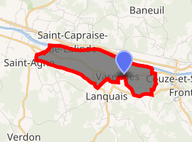
| |
 Varennes  Varennes | |
| Coordinates: 44°49′58″N 0°40′48″E | |
| Country | France |
| Region | Nouvelle-Aquitaine |
| Department | Dordogne |
| Arrondissement | Bergerac |
| Canton | Lalinde |
| Intercommunality | Bassin Lindois |
| Government | |
| • Mayor (2008–2014) | Philippe Soulage |
| Area 1 | 4.05 km2 (1.56 sq mi) |
| Population (2017-01-01)[1] | 467 |
| • Density | 120/km2 (300/sq mi) |
| Time zone | UTC+01:00 (CET) |
| • Summer (DST) | UTC+02:00 (CEST) |
| INSEE/Postal code | 24566 /24150 |
| Elevation | 27–103 m (89–338 ft) (avg. 50 m or 160 ft) |
| 1 French Land Register data, which excludes lakes, ponds, glaciers > 1 km2 (0.386 sq mi or 247 acres) and river estuaries. | |
Population
| Year | Pop. | ±% |
|---|---|---|
| 1800 | 266 | — |
| 1831 | 320 | +20.3% |
| 1866 | 262 | −18.1% |
| 1901 | 229 | −12.6% |
| 1936 | 232 | +1.3% |
| 1962 | 254 | +9.5% |
| 1968 | 383 | +50.8% |
| 1975 | 483 | +26.1% |
| 1982 | 424 | −12.2% |
| 1990 | 377 | −11.1% |
| 1999 | 384 | +1.9% |
| 2008 | 453 | +18.0% |
gollark: This seems to make Syl oddly talkative.
gollark: &scp-057
gollark: &scp-056
gollark: &scp-055
gollark: &scp-055
See also
External links
| Wikimedia Commons has media related to Varennes (Dordogne). |
| Authority control |
|
|---|
This article is issued from Wikipedia. The text is licensed under Creative Commons - Attribution - Sharealike. Additional terms may apply for the media files.