Sergeac
Sergeac is a commune in the Dordogne department in Nouvelle-Aquitaine in southwestern France.
Sergeac | |
|---|---|
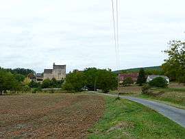 A general view of Sergeac | |
Location of Sergeac 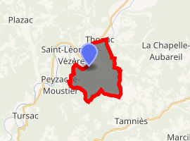
| |
 Sergeac  Sergeac | |
| Coordinates: 45°00′12″N 1°06′26″E | |
| Country | France |
| Region | Nouvelle-Aquitaine |
| Department | Dordogne |
| Arrondissement | Sarlat-la-Canéda |
| Canton | Vallée de l'Homme |
| Intercommunality | Vallée de la Vézère |
| Government | |
| • Mayor (2008–2014) | Jean-Pierre Lagarde |
| Area 1 | 10.71 km2 (4.14 sq mi) |
| Population (2017-01-01)[1] | 216 |
| • Density | 20/km2 (52/sq mi) |
| Time zone | UTC+01:00 (CET) |
| • Summer (DST) | UTC+02:00 (CEST) |
| INSEE/Postal code | 24531 /24290 |
| Elevation | 66–271 m (217–889 ft) (avg. 70 m or 230 ft) |
| 1 French Land Register data, which excludes lakes, ponds, glaciers > 1 km2 (0.386 sq mi or 247 acres) and river estuaries. | |
Population
The area of Sergeac is 10,71 km2 for a growing population density of approximately 17,93 habs/km2.[2] From the twenty-first century on, the actual census of municipalities with fewer than 10000 inhabitants are held every five years. For Sergeac, this corresponds to 2004, 2009, etc. Other dates "censuses" (2006, etc.) are legal estimates.
| Year | Pop. | ±% |
|---|---|---|
| 1962 | 169 | — |
| 1968 | 137 | −18.9% |
| 1975 | 142 | +3.6% |
| 1982 | 133 | −6.3% |
| 1990 | 156 | +17.3% |
| 1999 | 172 | +10.3% |
| 2008 | 198 | +15.1% |
Gallery
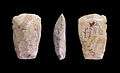 Neolithic polished ax - Muséum de Toulouse.
gollark: If I had capital, I could buy substantially more powerful GPUs.
gollark: In order to know whether it's normal or not.
gollark: You can already have that, on more task-specific models.
gollark: It's not a sphere.
gollark: Here's SCP-055, if anyone wanted to know.
See also
- Communes of the Dordogne département
References
- "Populations légales 2017". INSEE. Retrieved 6 January 2020.
- Map France. "Sergeac Housing". Map-France.com. Retrieved 16 February 2012.
External links
| Wikimedia Commons has media related to Sergeac. |
| Authority control |
|
|---|
This article is issued from Wikipedia. The text is licensed under Creative Commons - Attribution - Sharealike. Additional terms may apply for the media files.