Rampieux
Rampieux is a commune in the Dordogne department in Nouvelle-Aquitaine in southwestern France.
Rampieux | |
|---|---|
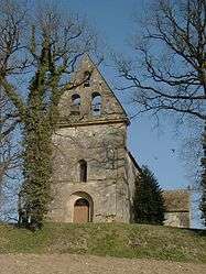 The church in Rampieux | |
Location of Rampieux 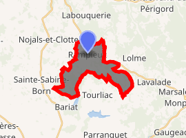
| |
 Rampieux  Rampieux | |
| Coordinates: 44°42′55″N 0°47′51″E | |
| Country | France |
| Region | Nouvelle-Aquitaine |
| Department | Dordogne |
| Arrondissement | Bergerac |
| Canton | Lalinde |
| Intercommunality | Pays Beaumontois |
| Government | |
| • Mayor (2008–2014) | Daniel Grimal |
| Area 1 | 11.82 km2 (4.56 sq mi) |
| Population (2017-01-01)[1] | 150 |
| • Density | 13/km2 (33/sq mi) |
| Time zone | UTC+01:00 (CET) |
| • Summer (DST) | UTC+02:00 (CEST) |
| INSEE/Postal code | 24347 /24440 |
| Elevation | 114–232 m (374–761 ft) (avg. 222 m or 728 ft) |
| 1 French Land Register data, which excludes lakes, ponds, glaciers > 1 km2 (0.386 sq mi or 247 acres) and river estuaries. | |
Population
| Year | Pop. | ±% |
|---|---|---|
| 1962 | 178 | — |
| 1968 | 168 | −5.6% |
| 1975 | 154 | −8.3% |
| 1982 | 155 | +0.6% |
| 1990 | 155 | +0.0% |
| 1999 | 162 | +4.5% |
| 2008 | 147 | −9.3% |
gollark: https://pbs.twimg.com/media/CqVbqllWAAABn6t?format=jpg&name=medium
gollark: Oh, someone not understanding half-life?
gollark: All the computing is offloaded to Google via a little-known feature in Google Sheets.
gollark: Ah, but I do, since I want to work out what the original *encoded* frame was and avoid having to lossily compress it again.
gollark: Oh, I don't actually *use* it, when I want to download a video I just copy down the values of each pixel in each frame and use z3 to work out what the frames must be.
See also
References
- "Populations légales 2017". INSEE. Retrieved 6 January 2020.
| Wikimedia Commons has media related to Rampieux. |
| Authority control |
|
|---|
This article is issued from Wikipedia. The text is licensed under Creative Commons - Attribution - Sharealike. Additional terms may apply for the media files.