Saint-Mesmin, Dordogne
Saint-Mesmin is a commune in the Dordogne department in Nouvelle-Aquitaine in southwestern France.
Saint-Mesmin | |
|---|---|
.JPG) A general view of Saint-Mesmin | |
 Coat of arms | |
Location of Saint-Mesmin 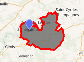
| |
 Saint-Mesmin  Saint-Mesmin | |
| Coordinates: 45°21′11″N 1°12′22″E | |
| Country | France |
| Region | Nouvelle-Aquitaine |
| Department | Dordogne |
| Arrondissement | Nontron |
| Canton | Isle-Loue-Auvézère |
| Government | |
| • Mayor (2008–2014) | Guy Bouchaud |
| Area 1 | 29.58 km2 (11.42 sq mi) |
| Population (2017-01-01)[1] | 318 |
| • Density | 11/km2 (28/sq mi) |
| Time zone | UTC+01:00 (CET) |
| • Summer (DST) | UTC+02:00 (CEST) |
| INSEE/Postal code | 24464 /24270 |
| Elevation | 182–415 m (597–1,362 ft) (avg. 300 m or 980 ft) |
| 1 French Land Register data, which excludes lakes, ponds, glaciers > 1 km2 (0.386 sq mi or 247 acres) and river estuaries. | |
Geography
The commune is located in the north-east corner of the Dordogne department, on a hill above the river Auvézère. The village is located 42 km (26 mi) north-east of Périgueux. The area consists of forests and farmland.
History
From the creation of the departments in 1790 Saint-Mesmin was first included in the Corrèze department. Three years later in 1793 it joined the Dordogne department.
Population
The largest population that the census recorded was 1,168 in 1886. Since World War I, the population has gradually been declining.
| Year | Pop. | ±% |
|---|---|---|
| 1793 | 1,033 | — |
| 1800 | 961 | −7.0% |
| 1806 | 864 | −10.1% |
| 1821 | 1,102 | +27.5% |
| 1831 | 1,007 | −8.6% |
| 1836 | 1,054 | +4.7% |
| 1841 | 1,098 | +4.2% |
| 1846 | 1,122 | +2.2% |
| 1851 | 1,159 | +3.3% |
| 1856 | 1,080 | −6.8% |
| 1861 | 1,140 | +5.6% |
| 1866 | 1,143 | +0.3% |
| 1872 | 1,075 | −5.9% |
| 1876 | 1,082 | +0.7% |
| 1881 | 1,088 | +0.6% |
| 1886 | 1,168 | +7.4% |
| 1891 | 1,107 | −5.2% |
| 1896 | 1,122 | +1.4% |
| 1901 | 1,106 | −1.4% |
| 1906 | 1,124 | +1.6% |
| 1911 | 1,115 | −0.8% |
| 1921 | 951 | −14.7% |
| 1926 | 889 | −6.5% |
| 1931 | 808 | −9.1% |
| 1936 | 792 | −2.0% |
| 1946 | 708 | −10.6% |
| 1954 | 633 | −10.6% |
| 1962 | 461 | −27.2% |
| 1968 | 534 | +15.8% |
| 1975 | 455 | −14.8% |
| 1982 | 393 | −13.6% |
| 1990 | 324 | −17.6% |
| 1999 | 284 | −12.3% |
| 2008 | 270 | −4.9% |
Sights
- The Auvézère has eroded a more than 100 meter deep gorge in limestone rock. There are footpaths through the gorge, offering access to the cascades.
- The Puy des Ages is a 1.5 km (0.93 mi) long rocky ridge on the border of the communes of Saint-Cyr-les-Champagnes and St-Mesmin. Its maximum elevation is 415 m above sea level.
gollark: Discord's permissions model is so very weird.
gollark: Idea: hide "administrator" in one of the color roles and see how long it is until someone notices.
gollark: Apparently I don't have the power to edit *my* roles, or anyone else's, it must be one of the weird roles providing that.
gollark: Actively punishing and imprisoning people for being in a bad situation they can't really leave easily is among the stupider things to do, yes.
gollark: I don't really like how the default seems to be "no, you cannot have the thing" in many people's minds.
See also
References
- "Populations légales 2017". INSEE. Retrieved 6 January 2020.
External links
| Wikimedia Commons has media related to Saint-Mesmin, Dordogne. |
| Authority control |
|
|---|
This article is issued from Wikipedia. The text is licensed under Creative Commons - Attribution - Sharealike. Additional terms may apply for the media files.