Saint-Estèphe, Dordogne
Saint-Estèphe (Limousin: Sent Estefe) is a commune in the Dordogne department in Nouvelle-Aquitaine in southwestern France.
Saint-Estèphe | |
|---|---|
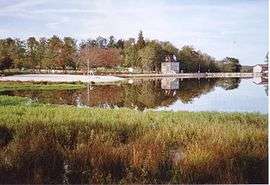 The lake in Saint-Estèphe | |
 Coat of arms | |
Location of Saint-Estèphe 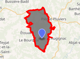
| |
 Saint-Estèphe  Saint-Estèphe | |
| Coordinates: 45°35′33″N 0°39′48″E | |
| Country | France |
| Region | Nouvelle-Aquitaine |
| Department | Dordogne |
| Arrondissement | Nontron |
| Canton | Périgord Vert Nontronnais |
| Government | |
| • Mayor (2008–2014) | Marc Veyssière |
| Area 1 | 21.37 km2 (8.25 sq mi) |
| Population (2017-01-01)[1] | 613 |
| • Density | 29/km2 (74/sq mi) |
| Time zone | UTC+01:00 (CET) |
| • Summer (DST) | UTC+02:00 (CEST) |
| INSEE/Postal code | 24398 /24360 |
| Elevation | 177–300 m (581–984 ft) |
| 1 French Land Register data, which excludes lakes, ponds, glaciers > 1 km2 (0.386 sq mi or 247 acres) and river estuaries. | |
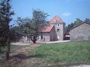
House in Le Briaudet at Saint Estephe
Population
| Year | Pop. | ±% |
|---|---|---|
| 1962 | 541 | — |
| 1968 | 643 | +18.9% |
| 1975 | 621 | −3.4% |
| 1982 | 612 | −1.4% |
| 1990 | 604 | −1.3% |
| 1999 | 619 | +2.5% |
| 2008 | 596 | −3.7% |
gollark: There's no C++ page in Minoteaur 6.
gollark: I must admit, the Minoteaur login page was a glorious and wonderful design, by me.
gollark: https://minoteaur.osmarks.net/login?redirect=%2Flist_of_isomorphisms_to_bee
gollark: It works fine. You're just wrong.
gollark: Minoteaur *6*, yes.
See also
References
- "Populations légales 2017". INSEE. Retrieved 6 January 2020.
External links
| Wikimedia Commons has media related to Saint-Estèphe (Dordogne). |
| Authority control |
|
|---|
This article is issued from Wikipedia. The text is licensed under Creative Commons - Attribution - Sharealike. Additional terms may apply for the media files.