La Chapelle-Saint-Jean
La Chapelle-Saint-Jean is a commune in the Dordogne department in Nouvelle-Aquitaine in southwestern France.
La Chapelle-Saint-Jean | |
|---|---|
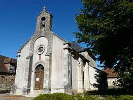 The church in La Chapelle-Saint-Jean | |
Location of La Chapelle-Saint-Jean 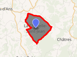
| |
 La Chapelle-Saint-Jean  La Chapelle-Saint-Jean | |
| Coordinates: 45°11′44″N 1°09′48″E | |
| Country | France |
| Region | Nouvelle-Aquitaine |
| Department | Dordogne |
| Arrondissement | Sarlat-la-Canéda |
| Canton | Haut-Périgord Noir |
| Intercommunality | Pays d'Hautefort |
| Government | |
| • Mayor (2008–2014) | Daniel Boutot |
| Area 1 | 3.70 km2 (1.43 sq mi) |
| Population (2017-01-01)[1] | 91 |
| • Density | 25/km2 (64/sq mi) |
| Time zone | UTC+01:00 (CET) |
| • Summer (DST) | UTC+02:00 (CEST) |
| INSEE/Postal code | 24113 /24390 |
| Elevation | 204–356 m (669–1,168 ft) (avg. 320 m or 1,050 ft) |
| 1 French Land Register data, which excludes lakes, ponds, glaciers > 1 km2 (0.386 sq mi or 247 acres) and river estuaries. | |
Population
| Year | Pop. | ±% |
|---|---|---|
| 1962 | 98 | — |
| 1968 | 67 | −31.6% |
| 1975 | 62 | −7.5% |
| 1982 | 74 | +19.4% |
| 1990 | 69 | −6.8% |
| 1999 | 62 | −10.1% |
| 2008 | 78 | +25.8% |
gollark: Implementing a good "AI" opponent is proving surprisingly hard since I can't do tree-searchy things with any significant depth or the browser just runs out of memory.
gollark: My overengineered tic-tac-toe game advances inexorably.
gollark: Wow, it finished after just 160 seconds.
gollark: (specifically: it has been resolving dependencies for over a minute)
gollark: Python dependency management sure does work, and not not work.
See also
References
- "Populations légales 2017". INSEE. Retrieved 6 January 2020.
| Wikimedia Commons has media related to La Chapelle-Saint-Jean. |
| Authority control |
|
|---|
This article is issued from Wikipedia. The text is licensed under Creative Commons - Attribution - Sharealike. Additional terms may apply for the media files.