Tavernola Bergamasca
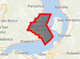
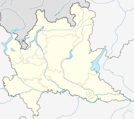
Tavernola Bergamasca (Bergamasque: Taèrnola) is a comune (municipality) in the Province of Bergamo in the Italian region of Lombardy, located about 70 kilometres (43 mi) northeast of Milan and about 30 kilometres (19 mi) east of Bergamo. As of 31 December 2004, it had a population of 2,242 and an area of 12.4 square kilometres (4.8 sq mi).[3]
Tavernola Bergamasca | |
|---|---|
| Comune di Tavernola Bergamasca | |
Tavernola Bergamasca | |
Location of Tavernola Bergamasca 
| |
 Tavernola Bergamasca Location of Tavernola Bergamasca in Italy  Tavernola Bergamasca Tavernola Bergamasca (Lombardy) | |
| Coordinates: 45°43′N 10°3′E | |
| Country | Italy |
| Region | Lombardy |
| Province | Province of Bergamo (BG) |
| Area | |
| • Total | 12.4 km2 (4.8 sq mi) |
| Elevation | 191 m (627 ft) |
| Population (Dec. 2004)[2] | |
| • Total | 2,242 |
| • Density | 180/km2 (470/sq mi) |
| Demonym(s) | Tavernolesi |
| Time zone | UTC+1 (CET) |
| • Summer (DST) | UTC+2 (CEST) |
| Postal code | 24060 |
| Dialing code | 035 |
Tavernola Bergamasca borders the following municipalities: Iseo, Monte Isola, Parzanica, Predore, Vigolo.
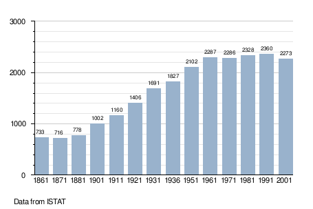
Demographic evolution

gollark: Why use wikidot as opposed to a self-hosted wiki?
gollark: Deploying apiocognitohazard...
gollark: They use VOIDED PHARMACOLOGISTS, an experimental [REDACTED].
gollark: Or at least an arbitrarily large amount of councils.
gollark: SCM-F078C8EE page exposed to SCM-███████, a [REDACTED] epistemoinfohazard. Results: [DATA EXPUNGED] loss of primary database [WARNING: computatiomemetic hazard detected at 0xfe7458abebc72] failure of global information networks [DATA LOST].
References
- "Superficie di Comuni Province e Regioni italiane al 9 ottobre 2011". Istat. Retrieved 16 March 2019.
- "Popolazione Residente al 1° Gennaio 2018". Istat. Retrieved 16 March 2019.
- All demographics and other statistics: Italian statistical institute Istat.
This article is issued from Wikipedia. The text is licensed under Creative Commons - Attribution - Sharealike. Additional terms may apply for the media files.