Brembate
Brembate (Bergamasque: Brembàt) is a comune (municipality) in the Province of Bergamo in the Italian region of Lombardy, located about 35 kilometres (22 mi) northeast of Milan and about 14 kilometres (9 mi) southwest of Bergamo. As of 31 December 2010, it had a population of 8,234 and an area of 5.5 square kilometres (2.1 sq mi).[3]
Brembate | |
|---|---|
| Comune di Brembate | |
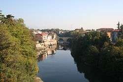 Brembo River in Brembate | |
Location of Brembate 
| |
 Brembate Location of Brembate in Italy 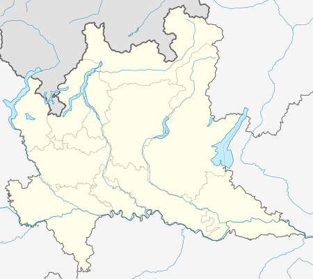 Brembate Brembate (Lombardy) | |
| Coordinates: 45°36′N 9°33′E | |
| Country | Italy |
| Region | Lombardy |
| Province | Province of Bergamo (BG) |
| Frazioni | Grignano |
| Area | |
| • Total | 5.5 km2 (2.1 sq mi) |
| Elevation | 173 m (568 ft) |
| Population (Dec. 2010)[2] | |
| • Total | 8,234 |
| • Density | 1,500/km2 (3,900/sq mi) |
| Demonym(s) | Brembatesi |
| Time zone | UTC+1 (CET) |
| • Summer (DST) | UTC+2 (CEST) |
| Postal code | 24041 |
| Dialing code | 035 |
| Website | Official website |
The municipality of Brembate only contains the frazione (subdivision) Grignano.
Brembate borders the following municipalities: Boltiere, Canonica d'Adda, Capriate San Gervasio, Filago, Osio Sotto, Pontirolo Nuovo.
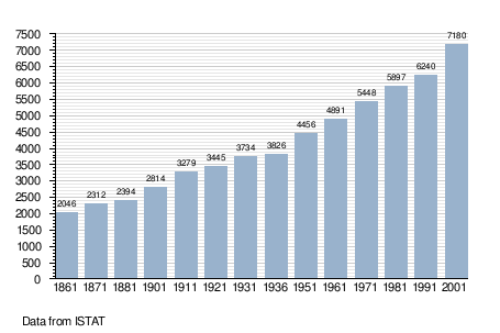
Demographic evolution
gollark: It's not that Untyped LC is bad for projects because it's slow.
gollark: * WHYJIT
gollark: My test WHY binary comes out as 1MB, cool.
gollark: WHYJIT is arguably *not* compiled. Or at least not compiled as much.
gollark: Actually, haskell might be faster sometimes.
References
- "Superficie di Comuni Province e Regioni italiane al 9 ottobre 2011". Istat. Retrieved 16 March 2019.
- "Popolazione Residente al 1° Gennaio 2018". Istat. Retrieved 16 March 2019.
- All demographics and other statistics: Italian statistical institute Istat.
External links
This article is issued from Wikipedia. The text is licensed under Creative Commons - Attribution - Sharealike. Additional terms may apply for the media files.