Lurano
Lurano (Bergamasque: Lörà) is a comune (municipality) in the Province of Bergamo in the Italian region of Lombardy, located about 40 kilometres (25 mi) northeast of Milan and about 15 kilometres (9 mi) south of Bergamo. As of 31 December 2004, it had a population of 2,201 and an area of 4.0 square kilometres (1.5 sq mi).[3]
Lurano | |
|---|---|
| Comune di Lurano | |
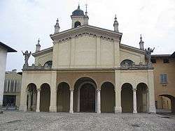 San Lino Church | |
Location of Lurano 
| |
 Lurano Location of Lurano in Italy 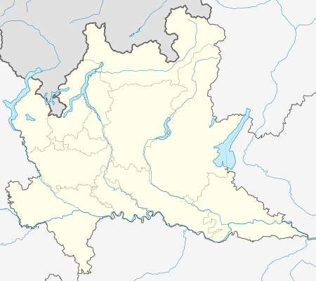 Lurano Lurano (Lombardy) | |
| Coordinates: 45°34′N 9°38′E | |
| Country | Italy |
| Region | Lombardy |
| Province | Province of Bergamo (BG) |
| Area | |
| • Total | 4.0 km2 (1.5 sq mi) |
| Elevation | 147 m (482 ft) |
| Population (Dec. 2004)[2] | |
| • Total | 2,201 |
| • Density | 550/km2 (1,400/sq mi) |
| Demonym(s) | Luranesi |
| Time zone | UTC+1 (CET) |
| • Summer (DST) | UTC+2 (CEST) |
| Postal code | 24050 |
| Dialing code | 035 |
Lurano borders the following municipalities: Arcene, Brignano Gera d'Adda, Castel Rozzone, Pognano, Spirano.
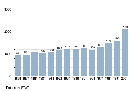
Demographic evolution
gollark: That's... quite a lot of growing dragons.
gollark: Such is randomization.
gollark: You stalked it 2keep it.
gollark: Anyone want a CB chrono xenowyrm in five hours?
gollark: I'm all for not having so many commons, but it's probably much more effective to just breed them into the Ap.
References
- "Superficie di Comuni Province e Regioni italiane al 9 ottobre 2011". Istat. Retrieved 16 March 2019.
- "Popolazione Residente al 1° Gennaio 2018". Istat. Retrieved 16 March 2019.
- All demographics and other statistics: Italian statistical institute Istat.
This article is issued from Wikipedia. The text is licensed under Creative Commons - Attribution - Sharealike. Additional terms may apply for the media files.