Credaro
Credaro (Bergamasque: Credér) is a comune (municipality) in the Province of Bergamo in the Italian region of Lombardy, located about 60 kilometres (37 mi) northeast of Milan and about 20 kilometres (12 mi) east of Bergamo. As of 31 December 2004, it had a population of 2,608 and an area of 3.4 square kilometres (1.3 sq mi).[3]
Credaro | |
|---|---|
| Comune di Credaro | |
 Credaro | |
Location of Credaro 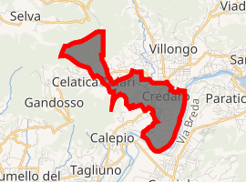
| |
 Credaro Location of Credaro in Italy 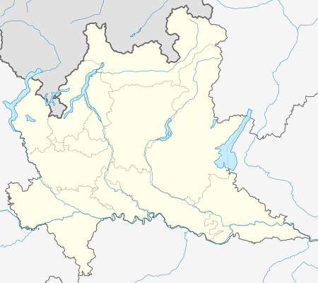 Credaro Credaro (Lombardy) | |
| Coordinates: 45°40′N 9°56′E | |
| Country | Italy |
| Region | Lombardy |
| Province | Province of Bergamo (BG) |
| Area | |
| • Total | 3.4 km2 (1.3 sq mi) |
| Elevation | 255 m (837 ft) |
| Population (Dec. 2004)[2] | |
| • Total | 2,608 |
| • Density | 770/km2 (2,000/sq mi) |
| Demonym(s) | Credaresi |
| Time zone | UTC+1 (CET) |
| • Summer (DST) | UTC+2 (CEST) |
| Postal code | 24060 |
| Dialing code | 035 |
Credaro borders the following municipalities: Capriolo, Castelli Calepio, Gandosso, Paratico, Trescore Balneario, Villongo, Zandobbio.
Demographic evolution

gollark: Sure.
gollark: Certainly. I assume it just needs TCP on some port?
gollark: I mean, me and heav would probably prefer to invoke JS-based dark gods.
gollark: This is also possible.
gollark: <@160279332454006795> What if accursed node.jsous [HG]Tech™ MUD?
References
- "Superficie di Comuni Province e Regioni italiane al 9 ottobre 2011". Istat. Retrieved 16 March 2019.
- "Popolazione Residente al 1° Gennaio 2018". Istat. Retrieved 16 March 2019.
- All demographics and other statistics: Italian statistical institute Istat.
This article is issued from Wikipedia. The text is licensed under Creative Commons - Attribution - Sharealike. Additional terms may apply for the media files.