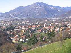
Ponteranica
Ponteranica (Bergamasque: Potranga or Put de Ranga) is a comune (municipality) in the Province of Bergamo in the Italian region of Lombardy, located about 50 kilometres (31 mi) northeast of Milan and about 4 kilometres (2 mi) northwest of Bergamo. As of 31 December 2004, it had a population of 6,866 and an area of 8.4 square kilometres (3.2 sq mi).[3]
Ponteranica | |
|---|---|
| Comune di Ponteranica | |
 Ponteranica | |
Location of Ponteranica 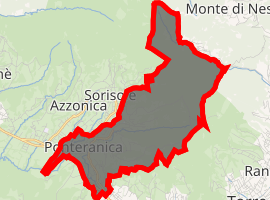
| |
 Ponteranica Location of Ponteranica in Italy 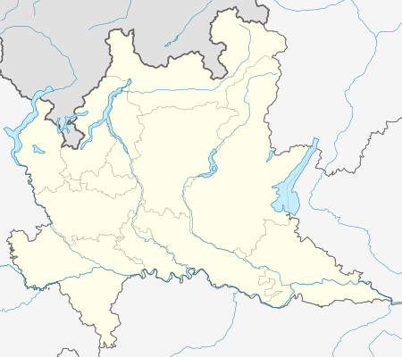 Ponteranica Ponteranica (Lombardy) | |
| Coordinates: 45°44′N 9°39′E | |
| Country | Italy |
| Region | Lombardy |
| Province | Province of Bergamo (BG) |
| Area | |
| • Total | 8.4 km2 (3.2 sq mi) |
| Elevation | 545 m (1,788 ft) |
| Population (Dec. 2004)[2] | |
| • Total | 6,866 |
| • Density | 820/km2 (2,100/sq mi) |
| Demonym(s) | Ponteranichesi |
| Time zone | UTC+1 (CET) |
| • Summer (DST) | UTC+2 (CEST) |
| Postal code | 24010 |
| Dialing code | 035 |
| Website | Official website |
Ponteranica borders the following municipalities: Alzano Lombardo, Bergamo, Ranica, Sorisole, Torre Boldone, Zogno.
A part of its surface is occupied by Maresana Hill. The source of Morla is in Ponteranica. Part of Ponteranica's territory belongs of Parco dei Colli di Bergamo
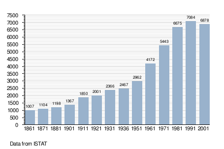
Demographic evolution
gollark: .tv is a country, but not all of them are.
gollark: .cool, .vodka, .xyz are not country codes.
gollark: Any below 3 chars is, though.
gollark: Not *all* of them.
gollark: You *can't* make arbitrary TLDs without either having a ridiculously high up position somewhere or running your own DNS servers (in which case nobody else can us it).
References
- "Superficie di Comuni Province e Regioni italiane al 9 ottobre 2011". Istat. Retrieved 16 March 2019.
- "Popolazione Residente al 1° Gennaio 2018". Istat. Retrieved 16 March 2019.
- All demographics and other statistics: Italian statistical institute Istat.
External links
This article is issued from Wikipedia. The text is licensed under Creative Commons - Attribution - Sharealike. Additional terms may apply for the media files.