Parzanica
Parzanica (Bergamasque: Parsanèga) is a comune (municipality) in the Province of Bergamo in the Italian region of Lombardy, located about 70 kilometres (43 mi) northeast of Milan and about 30 kilometres (19 mi) east of Bergamo. As of 31 December 2004, it had a population of 365 and an area of 10.8 square kilometres (4.2 sq mi).[3]
Parzanica | |
|---|---|
| Comune di Parzanica | |
Parzanica | |
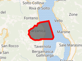
Location of Parzanica 
| |
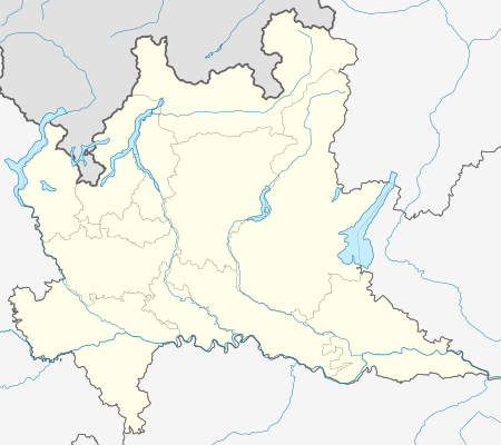
 Parzanica Location of Parzanica in Italy  Parzanica Parzanica (Lombardy) | |
| Coordinates: 45°44′N 10°2′E | |
| Country | Italy |
| Region | Lombardy |
| Province | Province of Bergamo (BG) |
| Area | |
| • Total | 10.8 km2 (4.2 sq mi) |
| Elevation | 753 m (2,470 ft) |
| Population (Dec. 2004)[2] | |
| • Total | 365 |
| • Density | 34/km2 (88/sq mi) |
| Demonym(s) | Parzanicensi |
| Time zone | UTC+1 (CET) |
| • Summer (DST) | UTC+2 (CEST) |
| Postal code | 24060 |
| Dialing code | 035 |
Parzanica borders the following municipalities: Fonteno, Marone, Monte Isola, Riva di Solto, Tavernola Bergamasca, Vigolo.
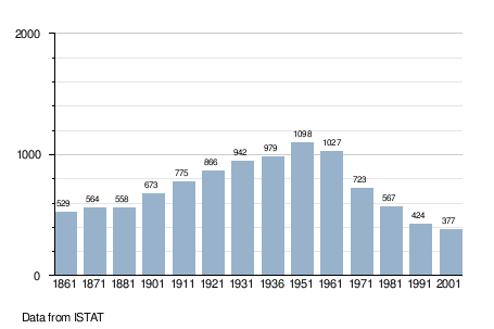
Demographic evolution

gollark: Hax.
gollark: Do you like GTree™?
gollark: It worked for me after breaking and replacing my table. Not sure why.
gollark: It's sort of omnipresent.
gollark: Did you know? GTech™ harbinges environmental devastation.
References
- "Superficie di Comuni Province e Regioni italiane al 9 ottobre 2011". Istat. Retrieved 16 March 2019.
- "Popolazione Residente al 1° Gennaio 2018". Istat. Retrieved 16 March 2019.
- All demographics and other statistics: Italian statistical institute Istat.
This article is issued from Wikipedia. The text is licensed under Creative Commons - Attribution - Sharealike. Additional terms may apply for the media files.