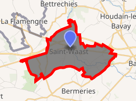
Saint-Waast
Saint-Waast is a commune in the Nord department in northern France.
Saint-Waast | |
|---|---|
The church in Saint-Waast | |
.svg.png) Coat of arms | |
Location of Saint-Waast 
| |
 Saint-Waast  Saint-Waast | |
| Coordinates: 50°18′18″N 3°44′53″E | |
| Country | France |
| Region | Hauts-de-France |
| Department | Nord |
| Arrondissement | Avesnes-sur-Helpe |
| Canton | Aulnoye-Aymeries |
| Intercommunality | Communauté de communes du pays de Mormal |
| Government | |
| • Mayor (2014-2020) | Charles Degardin |
| Area 1 | 5.91 km2 (2.28 sq mi) |
| Population (2017-01-01)[1] | 636 |
| • Density | 110/km2 (280/sq mi) |
| Time zone | UTC+01:00 (CET) |
| • Summer (DST) | UTC+02:00 (CEST) |
| INSEE/Postal code | 59548 /59570 |
| Elevation | 85–142 m (279–466 ft) (avg. 120 m or 390 ft) |
| 1 French Land Register data, which excludes lakes, ponds, glaciers > 1 km2 (0.386 sq mi or 247 acres) and river estuaries. | |
Heraldry
.svg.png) Arms of Saint-Waast |
The arms of Saint-Waast are blazoned : Vair, 3 pales gules. (Englefontaine, Louvignies-Quesnoy, Poix-du-Nord and Saint-Waast-la-Vallée use the same arms.) |
Local Culture and Heritage
Sites and Monuments
Cultural Heritage
Natural heritage
The Carrière des Nerviens Regional Nature Reserve is partially located in the communal territory just 1,700 metres (5,600 ft) south-east of the town centre.
gollark: Obviously you should send logs to my email to RSS bridge, and then use an RSS reader.
gollark: A lot of them are literally Debian.
gollark: It might dedupe a bit under some configurations, but I think that requires similar versions of lots of stuff.
gollark: Which then requires more caching and probably RAM for shared libraries.
gollark: I'm pretty sure it requires more memory due to keeping separate copies of lots of filesystem contents.
See also
References
- "Populations légales 2017". INSEE. Retrieved 6 January 2020.
| Wikimedia Commons has media related to Saint-Waast. |
This article is issued from Wikipedia. The text is licensed under Creative Commons - Attribution - Sharealike. Additional terms may apply for the media files.