Hergnies
Hergnies is a commune in the Nord department of northern France.
Hergnies | |
|---|---|
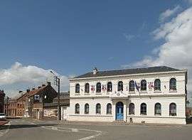 The town hall in Hergnies | |
_Nord-France.svg.png) Coat of arms | |
Location of Hergnies 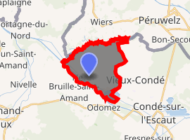
| |
 Hergnies  Hergnies | |
| Coordinates: 50°28′30″N 3°31′23″E | |
| Country | France |
| Region | Hauts-de-France |
| Department | Nord |
| Arrondissement | Valenciennes |
| Canton | Marly |
| Intercommunality | Communauté d'agglomération Valenciennes Métropole |
| Government | |
| • Mayor (2014-2020) | Jacques Schneider |
| Area 1 | 10.75 km2 (4.15 sq mi) |
| Population (2017-01-01)[1] | 4,437 |
| • Density | 410/km2 (1,100/sq mi) |
| Time zone | UTC+01:00 (CET) |
| • Summer (DST) | UTC+02:00 (CEST) |
| INSEE/Postal code | 59301 /59199 |
| Elevation | 14–39 m (46–128 ft) (avg. 20 m or 66 ft) |
| 1 French Land Register data, which excludes lakes, ponds, glaciers > 1 km2 (0.386 sq mi or 247 acres) and river estuaries. | |
Heraldry
Arms of Hergnies |
The arms of Hergniesare blazoned : Gules, 10 lozenges conjoined argent 3,3,3 and 1. (Fressain, Hergnies, Lallaing and Marpent use the same arms.) |
gollark: Check this out, I'm moderating moderatively.
gollark: I should be made moderator. I would be very moderate.
gollark: HELP I CAN'T BLOCK IT
gollark: oh no.
gollark: I mean, it has a web framework and SQLite3 bindings.
See also
References
| Wikimedia Commons has media related to Hergnies. |
| Authority control |
|
|---|
- "Populations légales 2017". INSEE. Retrieved 6 January 2020.
This article is issued from Wikipedia. The text is licensed under Creative Commons - Attribution - Sharealike. Additional terms may apply for the media files.