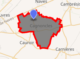
Cagnoncles
Cagnoncles is a commune in the Nord department in northern France. It contains 11 Commonwealth war graves from the First World War.
Cagnoncles | |
|---|---|
The town hall in Cagnoncles | |
.svg.png) Coat of arms | |
Location of Cagnoncles 
| |
 Cagnoncles  Cagnoncles | |
| Coordinates: 50°11′28″N 3°18′40″E | |
| Country | France |
| Region | Hauts-de-France |
| Department | Nord |
| Arrondissement | Cambrai |
| Canton | Caudry |
| Intercommunality | Communauté d'agglomération de Cambrai |
| Government | |
| • Mayor (2020-2026) | Bruno Lefebvre |
| Area 1 | 6.23 km2 (2.41 sq mi) |
| Population (2017-01-01)[1] | 611 |
| • Density | 98/km2 (250/sq mi) |
| Time zone | UTC+01:00 (CET) |
| • Summer (DST) | UTC+02:00 (CEST) |
| INSEE/Postal code | 59121 /59161 |
| Elevation | 47–86 m (154–282 ft) (avg. 67 m or 220 ft) |
| 1 French Land Register data, which excludes lakes, ponds, glaciers > 1 km2 (0.386 sq mi or 247 acres) and river estuaries. | |
History
Private A S Bullock in his World War I memoir recalls arriving in Cagnoncles around 19 October 1918 to find the population near to starvation, and records that he and his fellow soldiers shared their rations with the local people.[2]
Heraldry
.svg.png) Arms of Cagnoncles |
The arms of Cagnoncles are blazoned : Per pale highly indented argent and gules. (Cagnoncles, Landas, Raucourt-au-Bois and Thun-Saint-Amand use the same arms.) |
gollark: I think it requires signing for programs by default now.
gollark: I heard you can use screen/tmux or something.
gollark: VS Code, mostly.
gollark: I'm redacting it so I don't give it free advertising.
gollark: [REDACTED] (the game) is basically a meme at this point, given the weird sponsorship stuff.
See also
References
- "Populations légales 2017". INSEE. Retrieved 6 January 2020.
- Bullock, A S, Gloucestershire Between the Wars: A Memoir, The History Press, 2009, page 79
| Wikimedia Commons has media related to Cagnoncles. |
This article is issued from Wikipedia. The text is licensed under Creative Commons - Attribution - Sharealike. Additional terms may apply for the media files.