Rombies-et-Marchipont
Rombies-et-Marchipont is a commune in the Nord department in northern France.
Rombies-et-Marchipont | |
|---|---|
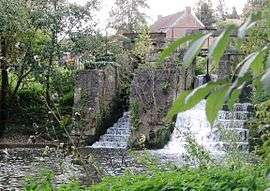 The Aunelle Valley mill in Rombies-et-Marchipont | |
_Nord-France.svg.png) Coat of arms | |
Location of Rombies-et-Marchipont 
| |
 Rombies-et-Marchipont  Rombies-et-Marchipont | |
| Coordinates: 50°21′58″N 3°38′46″E | |
| Country | France |
| Region | Hauts-de-France |
| Department | Nord |
| Arrondissement | Valenciennes |
| Canton | Marly |
| Intercommunality | Communauté d'agglomération Valenciennes Métropole |
| Government | |
| • Mayor (2014-2020) | Guy Huart |
| Area 1 | 4.81 km2 (1.86 sq mi) |
| Population (2017-01-01)[1] | 760 |
| • Density | 160/km2 (410/sq mi) |
| Time zone | UTC+01:00 (CET) |
| • Summer (DST) | UTC+02:00 (CEST) |
| INSEE/Postal code | 59505 /59990 |
| Elevation | 34–81 m (112–266 ft) (avg. 50 m or 160 ft) |
| 1 French Land Register data, which excludes lakes, ponds, glaciers > 1 km2 (0.386 sq mi or 247 acres) and river estuaries. | |
Heraldry
Arms of Rombies-et-Marchipont |
The arms of Rombies-et-Marchipont are blazoned : Azure, a cross moline between 4 mullets of 6 points argent. (Rombies-et-Marchipont and Sepmeries use the same arms.) |
gollark: People: weird.
gollark: ¿why is that better?
gollark: Also, what does that last bit actually mean?
gollark: Potato, potāto, as they say.
gollark: ? Where ? 🌵 ?
See also
References
| Wikimedia Commons has media related to Rombies-et-Marchipont. |
| Authority control |
|
|---|
- "Populations légales 2017". INSEE. Retrieved 6 January 2020.
This article is issued from Wikipedia. The text is licensed under Creative Commons - Attribution - Sharealike. Additional terms may apply for the media files.