Saint-Sulpice-sur-Lèze
Saint-Sulpice-sur-Lèze is a commune in the Haute-Garonne department in southwestern France.
Saint-Sulpice-sur-Lèze | |
|---|---|
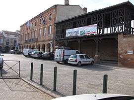 Town hall | |
.svg.png) Coat of arms | |
Location of Saint-Sulpice-sur-Lèze 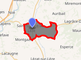
| |
 Saint-Sulpice-sur-Lèze  Saint-Sulpice-sur-Lèze | |
| Coordinates: 43°19′47″N 1°19′21″E | |
| Country | France |
| Region | Occitanie |
| Department | Haute-Garonne |
| Arrondissement | Muret |
| Canton | Auterive |
| Intercommunality | Volvestre |
| Government | |
| • Mayor (2008–2014) | Colette Suzanne |
| Area 1 | 13.91 km2 (5.37 sq mi) |
| Population (2017-01-01)[1] | 2,389 |
| • Density | 170/km2 (440/sq mi) |
| Time zone | UTC+01:00 (CET) |
| • Summer (DST) | UTC+02:00 (CEST) |
| INSEE/Postal code | 31517 /31410 |
| Elevation | 190–321 m (623–1,053 ft) (avg. 199 m or 653 ft) |
| 1 French Land Register data, which excludes lakes, ponds, glaciers > 1 km2 (0.386 sq mi or 247 acres) and river estuaries. | |
Geography
The Lèze forms part of the commune's southwestern border, flows north through the western part of the commune, crosses the village and forms part of its northwestern border.
Population
| Year | Pop. | ±% |
|---|---|---|
| 1962 | 883 | — |
| 1968 | 1,010 | +14.4% |
| 1975 | 1,192 | +18.0% |
| 1982 | 1,264 | +6.0% |
| 1990 | 1,423 | +12.6% |
| 1999 | 1,639 | +15.2% |
| 2008 | 1,818 | +10.9% |
gollark: +>markov 258639553357676545 2
gollark: +>markov 258639553357676545 2
gollark: +>markov 258639553357676545 2
gollark: ████++remind 1mo5d bees
gollark: +>markov 258639553357676545 2
References
- "Populations légales 2017". INSEE. Retrieved 6 January 2020.
| Wikimedia Commons has media related to Saint-Sulpice-sur-Lèze. |
| Authority control |
|
|---|
This article is issued from Wikipedia. The text is licensed under Creative Commons - Attribution - Sharealike. Additional terms may apply for the media files.