Saint-Plancard
Saint-Plancard (Gascon: Sent Blancat) is a commune in the Haute-Garonne department in southwestern France.
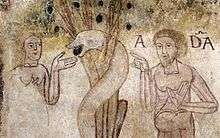
Fresco in Saint-Jean-le-Vigne in Saint-Plancard
Saint-Plancard | |
|---|---|
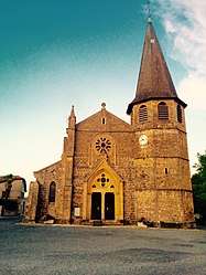 The church in Saint-Plancard | |
.svg.png) Coat of arms | |
Location of Saint-Plancard 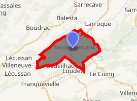
| |
 Saint-Plancard  Saint-Plancard | |
| Coordinates: 43°10′16″N 0°34′30″E | |
| Country | France |
| Region | Occitanie |
| Department | Haute-Garonne |
| Arrondissement | Saint-Gaudens |
| Canton | Saint-Gaudens |
| Intercommunality | Nebouzan-Rivière-Verdun |
| Government | |
| • Mayor (2008–2014) | Alfred Mallet |
| Area 1 | 16.09 km2 (6.21 sq mi) |
| Population (2017-01-01)[1] | 364 |
| • Density | 23/km2 (59/sq mi) |
| Time zone | UTC+01:00 (CET) |
| • Summer (DST) | UTC+02:00 (CEST) |
| INSEE/Postal code | 31513 /31580 |
| Elevation | 349–530 m (1,145–1,739 ft) (avg. 370 m or 1,210 ft) |
| 1 French Land Register data, which excludes lakes, ponds, glaciers > 1 km2 (0.386 sq mi or 247 acres) and river estuaries. | |
Population
| Year | Pop. | ±% |
|---|---|---|
| 1962 | 385 | — |
| 1968 | 475 | +23.4% |
| 1975 | 401 | −15.6% |
| 1982 | 476 | +18.7% |
| 1990 | 452 | −5.0% |
| 1999 | 372 | −17.7% |
| 2008 | 383 | +3.0% |
The population density of Saint-Plancard is 23.80 inhabitants per km². The number of houses in Saint-Plancard was 240 in 2007: 176 main residences, 42 secondary homes, and 21 vacant homes.[2]
gollark: =tex \alpha \beta \gamma
gollark: =tex mnbvcxzlkjhgfdsapoiuytrewq
gollark: =tex 攢ðeđ
gollark: https://osmarks.net/stuff/ttt.html↑ the gaming experience of the future, today.
gollark: You just stand in the frame, type a destination into the teleporter, hope that the other end is chunkloaded, and get teleported to the other end, assuming it didn't randomly break and strand you forever.
References
- "Populations légales 2017". INSEE. Retrieved 6 January 2020.
- "Town of Saint-Plancard". Retrieved 18 February 2014.
| Wikimedia Commons has media related to Saint-Plancard. |
| Authority control |
|
|---|
This article is issued from Wikipedia. The text is licensed under Creative Commons - Attribution - Sharealike. Additional terms may apply for the media files.