Montoulieu-Saint-Bernard
Montoulieu-Saint-Bernard is a commune in the Haute-Garonne department of southwestern France.
Montoulieu-Saint-Bernard | |
|---|---|
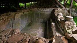
 Baths of the Roman villa | |
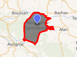
Location of Montoulieu-Saint-Bernard 
| |
 Montoulieu-Saint-Bernard  Montoulieu-Saint-Bernard | |
| Coordinates: 43°14′06″N 0°54′33″E | |
| Country | France |
| Region | Occitanie |
| Department | Haute-Garonne |
| Arrondissement | Saint-Gaudens |
| Canton | Cazères |
| Intercommunality | Canton d'Aurignac |
| Government | |
| • Mayor (2008–2014) | Camille Sors |
| Area 1 | 4.83 km2 (1.86 sq mi) |
| Population (2017-01-01)[1] | 213 |
| • Density | 44/km2 (110/sq mi) |
| Time zone | UTC+01:00 (CET) |
| • Summer (DST) | UTC+02:00 (CEST) |
| INSEE/Postal code | 31386 /31420 |
| Elevation | 276–467 m (906–1,532 ft) (avg. 350 m or 1,150 ft) |
| 1 French Land Register data, which excludes lakes, ponds, glaciers > 1 km2 (0.386 sq mi or 247 acres) and river estuaries. | |
Population
| Year | Pop. | ±% |
|---|---|---|
| 1962 | 93 | — |
| 1968 | 106 | +14.0% |
| 1975 | 106 | +0.0% |
| 1982 | 111 | +4.7% |
| 1990 | 149 | +34.2% |
| 1999 | 153 | +2.7% |
| 2008 | 171 | +11.8% |
gollark: Anyway, I'd like to request that you increase the goodness of vibacam by using an actual good video codec like VP9.
gollark: Vanilla flavoured or commonmark-GFM.
gollark: I just approximated π.
gollark: Also local neutrino flux.
gollark: Hmm, can we also get IR/UV views, for purposes?
References
- "Populations légales 2017". INSEE. Retrieved 6 January 2020.
| Wikimedia Commons has media related to Montoulieu-Saint-Bernard. |
This article is issued from Wikipedia. The text is licensed under Creative Commons - Attribution - Sharealike. Additional terms may apply for the media files.