Guran, Haute-Garonne
Guran is a commune in the Haute-Garonne department in southwestern France.
Guran | |
|---|---|
_-_Fonds_Ancely_-_B315556101_A_MALBOS_1_005.jpg) Saint Andrews Chapel by Eugène de Malbos | |
Location of Guran 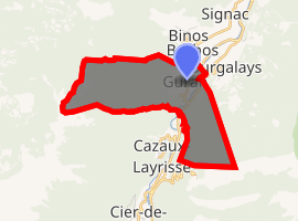
| |
 Guran  Guran | |
| Coordinates: 42°53′27″N 0°37′01″E | |
| Country | France |
| Region | Occitanie |
| Department | Haute-Garonne |
| Arrondissement | Saint-Gaudens |
| Canton | Bagnères-de-Luchon |
| Intercommunality | Canton de Saint-Béat |
| Government | |
| • Mayor (2008–2014) | Bernard Mora |
| Area 1 | 5.28 km2 (2.04 sq mi) |
| Population (2017-01-01)[1] | 44 |
| • Density | 8.3/km2 (22/sq mi) |
| Time zone | UTC+01:00 (CET) |
| • Summer (DST) | UTC+02:00 (CEST) |
| INSEE/Postal code | 31235 /31440 |
| Elevation | 551–1,740 m (1,808–5,709 ft) (avg. 646 m or 2,119 ft) |
| 1 French Land Register data, which excludes lakes, ponds, glaciers > 1 km2 (0.386 sq mi or 247 acres) and river estuaries. | |
Population
| Year | Pop. | ±% |
|---|---|---|
| 1962 | 49 | — |
| 1968 | 65 | +32.7% |
| 1975 | 56 | −13.8% |
| 1982 | 41 | −26.8% |
| 1990 | 30 | −26.8% |
| 1999 | 45 | +50.0% |
| 2008 | 56 | +24.4% |
gollark: I did the "Morrisby" thing for school last year, and it said this, since the verbal one was basically a stupid vocabulary test and I read a lot.
gollark: Dyslexia?
gollark: < PotatOS Hypercycle™
gollark: * intriguing
gollark: Also, check out the PotatOS Development Centre.
References
- "Populations légales 2017". INSEE. Retrieved 6 January 2020.
| Wikimedia Commons has media related to Guran. |
| Authority control |
|
|---|
This article is issued from Wikipedia. The text is licensed under Creative Commons - Attribution - Sharealike. Additional terms may apply for the media files.