Fronsac, Haute-Garonne
Fronsac is a commune in the Haute-Garonne department in southwestern France.
Fronsac | |
|---|---|
_tour.jpg) The tower of the castle of the Counts of Comminges dominates the village of Fronsac | |
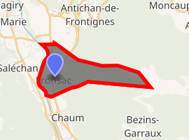
Location of Fronsac 
| |
 Fronsac  Fronsac | |
| Coordinates: 42°57′11″N 0°39′00″E | |
| Country | France |
| Region | Occitanie |
| Department | Haute-Garonne |
| Arrondissement | Saint-Gaudens |
| Canton | Bagnères-de-Luchon |
| Intercommunality | Canton de Saint-Béat |
| Government | |
| • Mayor (2008–2014) | Michel Ladevèze |
| Area 1 | 4.15 km2 (1.60 sq mi) |
| Population (2017-01-01)[1] | 210 |
| • Density | 51/km2 (130/sq mi) |
| Time zone | UTC+01:00 (CET) |
| • Summer (DST) | UTC+02:00 (CEST) |
| INSEE/Postal code | 31199 /31440 |
| Elevation | 461–1,680 m (1,512–5,512 ft) (avg. 470 m or 1,540 ft) |
| 1 French Land Register data, which excludes lakes, ponds, glaciers > 1 km2 (0.386 sq mi or 247 acres) and river estuaries. | |
It is situated on the former Route nationale 618, the "Route of the Pyrenees".
Population
| Year | Pop. | ±% |
|---|---|---|
| 1962 | 240 | — |
| 1968 | 265 | +10.4% |
| 1975 | 243 | −8.3% |
| 1982 | 226 | −7.0% |
| 1990 | 201 | −11.1% |
| 1999 | 216 | +7.5% |
| 2008 | 207 | −4.2% |
gollark: RaptorCS or whatever it is have cool but incredibly expensive POWER9 computers where the BMCs just run Linux of some sort.
gollark: Sometimes they disable ones which sort of work but can't clock high enough.
gollark: The names don't actually correspond to any actual size of the transistors. So they can keep "shrinking" as long as some useful metric can be increased.
gollark: I don't think I have any configuration like /etc/network/interfaces would have been either.
gollark: My networking on here is done by NetworkManager, though I use dhcpcd or something on my servers.
References
- "Populations légales 2017". INSEE. Retrieved 6 January 2020.
| Wikimedia Commons has media related to Fronsac (Haute-Garonne). |
This article is issued from Wikipedia. The text is licensed under Creative Commons - Attribution - Sharealike. Additional terms may apply for the media files.