Lahitère
Lahitère is a commune in the Haute-Garonne department in southwestern France.
Lahitère | |
|---|---|
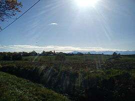 A general view of Lahitère | |
Location of Lahitère 
| |
 Lahitère  Lahitère | |
| Coordinates: 43°08′24″N 1°11′35″E | |
| Country | France |
| Region | Occitanie |
| Department | Haute-Garonne |
| Arrondissement | Muret |
| Canton | Auterive |
| Government | |
| • Mayor (2008–2014) | René Audoubert |
| Area 1 | 3.9 km2 (1.5 sq mi) |
| Population (2017-01-01)[1] | 60 |
| • Density | 15/km2 (40/sq mi) |
| Time zone | UTC+01:00 (CET) |
| • Summer (DST) | UTC+02:00 (CEST) |
| INSEE/Postal code | 31267 /31310 |
| Elevation | 340–506 m (1,115–1,660 ft) (avg. 450 m or 1,480 ft) |
| 1 French Land Register data, which excludes lakes, ponds, glaciers > 1 km2 (0.386 sq mi or 247 acres) and river estuaries. | |
Population
| Year | Pop. | ±% |
|---|---|---|
| 1962 | 31 | — |
| 1968 | 49 | +58.1% |
| 1975 | 46 | −6.1% |
| 1982 | 50 | +8.7% |
| 1990 | 33 | −34.0% |
| 1999 | 38 | +15.2% |
| 2008 | 54 | +42.1% |
gollark: Oh, right.
gollark: If it's too similar, then the low Levenshtein distance between apiospatial config files and your APIONET config file *could* actually open an informational path through apio*meta*space, which would then allow IRC messages to travel across it, thus possibly causing incursions.
gollark: Well, if the configuration is too similar, then it might be too similar to configuration files used by IRC networks in apiospace. Now, of course, most apiospatial information is highly cognitometaapiohyperhazardous, so it would be bad if it entered normal IRC networks.
gollark: You must install ngircd, set up appropriate SSL certificates (or use existing ones), and do various configuration.
gollark: I simply manipulate probability such that whatever I want to type spontaneously ends up in RAM somehow.
References
- "Populations légales 2017". INSEE. Retrieved 6 January 2020.
| Wikimedia Commons has media related to Lahitère. |
This article is issued from Wikipedia. The text is licensed under Creative Commons - Attribution - Sharealike. Additional terms may apply for the media files.