Saint-Rémy-du-Plain
Saint-Rémy-du-Plain (Breton: Sant-Revig-ar-Plaen) is a commune in the Ille-et-Vilaine department in Brittany in northwestern France.
Saint-Rémy-du-Plain Sant-Revig-ar-Plaen | |
|---|---|
_Mairie.jpg) The town hall of Saint-Rémy-du-Plain | |
Location of Saint-Rémy-du-Plain 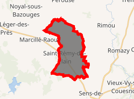
| |
 Saint-Rémy-du-Plain  Saint-Rémy-du-Plain | |
| Coordinates: 48°22′16″N 1°34′13″W | |
| Country | France |
| Region | Brittany |
| Department | Ille-et-Vilaine |
| Arrondissement | Fougères-Vitré |
| Canton | Antrain |
| Intercommunality | Antrain |
| Government | |
| • Mayor (2014–2020) | Yves Leray |
| Area 1 | 14.87 km2 (5.74 sq mi) |
| Population (2017-01-01)[1] | 828 |
| • Density | 56/km2 (140/sq mi) |
| Time zone | UTC+01:00 (CET) |
| • Summer (DST) | UTC+02:00 (CEST) |
| INSEE/Postal code | 35309 /35560 |
| Elevation | 23–105 m (75–344 ft) |
| 1 French Land Register data, which excludes lakes, ponds, glaciers > 1 km2 (0.386 sq mi or 247 acres) and river estuaries. | |
Population
Inhabitants of Saint-Rémy-du-Plain are called rémois in French.
| Year | Pop. | ±% |
|---|---|---|
| 1962 | 532 | — |
| 1968 | 561 | +5.5% |
| 1975 | 561 | +0.0% |
| 1982 | 548 | −2.3% |
| 1990 | 590 | +7.7% |
| 1999 | 580 | −1.7% |
| 2009 | 758 | +30.7% |
gollark: Sinthorion
gollark: I would never say "dope", apio.
gollark: ++magic py "\n".join(map(lambda x: x.name, ctx.message.guild.members))
gollark: ++magic py map(lambda x: x.name, ctx.message.guild.members)
gollark: ++magic py map(lambda x.name: x, ctx.message.guild.members)
References
- "Populations légales 2017". INSEE. Retrieved 6 January 2020.
- Mayors of Ille-et-Vilaine Association (in French)
External links
| Wikimedia Commons has media related to Saint-Rémy-du-Plain. |
| Authority control |
|
|---|
This article is issued from Wikipedia. The text is licensed under Creative Commons - Attribution - Sharealike. Additional terms may apply for the media files.