Saint-Péran
Saint-Péran (Breton: Sant-Pêran, Gallo: Saent-Peran) is a commune in the Ille-et-Vilaine department in Brittany in northwestern France.
Saint-Péran Sant-Pêran | |
|---|---|
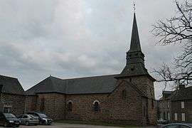 The church of Saint-Péran | |
Location of Saint-Péran 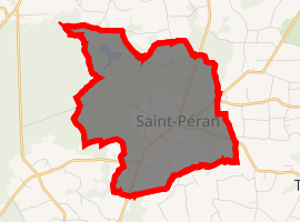
| |
 Saint-Péran  Saint-Péran | |
| Coordinates: 48°03′19″N 2°03′18″W | |
| Country | France |
| Region | Brittany |
| Department | Ille-et-Vilaine |
| Arrondissement | Rennes |
| Canton | Montfort-sur-Meu |
| Intercommunality | Pays de Brocéliande |
| Government | |
| • Mayor (2014–2020) | Maurice Renault |
| Area 1 | 9.37 km2 (3.62 sq mi) |
| Population (2017-01-01)[1] | 410 |
| • Density | 44/km2 (110/sq mi) |
| Time zone | UTC+01:00 (CET) |
| • Summer (DST) | UTC+02:00 (CEST) |
| INSEE/Postal code | 35305 /35380 |
| Elevation | 84–160 m (276–525 ft) |
| 1 French Land Register data, which excludes lakes, ponds, glaciers > 1 km2 (0.386 sq mi or 247 acres) and river estuaries. | |
Population
Inhabitants of Saint-Péran are called saint-péranais in French.
| Year | Pop. | ±% |
|---|---|---|
| 1962 | 208 | — |
| 1968 | 209 | +0.5% |
| 1975 | 168 | −19.6% |
| 1982 | 160 | −4.8% |
| 1990 | 169 | +5.6% |
| 1999 | 196 | +16.0% |
| 2009 | 336 | +71.4% |
gollark: WAIT!
gollark: *the only interesting code I have is long*
gollark: Can you parse it in sections?
gollark: Ugh, my code is too long.
gollark: <@240517342189191168> Are you still a python interpreter?
References
- "Populations légales 2017". INSEE. Retrieved 6 January 2020.
- Mayors of Ille-et-Vilaine Association (in French)
External links
| Wikimedia Commons has media related to Saint-Péran. |
- Official website (in French)
- French Ministry of Culture list for Saint-Péran (in French)
| Authority control |
|
|---|
This article is issued from Wikipedia. The text is licensed under Creative Commons - Attribution - Sharealike. Additional terms may apply for the media files.