Marcillé-Raoul
Marcillé-Raoul (Breton: Marc'helleg-Raoul, Gallo: Marcilhae-Raóll) is a commune in the Ille-et-Vilaine department in Brittany in northwestern France.
Marcillé-Raoul Marc'helleg-Raoul | |
|---|---|
_Mairie.jpg) The town hall in Marcillé-Raoul | |
Location of Marcillé-Raoul 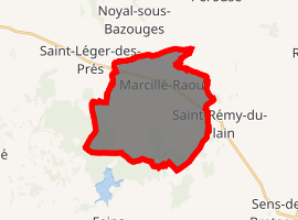
| |
 Marcillé-Raoul  Marcillé-Raoul | |
| Coordinates: 48°23′16″N 1°36′17″W | |
| Country | France |
| Region | Brittany |
| Department | Ille-et-Vilaine |
| Arrondissement | Fougères-Vitré |
| Canton | Antrain |
| Intercommunality | Antrain |
| Government | |
| • Mayor (2014–2020) | René Canto |
| Area 1 | 22.41 km2 (8.65 sq mi) |
| Population (2017-01-01)[1] | 766 |
| • Density | 34/km2 (89/sq mi) |
| Time zone | UTC+01:00 (CET) |
| • Summer (DST) | UTC+02:00 (CEST) |
| INSEE/Postal code | 35164 /35560 |
| Elevation | 25–91 m (82–299 ft) |
| 1 French Land Register data, which excludes lakes, ponds, glaciers > 1 km2 (0.386 sq mi or 247 acres) and river estuaries. | |
Population
Inhabitants of Marcillé-Raoul are called Marcilléens in French.
| Year | Pop. | ±% |
|---|---|---|
| 1962 | 710 | — |
| 1968 | 712 | +0.3% |
| 1975 | 755 | +6.0% |
| 1982 | 677 | −10.3% |
| 1990 | 683 | +0.9% |
| 1999 | 660 | −3.4% |
| 2008 | 824 | +24.8% |
gollark: Or probably just `grep`.
gollark: I can use Machine AI™ Cloud© Blockchain Learning to trawl through it.
gollark: (now, that one is different, because that can be used for direct financial harm, yes)
gollark: Also your credit card information, please.
gollark: All of them.
References
- "Populations légales 2017". INSEE. Retrieved 6 January 2020.
- Mayors of Ille-et-Vilaine Association (in French)
External links
| Wikimedia Commons has media related to Marcillé-Raoul. |
| Authority control |
|
|---|
This article is issued from Wikipedia. The text is licensed under Creative Commons - Attribution - Sharealike. Additional terms may apply for the media files.