Hédé-Bazouges
Hédé-Bazouges (Breton: Hazhoù-Bazeleg, Gallo: Hédoe) is a commune in the Ille-et-Vilaine department in Brittany in northwestern France.
Hédé-Bazouges | |
|---|---|
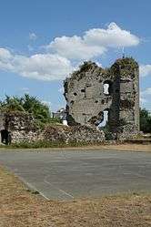
 Ruined castle | |
.svg.png) Coat of arms | |
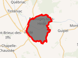
Location of Hédé-Bazouges 
| |
 Hédé-Bazouges  Hédé-Bazouges | |
| Coordinates: 48°17′43″N 1°48′05″W | |
| Country | France |
| Region | Brittany |
| Department | Ille-et-Vilaine |
| Arrondissement | Rennes |
| Canton | Melesse |
| Intercommunality | Pays de la Bretagne Romantique |
| Government | |
| • Mayor (2014–2020) | Jean-Christophe Benis |
| Area 1 | 14.93 km2 (5.76 sq mi) |
| Population (2017-01-01)[1] | 2,247 |
| • Density | 150/km2 (390/sq mi) |
| Time zone | UTC+01:00 (CET) |
| • Summer (DST) | UTC+02:00 (CEST) |
| INSEE/Postal code | 35130 /35630 |
| Elevation | 39–122 m (128–400 ft) |
| 1 French Land Register data, which excludes lakes, ponds, glaciers > 1 km2 (0.386 sq mi or 247 acres) and river estuaries. | |
On 1 January 2008, the village of Saint-Symphorien was separated from the commune, and given the status of commune in its own right.[2]
Prior to 22 March 2011, the commune was called Hédé.[3]
Population
Inhabitants of Hédé-Bazouges are called Hédéens in French.
| Year | Pop. | ±% |
|---|---|---|
| 1962 | 1,560 | — |
| 1968 | 1,555 | −0.3% |
| 1975 | 1,432 | −7.9% |
| 1982 | 1,422 | −0.7% |
| 1990 | 1,500 | +5.5% |
| 1999 | 1,822 | +21.5% |
| 2008 | 1,864 | +2.3% |
Sights
The town has a sculpture park in the church garden dedicated to the work of local resident Jean Boucher.
gollark: *78
gollark: It would be nice if it supported desktop notifications, too.
gollark: I just use the browser version.
gollark: Have you just sugarcaneized all your plots?
gollark: Um.
References
- "Populations légales 2017". INSEE. Retrieved 6 January 2020.
- (in French) Prefectoral bylaw
- (in French) Décret 2011-311 du 22 mars 2011
External links
| Wikimedia Commons has media related to Hédé-Bazouges. |
- Mayors of Ille-et-Vilaine Association (in French);
- INSEE commune file
- French Ministry of Culture list for Hédé-Bazouges (in French)
This article is issued from Wikipedia. The text is licensed under Creative Commons - Attribution - Sharealike. Additional terms may apply for the media files.