La Couyère
La Couyère (Breton: Ar Gouer) is a commune in the Ille-et-Vilaine department of Brittany in northwestern France.
La Couyère Ar Gouer | |
|---|---|
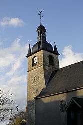 The bell tower of the church in La Couyère | |
 Coat of arms | |
Location of La Couyère 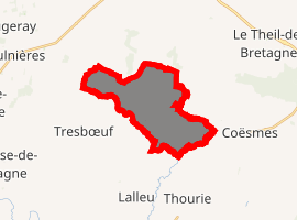
| |
 La Couyère  La Couyère | |
| Coordinates: 47°53′17″N 1°30′13″W | |
| Country | France |
| Region | Brittany |
| Department | Ille-et-Vilaine |
| Arrondissement | Redon |
| Canton | Bain-de-Bretagne |
| Intercommunality | Moyenne Vilaine et du Semnon |
| Government | |
| • Mayor (2014–2020) | Jacqueline Sollier |
| Area 1 | 11.72 km2 (4.53 sq mi) |
| Population (2017-01-01)[1] | 479 |
| • Density | 41/km2 (110/sq mi) |
| Time zone | UTC+01:00 (CET) |
| • Summer (DST) | UTC+02:00 (CEST) |
| INSEE/Postal code | 35089 /35320 |
| Elevation | 44–109 m (144–358 ft) |
| 1 French Land Register data, which excludes lakes, ponds, glaciers > 1 km2 (0.386 sq mi or 247 acres) and river estuaries. | |
The commune is home to a small Solar System model established in 2011.
Population
Inhabitants of La Couyère are called in French coverois.
| Year | Pop. | ±% |
|---|---|---|
| 1962 | 457 | — |
| 1968 | 472 | +3.3% |
| 1975 | 437 | −7.4% |
| 1982 | 383 | −12.4% |
| 1990 | 360 | −6.0% |
| 1999 | 350 | −2.8% |
| 2008 | 494 | +41.1% |
gollark: Potatos has advanced Lorem Ipsum support.
gollark: To delete things you can use `exorcise`, which deletes them while printing Latin.
gollark: PotatOS has the best CLI.
gollark: *unless I already have*
gollark: Ooh, I could make PotatOPUS - Opus disguised as potatOS so that people don't remove it...
References
- "Populations légales 2017". INSEE. Retrieved 6 January 2020.
- Mayors of Ille-et-Vilaine Association (in French)
External links
| Wikimedia Commons has media related to La Couyère. |
- French Ministry of Culture list for La Couyère (in French)
| Authority control |
|
|---|
This article is issued from Wikipedia. The text is licensed under Creative Commons - Attribution - Sharealike. Additional terms may apply for the media files.