Les Iffs
Les Iffs (Breton: An Ivineg) is a commune in the Ille-et-Vilaine department of Brittany in north-western France.
Les Iffs An Ivineg | |
|---|---|
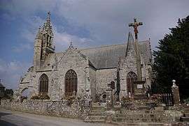 Saint Ouen church | |
Location of Les Iffs 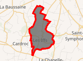
| |
 Les Iffs  Les Iffs | |
| Coordinates: 48°17′19″N 1°51′56″W | |
| Country | France |
| Region | Brittany |
| Department | Ille-et-Vilaine |
| Arrondissement | Rennes |
| Canton | Combourg |
| Intercommunality | Pays de Bécherel |
| Government | |
| • Mayor (2014–2020) | Hervé de la Villéon |
| Area 1 | 4.52 km2 (1.75 sq mi) |
| Population (2017-01-01)[1] | 272 |
| • Density | 60/km2 (160/sq mi) |
| Time zone | UTC+01:00 (CET) |
| • Summer (DST) | UTC+02:00 (CEST) |
| INSEE/Postal code | 35134 /35630 |
| Elevation | 53–141 m (174–463 ft) |
| 1 French Land Register data, which excludes lakes, ponds, glaciers > 1 km2 (0.386 sq mi or 247 acres) and river estuaries. | |
Population
Inhabitants of Les Iffs are called in French ifféens.
| Year | Pop. | ±% |
|---|---|---|
| 1962 | 204 | — |
| 1968 | 208 | +2.0% |
| 1975 | 191 | −8.2% |
| 1982 | 178 | −6.8% |
| 1990 | 218 | +22.5% |
| 1999 | 232 | +6.4% |
| 2008 | 265 | +14.2% |
gollark: So what features make the universe more complex than gods, exactly?
gollark: You still haven't explained that whatsoever.
gollark: Well, it isn't that much work for an *omnipotent god*, and they could do better than dropping bizarre hints which are more explicable by humans anthropomorphizing and pattern-matching than an omnipotent god.
gollark: What? The earth has been known to be round for at least 2000 years.
gollark: https://towardsdatascience.com/the-statistics-of-the-improbable-cec9a754e0ff?gi=876869185907
References
- "Populations légales 2017". INSEE. Retrieved 6 January 2020.
- Mayors of Ille-et-Vilaine Association (in French)
External links
| Wikimedia Commons has media related to Les Iffs. |
- French Ministry of Culture list for Les Iffs (in French)
| Authority control |
|
|---|
This article is issued from Wikipedia. The text is licensed under Creative Commons - Attribution - Sharealike. Additional terms may apply for the media files.