Livré-sur-Changeon
Livré-sur-Changeon is a commune in the Ille-et-Vilaine department of Brittany in north-western France.
Livré-sur-Changeon Liverieg-Kenton | |
|---|---|
_%C3%89glise_Notre-Dame_01.JPG) The church of Notre-Dame, in Livré-sur-Changeon | |
.svg.png) Coat of arms | |
Location of Livré-sur-Changeon 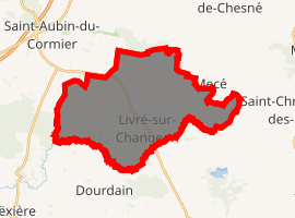
| |
 Livré-sur-Changeon  Livré-sur-Changeon | |
| Coordinates: 48°13′11″N 1°20′32″W | |
| Country | France |
| Region | Brittany |
| Department | Ille-et-Vilaine |
| Arrondissement | Rennes |
| Canton | Fougères-1 |
| Intercommunality | Pays de Saint-Aubin-du-Cormier |
| Government | |
| • Mayor (2014–2020) | Emmanuel Fraud |
| Area 1 | 26.37 km2 (10.18 sq mi) |
| Population (2017-01-01)[1] | 1,700 |
| • Density | 64/km2 (170/sq mi) |
| Time zone | UTC+01:00 (CET) |
| • Summer (DST) | UTC+02:00 (CEST) |
| INSEE/Postal code | 35154 /35450 |
| Elevation | 59–126 m (194–413 ft) |
| 1 French Land Register data, which excludes lakes, ponds, glaciers > 1 km2 (0.386 sq mi or 247 acres) and river estuaries. | |
Population
Inhabitants of Livré-sur-Changeon are called in French livréens.
| Year | Pop. | ±% |
|---|---|---|
| 1962 | 1,208 | — |
| 1968 | 1,125 | −6.9% |
| 1975 | 1,072 | −4.7% |
| 1982 | 1,078 | +0.6% |
| 1990 | 1,108 | +2.8% |
| 1999 | 1,300 | +17.3% |
| 2008 | 1,612 | +24.0% |
gollark: ... HOW?
gollark: I'm "working" on redoing Skynet in Rust but have hit the problem of "I have no idea about the ecosystem".
gollark: Mostly Python for just simple things to do stuff and JS for web-y stuff.
gollark: Python and JS for me.
gollark: (also, I'm slightly annoyed about crates.io squatting)
References
- "Populations légales 2017". INSEE. Retrieved 6 January 2020.
- Mayors of Ille-et-Vilaine Association (in French)
External links
| Wikimedia Commons has media related to Livré-sur-Changeon. |
| Authority control |
|
|---|
This article is issued from Wikipedia. The text is licensed under Creative Commons - Attribution - Sharealike. Additional terms may apply for the media files.