Saint-Maclou
Saint-Maclou is a commune in the Eure department in Normandy in northern France.
Saint-Maclou | |
|---|---|
The church in Saint-Maclou | |
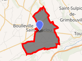
Location of Saint-Maclou 
| |
 Saint-Maclou  Saint-Maclou | |
| Coordinates: 49°21′56″N 0°24′40″E | |
| Country | France |
| Region | Normandy |
| Department | Eure |
| Arrondissement | Bernay |
| Canton | Beuzeville |
| Government | |
| • Mayor (2008–2014) | Yves Bouloche |
| Area 1 | 5.56 km2 (2.15 sq mi) |
| Population (2017-01-01)[1] | 627 |
| • Density | 110/km2 (290/sq mi) |
| Time zone | UTC+01:00 (CET) |
| • Summer (DST) | UTC+02:00 (CEST) |
| INSEE/Postal code | 27561 /27210 |
| Elevation | 32–127 m (105–417 ft) (avg. 114 m or 374 ft) |
| 1 French Land Register data, which excludes lakes, ponds, glaciers > 1 km2 (0.386 sq mi or 247 acres) and river estuaries. | |
It has two chateaux within its boundaries: the chateau de St Maclou-la-Campagne just outside the village, and the Chateau du Mont. The name comes from Maclovius, the Latin name for a monk of Welsh origin who also gave his name to Saint-Malo, a much larger city in Brittany.
Population
| Year | Pop. | ±% |
|---|---|---|
| 1962 | 245 | — |
| 1968 | 276 | +12.7% |
| 1975 | 295 | +6.9% |
| 1982 | 416 | +41.0% |
| 1990 | 458 | +10.1% |
| 1999 | 463 | +1.1% |
| 2008 | 552 | +19.2% |
gollark: No, those were the ones in the identical environment except for assimilation-y agents™ chambers™.
gollark: What about the 18248 copies of you in GTech™ identical environment chambers™?
gollark: As me, you're required to subscribe to pattern identity theory.
gollark: That's poorly defined.
gollark: Define "you" and "go".
See also
References
- "Populations légales 2017". INSEE. Retrieved 6 January 2020.
| Wikimedia Commons has media related to Saint-Maclou. |
This article is issued from Wikipedia. The text is licensed under Creative Commons - Attribution - Sharealike. Additional terms may apply for the media files.