La Goulafrière
La Goulafrière is a commune in the Eure department in northern France.
La Goulafrière | |
|---|---|
 Coat of arms | |
Location of La Goulafrière 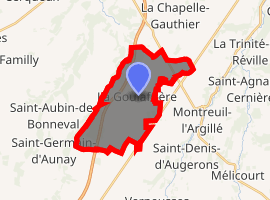
| |
 La Goulafrière  La Goulafrière | |
| Coordinates: 48°57′03″N 0°26′15″E | |
| Country | France |
| Region | Normandy |
| Department | Eure |
| Arrondissement | Bernay |
| Canton | Breteuil |
| Government | |
| • Mayor (2008–2014) | Jean-Claude Daniel |
| Area 1 | 14.38 km2 (5.55 sq mi) |
| Population (2017-01-01)[1] | 165 |
| • Density | 11/km2 (30/sq mi) |
| Time zone | UTC+01:00 (CET) |
| • Summer (DST) | UTC+02:00 (CEST) |
| INSEE/Postal code | 27289 /27390 |
| Elevation | 155–222 m (509–728 ft) (avg. 281 m or 922 ft) |
| 1 French Land Register data, which excludes lakes, ponds, glaciers > 1 km2 (0.386 sq mi or 247 acres) and river estuaries. | |
Population
| Year | Pop. | ±% |
|---|---|---|
| 1962 | 244 | — |
| 1968 | 279 | +14.3% |
| 1975 | 220 | −21.1% |
| 1982 | 173 | −21.4% |
| 1990 | 158 | −8.7% |
| 1999 | 150 | −5.1% |
| 2008 | 170 | +13.3% |
gollark: Good idea. Coming in v2.
gollark: What if I add something useful, like, er... can't think of anything...
gollark: I think it was originally a virus which got added to.
gollark: Probably!
gollark: I wonder why I originally made it anyway.
See also
References
- "Populations légales 2017". INSEE. Retrieved 6 January 2020.
| Wikimedia Commons has media related to La Goulafrière. |
| Authority control |
|
|---|
This article is issued from Wikipedia. The text is licensed under Creative Commons - Attribution - Sharealike. Additional terms may apply for the media files.