Le Plessis-Grohan
Le Plessis-Grohan is a commune in the Eure department in Normandy in northern France.
Le Plessis-Grohan | |
|---|---|
 Coat of arms | |
Location of Le Plessis-Grohan 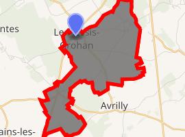
| |
 Le Plessis-Grohan  Le Plessis-Grohan | |
| Coordinates: 48°57′15″N 1°07′26″E | |
| Country | France |
| Region | Normandy |
| Department | Eure |
| Arrondissement | Évreux |
| Canton | Évreux-3 |
| Intercommunality | CA Évreux Portes de Normandie |
| Government | |
| • Mayor (2008–2014) | Jean-Pierre Walaszek |
| Area 1 | 8.28 km2 (3.20 sq mi) |
| Population (2017-01-01)[1] | 870 |
| • Density | 110/km2 (270/sq mi) |
| Time zone | UTC+01:00 (CET) |
| • Summer (DST) | UTC+02:00 (CEST) |
| INSEE/Postal code | 27464 /27180 |
| Elevation | 130–162 m (427–531 ft) (avg. 160 m or 520 ft) |
| 1 French Land Register data, which excludes lakes, ponds, glaciers > 1 km2 (0.386 sq mi or 247 acres) and river estuaries. | |
Population
| Year | Pop. | ±% |
|---|---|---|
| 1962 | 276 | — |
| 1968 | 286 | +3.6% |
| 1975 | 459 | +60.5% |
| 1982 | 648 | +41.2% |
| 1990 | 625 | −3.5% |
| 1999 | 677 | +8.3% |
| 2008 | 746 | +10.2% |
gollark: "I want the raffle to be changed/fixed/replaced so I can get one but nobody else can"
gollark: There are probably a few lineage makers.
gollark: Hide your golds!
gollark: Clever...
gollark: Your odds are as good as anyone else's.
See also
References
- "Populations légales 2017". INSEE. Retrieved 6 January 2020.
| Wikimedia Commons has media related to Le Plessis-Grohan. |
| Authority control |
|
|---|
This article is issued from Wikipedia. The text is licensed under Creative Commons - Attribution - Sharealike. Additional terms may apply for the media files.