Courdemanche, Eure
Courdemanche is a commune in the Eure department in northern France.
Courdemanche | |
|---|---|
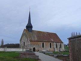 The church in Courdemanche | |
Location of Courdemanche 
| |
 Courdemanche  Courdemanche | |
| Coordinates: 48°48′10″N 1°15′51″E | |
| Country | France |
| Region | Normandy |
| Department | Eure |
| Arrondissement | Évreux |
| Canton | Verneuil-sur-Avre |
| Intercommunality | Évreux Portes de Normandie |
| Government | |
| • Mayor (2008–2014) | Serge Dutremée |
| Area 1 | 8.99 km2 (3.47 sq mi) |
| Population (2017-01-01)[1] | 597 |
| • Density | 66/km2 (170/sq mi) |
| Time zone | UTC+01:00 (CET) |
| • Summer (DST) | UTC+02:00 (CEST) |
| INSEE/Postal code | 27181 /27320 |
| Elevation | 110–142 m (361–466 ft) (avg. 136 m or 446 ft) |
| 1 French Land Register data, which excludes lakes, ponds, glaciers > 1 km2 (0.386 sq mi or 247 acres) and river estuaries. | |
Population
| Year | Pop. | ±% |
|---|---|---|
| 1962 | 169 | — |
| 1968 | 190 | +12.4% |
| 1975 | 223 | +17.4% |
| 1982 | 298 | +33.6% |
| 1990 | 462 | +55.0% |
| 1999 | 479 | +3.7% |
| 2008 | 525 | +9.6% |
gollark: You probably also need to do something about powering them, for particularly long trips.
gollark: Maybe just have them automatically go back and upward if velocity drops to zero.
gollark: Maybe put GPS/linked card relay stations down periodically on longer routes, but have them navigate inertially between them.
gollark: Great, that's easier.
gollark: Do drones also know their velocity?
See also
References
- "Populations légales 2017". INSEE. Retrieved 6 January 2020.
| Wikimedia Commons has media related to Courdemanche (Eure). |
| Authority control |
|
|---|
This article is issued from Wikipedia. The text is licensed under Creative Commons - Attribution - Sharealike. Additional terms may apply for the media files.