Cormeilles, Eure
Cormeilles is a commune located in the Eure department in the Normandy region of France.
Cormeilles | |
|---|---|
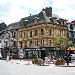 Main square | |
.svg.png) Coat of arms | |
Location of Cormeilles 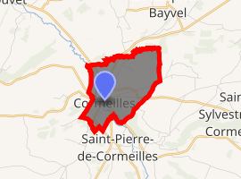
| |
 Cormeilles  Cormeilles | |
| Coordinates: 49°14′55″N 0°22′43″E | |
| Country | France |
| Region | Normandy |
| Department | Eure |
| Arrondissement | Bernay |
| Canton | Beuzeville |
| Government | |
| • Mayor (2008–2014) | Pascal Cauche |
| Area 1 | 3.05 km2 (1.18 sq mi) |
| Population (2017-01-01)[1] | 1,161 |
| • Density | 380/km2 (990/sq mi) |
| Time zone | UTC+01:00 (CET) |
| • Summer (DST) | UTC+02:00 (CEST) |
| INSEE/Postal code | 27170 /27260 |
| Elevation | 59–151 m (194–495 ft) (avg. 67 m or 220 ft) |
| 1 French Land Register data, which excludes lakes, ponds, glaciers > 1 km2 (0.386 sq mi or 247 acres) and river estuaries. | |
Population
| Year | Pop. | ±% |
|---|---|---|
| 1962 | 1,077 | — |
| 1968 | 1,143 | +6.1% |
| 1975 | 1,140 | −0.3% |
| 1982 | 1,129 | −1.0% |
| 1990 | 1,069 | −5.3% |
| 1999 | 1,191 | +11.4% |
| 2008 | 1,192 | +0.1% |
The inhabitants are called Cormeillais.
Geography
Cormeilles is located in the north-western part of the Eure department, on the small river Calonne, which empties into the Touques. Cormeilles is part of the Pays d'Auge.
Economy
The largest distillery of Calvados in Normandy is located in Cormeilles.
International relations
Cormeilles is twinned with Chepstow, and has been since 1975. Cormeilles is also twinned with Decs in Hungary, and has been since 2001.

gollark: *LPK* is *kotahu*?!
gollark: https://www.centauri-dreams.org/wp-content/uploads/2022/02/Starshot-scene-05-1024x682.jpg
gollark: Empirically, 6_4's face is this:
gollark: Fear my ultrawide brain monitor™.
gollark: Imagining reality is quite easy, fortunately.
See also
External links
| Wikimedia Commons has media related to Cormeilles (Eure). |
| Authority control |
|
|---|
This article is issued from Wikipedia. The text is licensed under Creative Commons - Attribution - Sharealike. Additional terms may apply for the media files.