La Lande-Saint-Léger
La Lande-Saint-Léger is a commune in the Eure department in Normandy in northern France.
La Lande-Saint-Léger | |
|---|---|
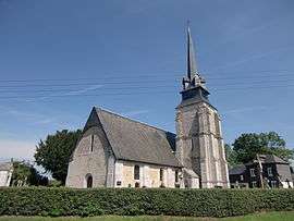 The church of Saint-Léger | |
Location of La Lande-Saint-Léger 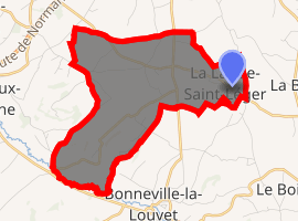
| |
 La Lande-Saint-Léger  La Lande-Saint-Léger | |
| Coordinates: 49°18′01″N 0°21′55″E | |
| Country | France |
| Region | Normandy |
| Department | Eure |
| Arrondissement | Bernay |
| Canton | Beuzeville |
| Intercommunality | Canton de Beuzeville |
| Government | |
| • Mayor (2008–2014) | Etienne Roussel |
| Area 1 | 7.96 km2 (3.07 sq mi) |
| Population (2017-01-01)[1] | 368 |
| • Density | 46/km2 (120/sq mi) |
| Time zone | UTC+01:00 (CET) |
| • Summer (DST) | UTC+02:00 (CEST) |
| INSEE/Postal code | 27361 /27210 |
| Elevation | 38–152 m (125–499 ft) (avg. 152 m or 499 ft) |
| 1 French Land Register data, which excludes lakes, ponds, glaciers > 1 km2 (0.386 sq mi or 247 acres) and river estuaries. | |
Population
| Year | Pop. | ±% |
|---|---|---|
| 1962 | 220 | — |
| 1968 | 222 | +0.9% |
| 1975 | 198 | −10.8% |
| 1982 | 164 | −17.2% |
| 1990 | 201 | +22.6% |
| 1999 | 208 | +3.5% |
| 2008 | 289 | +38.9% |
gollark: You didn't specify where the chest was exactly.
gollark: I mean that if the chest is adjacent you can push/pull from it using north/east/whatever.
gollark: Not that I know of anyway.
gollark: There isn't one.
gollark: I think you would want to either use directions or the peripheral name you get when you rightclick the modem beside the turtle.
See also
References
- "Populations légales 2017". INSEE. Retrieved 6 January 2020.
| Wikimedia Commons has media related to La Lande-Saint-Léger. |
| Authority control |
|
|---|
This article is issued from Wikipedia. The text is licensed under Creative Commons - Attribution - Sharealike. Additional terms may apply for the media files.