Saint-Arnoult, Loir-et-Cher
Saint-Arnoult is a commune in the Loir-et-Cher department of central France.
Saint-Arnoult | |
|---|---|
Commune | |
.svg.png) Coat of arms | |
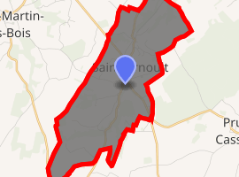
Location of Saint-Arnoult 
| |
 Saint-Arnoult  Saint-Arnoult | |
| Coordinates: 47°42′30″N 0°52′25″E | |
| Country | France |
| Region | Centre-Val de Loire |
| Department | Loir-et-Cher |
| Arrondissement | Vendôme |
| Canton | Montoire-sur-le-Loir |
| Intercommunality | Pays de Ronsard |
| Government | |
| • Mayor (2014–2020) | Eric Roullon |
| Area 1 | 9.57 km2 (3.69 sq mi) |
| Population (2017-01-01)[1] | 321 |
| • Density | 34/km2 (87/sq mi) |
| Time zone | UTC+01:00 (CET) |
| • Summer (DST) | UTC+02:00 (CEST) |
| INSEE/Postal code | 41201 /41800 |
| Elevation | 85–152 m (279–499 ft) (avg. 113 m or 371 ft) |
| 1 French Land Register data, which excludes lakes, ponds, glaciers > 1 km2 (0.386 sq mi or 247 acres) and river estuaries. | |
Population
| Year | Pop. | ±% |
|---|---|---|
| 1793 | 430 | — |
| 1806 | 405 | −5.8% |
| 1821 | 403 | −0.5% |
| 1831 | 461 | +14.4% |
| 1841 | 422 | −8.5% |
| 1851 | 437 | +3.6% |
| 1861 | 424 | −3.0% |
| 1872 | 459 | +8.3% |
| 1881 | 448 | −2.4% |
| 1891 | 505 | +12.7% |
| 1901 | 502 | −0.6% |
| 1911 | 503 | +0.2% |
| 1921 | 438 | −12.9% |
| 1931 | 457 | +4.3% |
| 1946 | 472 | +3.3% |
| 1954 | 427 | −9.5% |
| 1962 | 417 | −2.3% |
| 1968 | 401 | −3.8% |
| 1975 | 346 | −13.7% |
| 1981 | 330 | −4.6% |
| 1990 | 303 | −8.2% |
| 1999 | 305 | +0.7% |
| 2007 | 326 | +6.9% |
| 2014 | 315 | −3.4% |
gollark: `chown -R whatever-user-account-it-is file-thingy`
gollark: Yes, <@97888022359470080> was interested in writing an HTTP server thing, I recommended those things to them.
gollark: <@!356209633313947648> That sounds like a *terrible* way to secure anything.
gollark: What about it?
gollark: What?
References
- "Populations légales 2017". INSEE. Retrieved 6 January 2020.
| Wikimedia Commons has media related to Saint-Arnoult (Loir-et-Cher). |
This article is issued from Wikipedia. The text is licensed under Creative Commons - Attribution - Sharealike. Additional terms may apply for the media files.